Hockley (Birmingham) railway station
| Hockley | |
|---|---|
|
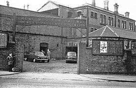
Hockley station in 1967 | |
| Location | |
| Place | Hockley |
| Area | Birmingham |
| Operations | |
| Original company | Great Western Railway |
| Pre-grouping | Great Western Railway |
| Platforms | 4 |
| History | |
| 1854 | Opened |
| 1972 | Closed |
| 1995 | Jewellery Quarter station opened a short distance east. |
| Disused railway stations in the United Kingdom | |
|
Closed railway stations in Britain A B C D–F G H–J K–L M–O P–R S T–V W–Z | |
|
| |
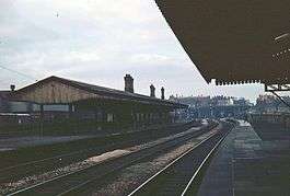
Hockley was an intermediate station on the Great Western Railway's London (Paddington) to Birkenhead via Birmingham (Snow Hill) line, England, serving the Hockley area of Birmingham. It was around one mile from Snow Hill station. Opened in 1854, it lasted for the duration of the line's original life, eventually closing with the line in 1972.[1]
Replacement
When the line was reopened in 1995, Hockley station was not reopened. However a new station; Jewellery Quarter station was opened around 100 yards (91 m) to the east, at the mouth of Hockley No 2 Tunnel. On the other side of Icknield Street.[2]
Little trace now remains of the original station, as the site was cleared in the 1990s when the line was reopened.
Image gallery
-

Hockley station exterior, March 1967 -

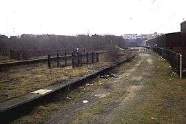
The remains of the station in the 1980s after closure. The tunnel in the background is the site of the present Jewellery Quarter station.
Hockley goods depot
Between 1854 and 1967, a large goods depot was situated alongside the station. It was the Great Western Railway's principal goods depot for the Birmingham area. The depot measured three-quarters of a mile long by two to three hundred yards wide. At the western end it had a transshipment interchange with barges on the Soho Loop of the Birmingham Canal. In the 1920s the depot employed over one thousand permanent staff.[3]
| Preceding station | Disused railways | Following station | ||
|---|---|---|---|---|
| Birmingham Snow Hill | Great Western Railway Later British Rail Birmingham-Wolverhampton (1854-1972) |
Soho and Winson Green | ||
References
- ↑ Bartholomew's Pocket Atlas and Guide to Birmingham. Edinburgh: John Bartholomew' & Son Ltd. 1949. p. 20.
- ↑ "Jewellery Quarter station". railaroundbirmingham. Rail around Birmingham. Retrieved 12 October 2013.
- ↑ "Hockley Goods Depot". Warwickshire Railways. Retrieved 5 May 2014.
- Rail Around Birmingham and the West Midlands: Hockley railway station
- Hockley Station - Warwickshire Railways.com
- Hockley Goods Depot - Warwickshire Railways.com
Coordinates: 52°29′25″N 1°55′01″W / 52.4904°N 1.9169°W
