Horsehouse
Coordinates: 54°13′42″N 1°55′42″W / 54.22831°N 1.92825°W
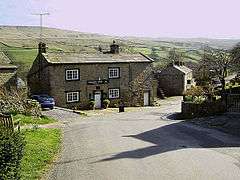
Horsehouse is a village in Coverdale in the Yorkshire Dales, North Yorkshire, England. The River Cover runs near the village. The village, which is small and remote, is home to St. Botolph's Church and the Thwaite Arms public house.
External links
- The ancient parish of Coverham: historical and genealogical information at GENUKI.
This article is issued from Wikipedia - version of the 9/19/2016. The text is available under the Creative Commons Attribution/Share Alike but additional terms may apply for the media files.

