Kilmaley
| Kilmaley Cill Mháille | |
|---|---|
| Parish and village | |
 Kilmaley Location in Ireland | |
| Coordinates: 52°49′04″N 9°06′33″W / 52.817651°N 9.109304°WCoordinates: 52°49′04″N 9°06′33″W / 52.817651°N 9.109304°W | |
| Country | Ireland |
| Province | Munster |
| County | County Clare |
| Elevation | 70 m (230 ft) |
| Time zone | WET (UTC+0) |
| • Summer (DST) | IST (WEST) (UTC-1) |
| Irish Grid Reference | R258774 |
Kilmaley (Irish: Cill Mháille[1]) is civil parish and a village situated 12 kilometres (7.5 mi) west of the town of Ennis, County Clare, Ireland. The name "Kilmaley" came from the Irish language "Cill Mhaile" which translates to Church of (Saint) Maley. The civil parish is coextensive with the Catholic parish of Inch and Kilmaley, and includes the village of Inch.
Location
Kilmaley is in the barony of Islands, 5 miles (8.0 km) southwest of Ennis. It is 7 by 4.25 miles (11.27 by 6.84 km) and covers 23,936 acres (9,687 ha). Much of the land is moor or mountain.[2] Every hill in the parish holds the remains of an ancient fort or rath, over 30 in total.[3] The Kilmaley Parish area is the largest in County Clare. A river called Kilmaley river runs though the village. There is forestry, in which you can go on short trails and many lakes for fishing.
There was a castle at Ballymacooda that in 1580 belonged to the Baron of Inchiquin.[4] The parish is crossed by the road from Ennis to Milltown Malbay.[2] In the 1830s fairs were held at Cornally four times a year.[3] In 1841 the population was 4,908 in 758 houses.[2]
Sports
The Kilmaley Gaelic Athletic Association (GAA) club was senior champions of Clare in 1985 and 2004.[5] There two sport fields in Kilmaley. The main field is a GAA field. The second field is located behind Kilmaley National School and is used mainly for hurling and camogie but also for playing men's and women's soccer.
Athletics is also very prominent where St. Cronans Athletic club lead the way in activities.
Catholic Parish
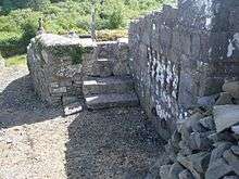
The Kilmaley church was established in 1195 by Domnall Mór Ua Briain, King of Limerick and Thomond. He placed it in the charge of the Augustinians.[5] In 1893 only part of the old church was still standing. Nearby there was a large cemetery and not far away two holy wells.[4] The parish has its Parish Office in Parochial House, Kilmaley.[6] Churches are Our Lady of the Wayside in Inch, St John the Baptist in Kilmaley and St Michael the Archangel in Connolly.[7] The Kilmaley Gaelic Athletic Association (GAA) club was senior champions of Clare in 1985 and 2004.[5]
Education
There are three primary schools in Kilmaley parish; Kilmaley National School, Connolly National School and Inch National School. Two other schools; Kinkurk National School and Lisroe National School closed in 1969 and 1970 respectively due to low class numbers. There is now also a playschool or crèche located adjacent to Kilmaley National School and the main parish church (St Johns Church).
Local business
There are three pubs and three shops in the Kilmaley Parish area. There is also some further local businesses including a number of local tractor and car repair garages.
Townlands

There are 54 Townlands in the parish, these are Ailldavore, Balleen, Ballydonohoe, Ballyillaun, Ballymacaula, Ballymacooda, Ballyvoe, Bealcragga, Booltiagh, Boolybrien, Boolynaknockaun, Boolynagleragh, Boolyneaska, Caherea, Cahermore, Cappalea North, Cappalea South, Carncreagh, Cloonlaheen, Cloontabonniv, Cloonbooly, Culleen, Derrynacarragh, Drumanure, Drumatehy, Feighroe, Furroor, Garrynagry, Glenletternafinny, Gortaganniv, Kilcloher, Kilcolumb, Kilmaley, Kinturk, Knockadangan, Knockatunna, Knockmore, Knockmoy, Kyleatunna, Lehaknock, Lecarrow Beg, Lecarrow More, Letteragh, Lisbiggeen, Lispuckaun, Lisroe, Loughburke, Magowna, Rathcrony, Reanagishagh, Sheeaun, Slaghbooly, Slievealoughaun and Tullaghaboy.[8]
References
Citations
| Wikimedia Commons has media related to Kilmaley. |
Sources
- "Cill Mháille". Placenames Database of Ireland. Retrieved 2014-04-11.
- Frost, James (1903). "Ui Cormaic, Kilmaley Parish". The History and Topography of the County of Clare. Retrieved 2014-04-12.
- "Inch and Kilmaley". Diocese of Killaloe. Retrieved 2014-03-31.
- "Inch and Kilmaley, Churches". Diocese of Killaloe. Retrieved 2014-04-18.
- "Inch and Kilmaley, Map". Diocese of Killaloe. Retrieved 2014-04-18.
- Lewis, Samuel (1837). "Kilmaly". County Clare: A History and Topography. Retrieved 2014-04-12.
- "Map of Kilmaley Parish showing Townlands". Clare County Library. Retrieved 2014-04-12.
- "Kilmaly". Parliamentary Gazeteer of Ireland 1845. Retrieved 2014-04-12.
- "Welcome to Kilmaley". Ireland Reaching Out. Retrieved 2014-04-12.
