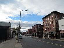
Indian Orchard, Springfield, Massachusetts


Indian Orchard is a neighborhood in the City of Springfield, Massachusetts. It is located in the northeastern corner of the city, beginning about four and a half miles from Metro Center. Containing 1,251 acres plus rights of way and water bodies, it is the fifth largest of Springfield's seventeen neighborhoods. Principal boundaries are the Chicopee River and the Town of Ludlow to the north; the Boston & Albany Railroad to the south; the Town of Wilbraham to the east; and portions of Brookdale Drive, the Athol rail line, and Worcester Street to the west. Located in the northeast corner of Springfield, Indian Orchard affords the quickest commute to Worcester, I-495, and Boston by way of the Mass Turnpike (I-90). [1]
Indian Orchard began in the 1840s as an isolated mill town and has preserved its identity over the years, even after becoming more fully encompassed by "The City of Firsts."[2]
One of Indian Orchard's former mills is now a large artists' studio space; this has been the catalyst for the neighborhood's growing arts & crafts scene. The Indian Orchard Mills/Dane Gallery hosts an artists' open house twice a year. Hubbard Park is a major source of recreational activities. The newly expanded Indian Orchard branch of the Springfield Library offers adult and family activities. The neighborhood is also home to Lake Lorraine State Park, a public swimming beach.[3] Large employers include Solutia and a US Postal Service bulk mail facility. There is a thorough weekly Farmer's Market at 187 Main St, Indian Orchard on Fridays 11:00 - 4:00, from May 8 to October 30.
References
Coordinates: 42°9′33.6″N 72°29′58.1″W / 42.159333°N 72.499472°W