Kordia
 | |
| State-owned enterprise | |
| Industry | telecommunications |
| Founded |
New Zealand, 2003 as THL; New Zealand, 2006 as Kordia |
| Headquarters | New Zealand |
Key people | Scott Bartlett, CEO |
| Website |
www |
Kordia is a New Zealand government-owned broadcast and telecommunications company, operating in Australia and New Zealand. It provides national communications services for broadcast and telecommunications customers in New Zealand, as well as specialised network systems. New Zealand customers include: Vodafone New Zealand, 2degrees, Sky Television, TVNZ, Mediaworks, Radio New Zealand, Spark New Zealand, Freeview, and The Radio Network. In Australia, Kordia provides contracting and consulting services for major telecommunications players, including Telstra, Optus, Vodafone and Hutchison.
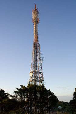
The New Zealand Kordia network is based primarily on digital microwave technology. The company also has access to a number of fibre networks running between Auckland, Wellington and Christchurch. Part of Kordia's 60 year heritage is the nationwide network of transmission towers that was built by the company in its various iterations, including: NZBC, Television New Zealand, BCL and now Kordia. In 2007, Kordia upgraded its high sites to build the digital terrestrial television (DTT) platform, which now hosts Freeview (Free-to-air digital television in New Zealand).
As well as use of licensed point-to-point microwave network links, Kordia also owns a variety of radio spectrum usage rights, including frequencies suitable for television and radio broadcast. Kordia also owns and operates a point-to-multipoint CDMA-based network for wireless broadband and WiMax technologies.
History

In November 2006, the business (THL Group, BCL, THLA, AAPCS) was rebranded to Kordia. The name “Kordia” is derived from the Latin word “accordia”, meaning “harmony”. The New Zealand business was formed as a subsidiary of Television New Zealand Ltd (TVNZ) on 1 July 1989[1] and was sold off as a separate entity in 2003.
Kordia operates both the analogue and digital television platforms in New Zealand – digital terrestrial television (DTT) and direct-to-home (DTH-satellite), including:
Maori Television
Sky Television
Other Nationwide Stations
- ChoiceTV
- Parliament TV
- Sommet Sports
- Chinese TV8
- Apna Television
Regional Stations
- CTV
- Dunedin Television
- TV Central
- Cue
Radio Networks
Kordia's nearly 400 high sites are available for co-location. This allows the introduction of other network operators' equipment into these strategic sites.
Today
Kordia competes and co-operates with other operators of physical (layer 1) telecommunication network providers such as Spark New Zealand, Vodafone New Zealand and Transpower New Zealand Limited (the national grid operator). Kordia has trialled DVB in New Zealand and DAB in New Zealand and Australia.
Kordia owns and operates New Zealand’s third largest telecommunications network – by geographical reach.[2]
In early 2007, Kordia announced that it had signed a distribution agreement with RoamAD for the distribution of RoamAD metro Wi-Fi networks throughout New Zealand.
Kordia acquired Orcon Internet on 2 July 2007,[3] and sold it in April 2013.[4]
On 7 September 2007, Kordia launched Kordia Metro WiFi, an unbundled open access network of metro Wi-Fi hotzones.
In 2011, Kordia announced that it is the first company in New Zealand to achieve the Microsoft SIP Trunking qualification for Microsoft Lync[5]
In 2012, Kordia has launched a new data transit service from New Zealand to Asia, allowing Kiwi businesses to access the lowest latency route to Microsoft’s Office 365 cloudbased productivity tools.[6]
Main high sites
See also
References
- ↑ History. Kordia Solutions. Retrieved 23 July 2012.
- ↑ Telecommunications Solutions. Kordia. Retrieved 23 July 2012.
- ↑ announces acquisition of Orcon. Kordia. Retrieved 23 July 2012.
- ↑ Putt, Sarah (15 April 2013). "Kordia sells Orcon to private investors". Computerworld. Retrieved 16 April 2013.
- ↑ Kordia first to achieve Microsoft certification. Kordia.co.nz (14 September 2011). Retrieved 23 July 2012.
- ↑ Kordia launches lowest latency link to Microsoft. Kordia.co.nz (23 April 2012). Retrieved 23 July 2012.
External links
| Wikimedia Commons has media related to Kordia. |