Kortright Centre for Conservation
| Kortright Centre for Conservation | |
|---|---|
|
Birds taking flight from a pond at the Kortright Centre | |
| Nearest city | Vaughan |
| Created | 1979 |
| Operator | Toronto and Region Conservation Authority |
| Website |
kortright |
Kortright Centre for Conservation, or simply Kortright Centre, is a suburban conservation area in Vaughan, Ontario, Canada in the northern part of the Greater Toronto Area. It is between Rutherford Road to the south and Major Mackenzie Drive to the north. It is located 38 km northwest of downtown Toronto, about 4 km west of Highway 400. The area in which it is located is predominantly forested in its western and northern extent. The Humber River is situated in the west and the Cold Creek and Harris Creek are to the north.
The 325 hectare Kortright Centre, which opened in 1979, is operated by the Toronto and Region Conservation Authority. It is named after Dr. Francis Kortright (1887–1972), an engineer, businessman, author and dedicated conservationist.[1]
The forest consists of pine trees to the north and east, especially northeast of the main attraction and the centre and maple trees to the south, and the west. The attractions include horse riding 50 m to the east not far from the parking lots. A field which is used only for horses is to the north.
Inside the main attraction, there is a shop and in the east is a small theatre showing films that discuss the endangerment of forests in the Toronto area. The access to the pathway leading to the syrup shacks is located at the west exit. The newly constructed Earth Rangers Centre is situated about 500 m south of the building and is situated in the southwest. The Centre houses Earth Rangers: a non-profit organization focused on providing environmental education to youth in the Greater Toronto Area. Construction began in the early-2000s. The Centre is between Pine Valley Drive and Kortright Centre.
Maple syrup

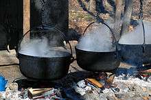
Between March and mid-April, the Kortright Centre for Conservation hosts its annual Maple Syrup Festival.The focus of the Maple Syrup Festival is to educate the public on how Maple Syrup production has changed over time. Demonstrations are given on how to properly identify a maple tree, how First Nations People discovered and cooked Maple Syrup or Sweet Water, how pioneers brought over kettles for cooking, and how Maple Syrup is made today in a modern Sugar Shack. Maple syrup samples are given to the public at the pioneer site. The Maple Syrup Festival also features wagon rides, face painting, balloon animals, and magic shows during March Break and on Weekends. The distance of the trail is about 400 to 500 m west by southwest.
References
- ↑ "Our Supporters - Special Places". University of Guelph. Retrieved 2010-04-06.
External links
| Wikimedia Commons has media related to Kortright Centre for Conservation. |
- Kortright Centre for Conservation
- Kortright Centre for Conservation - official site
Coordinates: 43°49′55″N 79°35′28″W / 43.83202°N 79.5912°W

