Kubrat Knoll
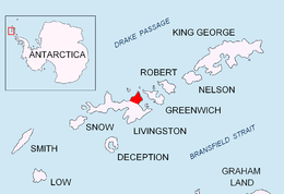
Kubrat Knoll (Kubratova Mogila \ku-'bra-to-va mo-'gi-la\) is a rocky peak of elevation 140 m at the base of Inott Point, Varna Peninsula on eastern Livingston Island in the South Shetland Islands, Antarctica. It is named after Khan Kubrat, 632-668 AD, who founded the Kingdom of Great Bulgaria on the territory bounded by the Caucasus, Volga and the Carpathians in 632 AD.
Location
The knoll is located at 62°31′36″S 60°01′05″W / 62.52667°S 60.01806°WCoordinates: 62°31′36″S 60°01′05″W / 62.52667°S 60.01806°W which is 700 m west by south of Inott Point, 1.93 km east of Arbanasi Nunatak and 1.7 km north of Edinburgh Hill (Bulgarian mapping in 2005 and 2009 from the Tangra 2004/05 topographic survey).
Maps
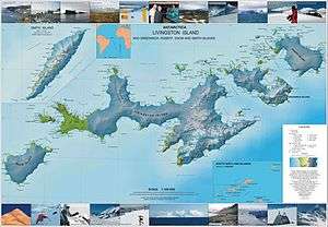
- L.L. Ivanov et al. Antarctica: Livingston Island and Greenwich Island, South Shetland Islands. Scale 1:100000 topographic map. Sofia: Antarctic Place-names Commission of Bulgaria, 2005.
- L.L. Ivanov. Antarctica: Livingston Island and Greenwich, Robert, Snow and Smith Islands. Scale 1:120000 topographic map. Troyan: Manfred Wörner Foundation, 2009.
References
This article includes information from the Antarctic Place-names Commission of Bulgaria which is used with permission.