Lake Hood Strip
| Lake Hood Strip | |||||||||||
|---|---|---|---|---|---|---|---|---|---|---|---|
 | |||||||||||
| IATA: none – ICAO: PALH – FAA LID: LHD | |||||||||||
| Summary | |||||||||||
| Airport type | Public | ||||||||||
| Owner | State of Alaska Department of Transportation & Public Facilities - Central Region | ||||||||||
| Location | Anchorage, Alaska | ||||||||||
| Elevation AMSL | 73 ft / 22 m | ||||||||||
| Coordinates | 61°10′54″N 149°57′59″W / 61.18167°N 149.96639°WCoordinates: 61°10′54″N 149°57′59″W / 61.18167°N 149.96639°W | ||||||||||
| Map | |||||||||||
 Lake Hood Strip | |||||||||||
| Runways | |||||||||||
| |||||||||||
| Statistics | |||||||||||
| |||||||||||
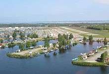
Lake Hood Strip (ICAO: PALH, FAA LID: LHD) is a state-owned public-use general aviation airstrip adjacent to the Lake Hood Seaplane Base (ICAO: PALH, FAA LID: LHD), three miles (5 km) southwest of downtown Anchorage in the U.S. state of Alaska.[1] The airstrip and seaplane base are located at Lake Hood, just east of Ted Stevens Anchorage International Airport (IATA: ANC, ICAO: PANC, FAA LID: ANC).[2] The gravel strip airport's previous code of (FAA LID: Z41) has been decommissioned and combined with (ICAO: PALH, FAA LID: LHD) as another landing surface.[3]
Facilities and aircraft
Lake Hood Strip has one runway (14/32) [4] a gravel surface measuring 2,200 x 75 ft. (671 x 23 m). There are 437 aircraft based at this airport: 97% single-engine and 3% multi-engine.[1]
References
- 1 2 3 FAA Airport Master Record for LHD (Form 5010 PDF), effective 2007-10-25
- ↑ Great Circle Mapper: ANC / PANC - Anchorage, Alaska
- ↑ "Alaska Supplement digital - Airport/Facility Directory" (PDF). FAA. Retrieved 2014-05-21.
- ↑ "Ted Stevens Anchorage International Airport - General Aviation". State of Alaska. Retrieved 2012-12-17.
External links
- FAA Alaska airport diagram (GIF)
- Resources for this airport:
- FAA airport information for Z41
- AirNav airport information for Z41
- FlightAware airport information and live flight tracker
- SkyVector aeronautical chart for Z41
This article is issued from Wikipedia - version of the 4/21/2016. The text is available under the Creative Commons Attribution/Share Alike but additional terms may apply for the media files.