Zrebar Lake
| Lake Zarivar زریوار Zrêbar | |
|---|---|
| Location |
Zagros Mountains, Kurdistan Province, Iran |
| Coordinates | 35°32′N 46°08′E / 35.533°N 46.133°ECoordinates: 35°32′N 46°08′E / 35.533°N 46.133°E |
| Primary outflows | Zrêbar River |
| Basin countries | Iran |
| Max. length | 5 km |
| Max. width | 1.6 km |
| Max. depth | 6 m |
| Water volume | 30.000,000 m³ |
| Surface elevation | 1,285 m |
| Settlements | Marivan |
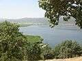
Lake Zarivar (Persian: زریوار Zarivār), also known as Zeribar or Zrewar (Kurdish: Zrêwar or Zrêbar),(Kurdish: زرێبار), is a lake in the Zagros Mountains, within Kurdistan Province of western Iran.
Etymology
The name is composed of zrê ("sea") and the suffix -bar (which in Kurdish means "lake").
Situation
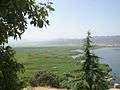
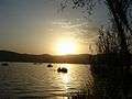
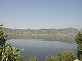
The lake is situated in the Iranian province of Kordestan west of Marivan and has a length of 5 km (3.1 mi) and a maximum width of 1.6 km (0.99 mi). The lake's water is fresh and has a maximum depth of 6 metres (20 ft).
Zeribar Lake is a major touristic attraction in the region.[1] There is a great deal of folklore about the origins of this lake amongst the Kurdish people of the area.
Gallery
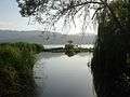
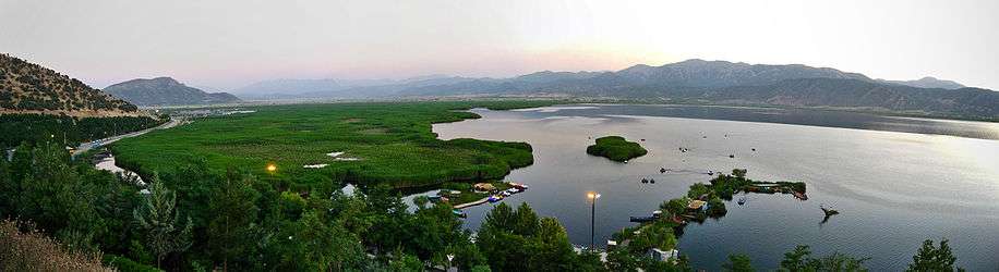
Panoramic view from Zrêbar in summer of 2007
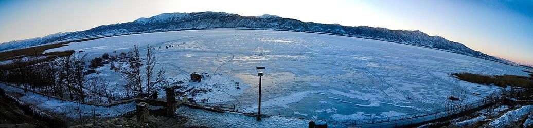
Panoramic view from totally frozen Zrêbar in winter of 2008
References
- ↑ SBB/MMN (Jan 11, 2008). "Cold hits Iran mythological landmark" (web). News Article. PressTV. Retrieved September 3, 2010.
External links
| Capital |  | ||||||||||||||||||||||||||||||||||||||
|---|---|---|---|---|---|---|---|---|---|---|---|---|---|---|---|---|---|---|---|---|---|---|---|---|---|---|---|---|---|---|---|---|---|---|---|---|---|---|---|
| Counties and cities | |||||||||||||||||||||||||||||||||||||||
| Sights |
| ||||||||||||||||||||||||||||||||||||||
| populated places | |||||||||||||||||||||||||||||||||||||||
This article is issued from Wikipedia - version of the 3/20/2016. The text is available under the Creative Commons Attribution/Share Alike but additional terms may apply for the media files.