Leland Trail
| Leland Trail | |
|---|---|
|
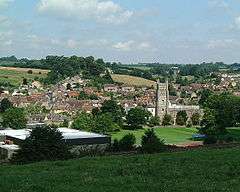
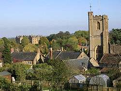
Montacute showing the tower of the Church of St. Catherine | |
| Length | 28 mi (45 km) |
| Location | Somerset, England |
| Trailheads | Penselwood/Ham Hill Country Park |
| Use | Hiking |
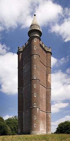
The Leland Trail, a 28 miles (45.1 km) footpath in Somerset, England. It runs from King Alfred's Tower in Penselwood to Ham Hill Country Park.[1]
History
The path was established by creating rights of way via tracks and lanes. It is named after John Leland who visited South Somerset during the years 1535 - 1543.[1] In his role as royal librarian, his journeys and tasks during that period were mapped out for him by King Henry VIII. His job was to reveal to the King all reference to "antiquities" and possessions of the local churches and priories.[2] The exact route taken by John Leland over much of South Somerset may never be known but what has remained of the records of the time now form the basis of the trail.
Route

Typical all day walks allow the track to be traversed in manageable stages. Traditionally it is broken down into seven smaller parts.[3]
The walk from Penselwood to Bruton, is fairly easy going for 5 miles (8.0 km) and takes about 3 hours. Then the journey onward to Castle Cary which takes a little over 2 hours to cover the next 4 miles (6.4 km). The next stage to North Cadbury will add about another 2 hours to the journey. Queen Camel is a further 4 miles (6.4 km) and takes just over 2 hours.
The rest of the trail goes from Queen Camel to Ilchester covers mainly level ground and takes about 2 hours for a distance of 5 miles (8.0 km) miles. Montacute is the next "port of call" en route, the slightly more difficult terrain will need well over two hours to complete the next 4 miles (6.4 km). Ham Hill, which is the end of the trail takes another hour.
Places of interest
The forest of Penselwood. Bruton has its packhorse bridge, dovecote and famous twin-towered church. Near Castle Cary is Cadbury Castle whose summit offers a spectacular panorama of the South Somerset countryside. The busy military airfield at Yeovilton, is also home to the Fleet Air Arm Museum. Montacute House is also close to the site of the former Cluniac Montacute Priory. At Ham Hill Country Park you can view Exmoor, the Quantock Hills, and the Bristol Channel. Looking east is the trails starting point, Alfred's Tower.
Intersecting trails
The Leland Trail links with the Monarch's Way at Ilchester and the Liberty Trail and the River Parrett Trail at Ham Hill.[4]
Key points and map
| Point | Coordinates (Links to map resources) |
OS Grid Ref | Notes |
|---|---|---|---|
| Start | 51°06′54″N 2°21′36″W / 51.115°N 2.36°W | ST744352 | King Alfred's Tower in Penselwood |
| Packhorse bridge | 51°06′47″N 2°27′00″W / 51.113°N 2.45°W | ST683350 | Bruton |
| Market town and Cadbury Castle | 51°05′13″N 2°30′47″W / 51.087°N 2.513°W | ST641322 | Castle Cary |
| North Cadbury Court | 51°02′42″N 2°31′19″W / 51.045°N 2.522°W | ST635275 | North Cadbury |
| River Cam and Church of St Barnabas | 51°01′12″N 2°34′41″W / 51.020°N 2.578°W | ST595247 | Queen Camel |
| River Yeo | 51°00′04″N 2°40′55″W / 51.001°N 2.682°W | ST522226 | Ilchester |
| Montacute House and Montacute Priory | 50°57′N 2°43′W / 50.95°N 2.72°W | ST4916 | Montacute |
| End | 50°57′00″N 2°44′35″W / 50.950°N 2.743°W | ST478170 | Ham Hill, Somerset |
References
- 1 2 "The Leland Trail". Discover South Somerset. Retrieved 30 November 2009.
- ↑ "The Leland Trail". Walking Pages. Retrieved 16 October 2010.
- ↑ "Leland Trail". Walking Pages. Retrieved 30 November 2009.
- ↑ "Liberty Trail". Walking on the Web. Retrieved 16 October 2010.

