List of Michigan State Historic Sites in Chippewa County
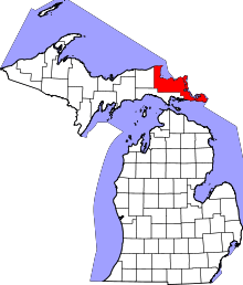
Location of Chippewa County in Michigan
The following is a list of Michigan State Historic Sites in Chippewa County, Michigan. Sites marked with a dagger (†) are also listed on the National Register of Historic Places in Chippewa County, Michigan.[1]
Current listings
| Name | Image | Location | City | Listing date |
|---|---|---|---|---|
| Allen House | 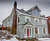 |
126 E. Waters | Sault Ste. Marie | October 1, 1971 |
| Bishop Frederick Baraga House | 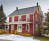 |
305 E Portage Avenue | Sault Ste. Marie | February 19, 1958 |
| Bay City House Hotel | 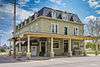 |
501 East Portage | Sault Ste. Marie | March 22, 1983 |
| Birch Lodge† | 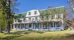 |
21830 S. Birch Lodge Dr. | Trout Lake | November 20, 1987 |
| Carnegie Library | 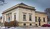 |
315 Armory Place | Sault Ste. Marie | January 8, 1981 |
| Central Methodist Church† | 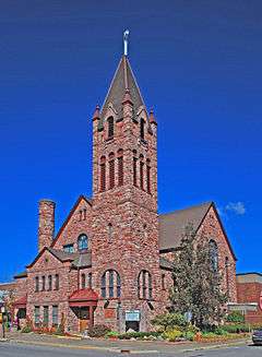 |
111 East Spruce Street | Sault Ste. Marie | June 17, 1993 |
| Church of Our Saviour, Friend of Children† | 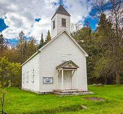 |
North Shore Road, Sugar Island, Payment Settlement | Sugar Island Township | January 19, 1978 |
| Elmwood† | |
705 East Portage Avenue | Sault Ste. Marie | September 25, 1956 |
| Emerson Informational Site | M-123 | Paradise vicinity | August 3, 1979 | |
| Federal Building† | 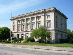 |
209 East Portage Avenue | Sault Ste. Marie | December 14, 1976 |
| Fort Brady (20CH51)† | 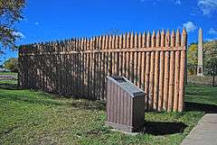 |
Bounded by the C.O.E. Service Plaza on the north, Portage St. on the south, Brady St. on the east, and Bingham St. on the west | Sault Ste. Marie | August 23, 1956 |
| Fort Colyer† | 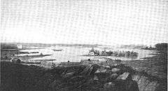 |
West end of Drummond Island (northwest shore of Whitney Bay), Sec. 1, T41N, R4E | De Tour Village vicinity | November 27, 1956 |
| Fort Repentigny Informational Designation | Park Place and River Street | Sault Ste. Marie | February 18, 1956 | |
| Governor Cass and the Indians Informational Designation | Foot of Bingham Avenue, Brady Field | Sault Ste. Marie | February 18, 1956 | |
| Johnston Homestead Informational Site | Neebish Island | Barbeau vicinity | April 4, 1975 | |
| John Johnston House† |  |
415 East Waters Street | Sault Ste. Marie | February 19, 1958 |
| Lake Superior State College |  |
West Easterday Road near the intersection with Meridian Road | Sault Ste. Marie | February 21, 1975 |
| Larke Road Informational Designation | Three Mile Road | Sault Ste. Marie | January 13, 1982 | |
| Legends of Hiawatha | Tahquamenon Falls State Park | Whitefish Township | February 12, 1959 | |
| Louis W. Hill† |  |
Old Union Carbide Dock, foot of Johnstone Street | Sault Ste. Marie | October 1, 1971 |
| Methodist Indian Mission Informational Site | Riverside Drive | Sault Ste. Marie | October 9, 1978 | |
| New Fort Brady† | 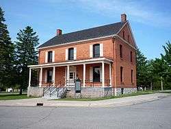 |
Lake Superior State College campus | Sault Ste. Marie | July 17, 1970 |
| New Pine Grove Cemetery | Route #2 | Sault Ste. Marie | July 18, 1996 | |
| Governor Chase Salmon Osborn Informational Designation | 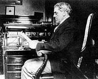 |
Historic Walkway of Sault Ste. Marie | Sault Ste. Marie | April 10, 1986 |
| Saint Mary's Falls Canal† | 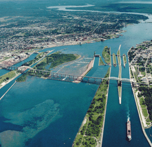 |
Canal Park, Portage Avenue | Sault Ste. Marie | February 12, 1959 |
| Saint Mary's Pro-Cathedral† | 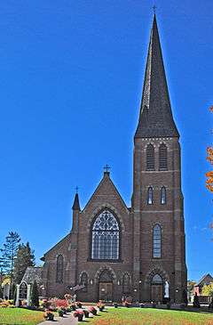 |
320 E Portage Avenue | Sault Ste. Marie | July 20, 1989 |
| Sault Ste. Marie Informational Designation |  |
Rest Area on I-75, 5 miles south of Sault Ste. Marie | Sault Ste. Marie | February 18, 1956 |
| Shelldrake Informational Site | .JPG) |
Whitefish Point Rd | Paradise vicinity | August 3, 1979 |
| Whitefish Point Lighthouse† | 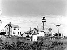 |
Whitefish Point, 6 miles NE of Shelldrake on Whitefish Road | Shelldrake vicinity | February 22, 1974 |
| Whitefish Point Post Office | M-123 | Paradise vicinity | August 3, 1979 | |
| Whitefish Township Informational Designation | S.R. 48 M-123 | Paradise | March 15, 1990 |
See also
Sources
- Historic Sites Online – Chippewa County. Michigan State Housing Developmental Authority. Accessed January 23, 2011.
References
- ↑ National Park Service (2009-03-13). "National Register Information System". National Register of Historic Places. National Park Service.
This article is issued from Wikipedia - version of the 12/11/2015. The text is available under the Creative Commons Attribution/Share Alike but additional terms may apply for the media files.