| [3] |
Name on the Register[4] |
Image |
Date listed[5] |
Location |
City or town |
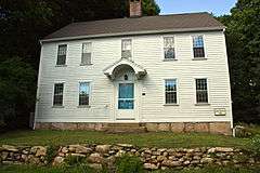
Description |
|---|
| 1 |
George S. Abbott Building |
Upload image |
000000001982-06-14-0000June 14, 1982
(#82004359) |
235-247 N. Main St.
41°33′31″N 73°02′20″W / 41.558611°N 73.038889°W / 41.558611; -73.038889 (George S. Abbott Building) |
Waterbury |
|
| 2 |
Academy of Our Lady of Mercy at Lauralton Hall |
Upload image |
000000002011-08-31-0000August 31, 2011
(#11000611) |
200 High St.
41°13′23″N 73°03′52″W / 41.223056°N 73.064444°W / 41.223056; -73.064444 (Academy of Our Lady of Mercy at Lauralton Hall) |
Milford |
|
| 3 |
Acadian House |
|
000000001975-09-05-0000September 5, 1975
(#75001928) |
Union St.
41°17′07″N 72°40′47″W / 41.285278°N 72.679722°W / 41.285278; -72.679722 (Acadian House) |
Guilford |
|
| 4 |
Allis-Bushnell House |
|
000000001982-02-25-0000February 25, 1982
(#82004352) |
853 Boston Post Rd.
41°16′45″N 72°35′33″W / 41.279167°N 72.5925°W / 41.279167; -72.5925 (Allis-Bushnell House) |
Madison |
|
| 5 |
American Mills Web Shop |
Upload image |
000000001983-03-10-0000March 10, 1983
(#83001276) |
114-152 Orange Ave.
41°17′44″N 72°57′20″W / 41.295556°N 72.955556°W / 41.295556; -72.955556 (American Mills Web Shop) |
West Haven |
|
| 6 |
William Andrew House |
|
000000002002-12-27-0000December 27, 2002
(#02001695) |
131 Old Tavern Rd.
41°15′55″N 73°00′44″W / 41.265278°N 73.012222°W / 41.265278; -73.012222 (William Andrew House) |
Orange |
Historic 18th century house
|
| 7 |
Moses Andrews House |
|
000000001978-12-01-0000December 1, 1978
(#78002859) |
424 W. Main St.
41°32′23″N 72°49′03″W / 41.539722°N 72.8175°W / 41.539722; -72.8175 (Moses Andrews House) |
Meriden |
|
| 8 |
Ansonia Library |
|
000000001985-08-23-0000August 23, 1985
(#85001828) |
53 South Cliff St.
41°20′43″N 73°04′37″W / 41.345278°N 73.076944°W / 41.345278; -73.076944 (Ansonia Library) |
Ansonia |
|
| 9 |
George Atwater House |
Upload image |
000000001992-01-17-0000January 17, 1992
(#91001921) |
1845 State St.
41°19′57″N 72°54′01″W / 41.3325°N 72.900278°W / 41.3325; -72.900278 (George Atwater House) |
Hamden |
|
| 10 |
Atwater-Linton House |
Upload image |
000000001992-01-17-0000January 17, 1992
(#91001923) |
1804 State St.
41°19′51″N 72°52′37″W / 41.330833°N 72.876944°W / 41.330833; -72.876944 (Atwater-Linton House) |
Hamden |
|
| 11 |
George Baldwin House |
|
000000001977-09-15-0000September 15, 1977
(#77001411) |
West of North Branford at 530 Foxon Rd.
41°19′54″N 72°48′17″W / 41.331667°N 72.804722°W / 41.331667; -72.804722 (George Baldwin House) |
North Branford |
|
| 12 |
Timothy Baldwin House |
|
000000001988-12-01-0000December 1, 1988
(#88002633) |
186 Damascus Rd.
41°17′12″N 72°46′56″W / 41.286667°N 72.782222°W / 41.286667; -72.782222 (Timothy Baldwin House) |
Branford |
|
| 13 |
Zaccheus Baldwin House |
|
000000001988-12-01-0000December 1, 1988
(#88002631) |
154 Damascus Rd.
41°17′10″N 72°47′09″W / 41.286111°N 72.785833°W / 41.286111; -72.785833 (Zaccheus Baldwin House) |
Branford |
|
| 14 |
Bank Street Historic District |
|
000000001983-07-28-0000July 28, 1983
(#83001277) |
207-231 Bank St.
41°33′11″N 73°02′30″W / 41.553056°N 73.041667°W / 41.553056; -73.041667 (Bank Street Historic District) |
Waterbury |
Isolated group of four late 19th-century brick buildings, including one of only two Queen Anne commercial buildings in Waterbury
|
| 15 |
John Barker House |
|
000000001974-08-03-0000August 3, 1974
(#74002051) |
898 Clintonville Rd.
41°24′28″N 72°49′39″W / 41.407778°N 72.8275°W / 41.407778; -72.8275 (John Barker House) |
Wallingford |
|
| 16 |
Samuel Beach House |
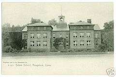
|
000000001988-12-01-0000December 1, 1988
(#88002634) |
94 E. Main St.
41°17′13″N 72°48′24″W / 41.286944°N 72.806667°W / 41.286944; -72.806667 (Samuel Beach House) |
Branford |
|
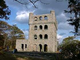
| 17 |
Benedict-Miller House |
|
000000001981-06-12-0000June 12, 1981
(#81000616) |
32 Hillside Ave.
41°33′42″N 73°02′30″W / 41.561667°N 73.041667°W / 41.561667; -73.041667 (Benedict-Miller House) |
Waterbury |
|
| 18 |
Beth El Synagogue |
Upload image |
000000001995-05-11-0000May 11, 1995
(#95000560) |
359-375 Cooke St.
41°34′03″N 73°02′27″W / 41.5675°N 73.040833°W / 41.5675; -73.040833 (Beth El Synagogue) |
Waterbury |
|
| 19 |
Birmingham Green Historic District |
|
000000002000-04-21-0000April 21, 2000
(#00000325) |
Roughly bounded by 5th, Caroline, 4th, and Olivia Sts.
41°19′21″N 73°05′20″W / 41.32242°N 73.089026°W / 41.32242; -73.089026 (Birmingham Green Historic District) |
Derby |
|
| 20 |
Bishop School |
Upload image |
000000001982-11-30-0000November 30, 1982
(#82001003) |
178 Bishop St.
41°33′50″N 73°02′12″W / 41.563889°N 73.036667°W / 41.563889; -73.036667 (Bishop School) |
Waterbury |
|
| 21 |
Blackstone House |
|
000000001988-12-01-0000December 1, 1988
(#88002639) |
37 1st Ave.
41°15′58″N 72°47′11″W / 41.266111°N 72.786389°W / 41.266111; -72.786389 (Blackstone House) |
Branford |
|
| 22 |
Joseph Blakeslee House |
Upload image |
000000001998-04-13-0000April 13, 1998
(#98000362) |
1211 Barnes Rd.
41°28′47″N 72°46′03″W / 41.479722°N 72.7675°W / 41.479722; -72.7675 (Joseph Blakeslee House) |
Wallingford |
|
| 23 |
Timothy Bradley House |
|
000000001988-12-01-0000December 1, 1988
(#88002630) |
12 Bradley St.
41°16′36″N 72°49′14″W / 41.276667°N 72.820556°W / 41.276667; -72.820556 (Timothy Bradley House) |
Branford |
|
| 24 |
Branford Center Historic District |
|
000000001987-05-06-0000May 6, 1987
(#87000636) |
Roughly bounded by U.S. Route 1, the Branford River on the east and the south, and Monroe and Kirkham Sts.
41°16′42″N 72°48′45″W / 41.278333°N 72.8125°W / 41.278333; -72.8125 (Branford Center Historic District) |
Branford |
|
| 25 |
Branford Electric Railway Historic District |
|
000000001983-06-03-0000June 3, 1983
(#83001278) |
17 River St. to Court St.
41°15′59″N 72°51′21″W / 41.266389°N 72.855833°W / 41.266389; -72.855833 (Branford Electric Railway Historic District) |
Branford and East Haven |
Trolley line and historic trolley collection
|
| 26 |
Branford Point Historic District |
|
000000001988-09-15-0000September 15, 1988
(#88001583) |
Roughly along Harbor St. north from Curve St. to Branford Point and also Maple St. east from Reynolds St. to Harbor St.
41°15′57″N 72°49′18″W / 41.265833°N 72.821667°W / 41.265833; -72.821667 (Branford Point Historic District) |
Branford |
|
| 27 |
Bridge No. 1132 |
|
000000002004-09-29-0000September 29, 2004
(#04001091) |
CT 80 at the Hammonasset River
41°21′26″N 72°36′45″W / 41.357222°N 72.612553°W / 41.357222; -72.612553 (Bridge No. 1132) |
Madison |
Open-spandrel concrete arch bridge built in 1934; extends into Killingworth in Middlesex County
|
| 28 |
Aaron Bronson House |
Upload image |
000000001993-07-29-0000July 29, 1993
(#93000656) |
846 Southford Rd.
41°28′25″N 73°11′10″W / 41.473611°N 73.186111°W / 41.473611; -73.186111 (Aaron Bronson House) |
Southbury |
|
| 29 |
Josiah Bronson House |
Upload image |
000000001982-02-25-0000February 25, 1982
(#82004356) |
Breakneck Hill Rd.
41°32′51″N 73°07′29″W / 41.5475°N 73.124722°W / 41.5475; -73.124722 (Josiah Bronson House) |
Middlebury |
|
| 30 |
Buckingham House |
|
000000001977-07-25-0000July 25, 1977
(#77001406) |
61 North St.
41°13′42″N 73°03′25″W / 41.228333°N 73.056944°W / 41.228333; -73.056944 (Buckingham House) |
Milford |
|
| 31 |
Bullet Hill School |
|
000000001972-02-23-0000February 23, 1972
(#72001346) |
Main St. and Seymour Rd.
41°28′56″N 73°12′50″W / 41.482222°N 73.213889°W / 41.482222; -73.213889 (Bullet Hill School) |
Southbury |
|
| 32 |
Thomas Burgis II House |
|
000000002000-12-28-0000December 28, 2000
(#00001562) |
85 Boston St.
41°16′56″N 72°40′41″W / 41.282222°N 72.678056°W / 41.282222; -72.678056 (Thomas Burgis II House) |
Guilford |
|
| 33 |
Canoe Brook Historic District |
Upload image |
000000002002-04-11-0000April 11, 2002
(#02000335) |
Roughly along Bradley St., Cherry Hill Rd., Home Place, Lincoln Ave., and Main and N. Harbor Sts.
41°16′37″N 72°49′21″W / 41.276944°N 72.8225°W / 41.276944; -72.8225 (Canoe Brook Historic District) |
Branford |
|
| 34 |
Dr. Andrew Castle House |
|
000000002000-03-31-0000March 31, 2000
(#00000299) |
555 Amity Rd.
41°22′38″N 73°00′04″W / 41.377222°N 73.001111°W / 41.377222; -73.001111 (Dr. Andrew Castle House) |
Woodbridge |
|
| 35 |
Center Street Cemetery |
|
000000001997-08-01-0000August 1, 1997
(#97000833) |
2 Center St.
41°27′19″N 72°49′26″W / 41.455278°N 72.823889°W / 41.455278; -72.823889 (Center Street Cemetery) |
Wallingford |
|
| 36 |
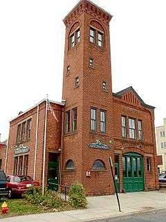
Charter Oak Firehouse |
|
000000001994-03-17-0000March 17, 1994
(#94000255) |
105 Hanover St.
41°32′12″N 72°48′24″W / 41.536667°N 72.806667°W / 41.536667; -72.806667 (Charter Oak Firehouse) |
Meriden |
|
| 37 |
Chatfield Farmstead |
Upload image |
000000002010-03-15-0000March 15, 2010
(#10000061) |
265 Seymour Rd.
41°23′36″N 73°02′35″W / 41.393386°N 73.043094°W / 41.393386; -73.043094 (Chatfield Farmstead) |
Woodbridge |
|
| 38 |
Cheshire Historic District |
|
000000001986-08-29-0000August 29, 1986
(#86002793) |
Roughly bounded by Main St., Highland Ave., Wallingford Rd., S. Main, Cornwall, and Spring Sts.
41°29′50″N 72°54′15″W / 41.497222°N 72.904167°W / 41.497222; -72.904167 (Cheshire Historic District) |
Cheshire |
|
| 39 |
Colony Street-West Main Street Historic District |
|
000000001987-09-04-0000September 4, 1987
(#87001387) |
1-62 Colony, 55 Grove, 1-119 and 82-110 W. Main Sts.
41°32′19″N 72°48′17″W / 41.538611°N 72.804722°W / 41.538611; -72.804722 (Colony Street-West Main Street Historic District) |
Meriden |
|
| 40 |
Curtis Memorial Library |
|
000000001981-04-27-0000April 27, 1981
(#81000618) |
175 E. Main St.
41°32′08″N 72°47′53″W / 41.535556°N 72.798056°W / 41.535556; -72.798056 (Curtis Memorial Library) |
Meriden |
|
| 41 |
Reuben Curtiss House |
Upload image |
000000001993-07-29-0000July 29, 1993
(#93000658) |
1770 Bucks Hill Rd.
41°28′33″N 73°10′11″W / 41.475833°N 73.169722°W / 41.475833; -73.169722 (Reuben Curtiss House) |
Southbury |
|
| 42 |
Thomas Darling House and Tavern |
|
000000001979-01-17-0000January 17, 1979
(#79002639) |
East of Woodbridge at 1907 Litchfield Turnpike
41°21′41″N 72°58′59″W / 41.361394°N 72.983037°W / 41.361394; -72.983037 (Thomas Darling House and Tavern) |
Woodbridge |
|
| 43 |
Depot Street Bridge |
|
000000002007-03-09-0000March 9, 2007
(#07000108) |
Depot St.
41°26′31″N 73°03′48″W / 41.441944°N 73.063333°W / 41.441944; -73.063333 (Depot Street Bridge) |
Beacon Falls |
|
| 44 |
Jonathan Dickerman II House |
Upload image |
000000001982-04-15-0000April 15, 1982
(#82004351) |
105 Mt. Carmel Ave.
41°25′11″N 72°54′02″W / 41.419722°N 72.900556°W / 41.419722; -72.900556 (Jonathan Dickerman II House) |
Hamden |
|
| 45 |
Downtown Seymour Historic District |
|
000000001983-08-25-0000August 25, 1983
(#83001279) |
Roughly bounded by the Naugatuck River, Main, Wakeley, and DeForest Sts.
41°23′39″N 73°04′28″W / 41.394167°N 73.074444°W / 41.394167; -73.074444 (Downtown Seymour Historic District) |
Seymour |
|
| 46 |
Downtown Waterbury Historic District |
|
000000001983-08-03-0000August 3, 1983
(#83001280) |
Roughly bounded by Main, Meadow, and Elm Sts.
41°33′19″N 73°02′34″W / 41.555278°N 73.042778°W / 41.555278; -73.042778 (Downtown Waterbury Historic District) |
Waterbury |
Historic core of downtown Waterbury, with most buildings from era after early 20th-century fire.
|
| 47 |
Dudleytown Historic District |
Upload image |
000000001991-08-09-0000August 9, 1991
(#91000951) |
Roughly Clapboard Hill Rd. from Tanner Marsh Rd. to Murray Ln., East River Rd. southeast to Trailwood Dr., and Duck Hole Rd.
41°17′58″N 72°39′29″W / 41.299444°N 72.658056°W / 41.299444; -72.658056 (Dudleytown Historic District) |
Guilford |
|
| 48 |
East Haven Green Historic District |
|
000000002002-04-11-0000April 11, 2002
(#02000336) |
263, 270, 274 Hemingway Ave., 125, 129, 133, 139, 143, 150 Main St., 3, 7, 11, 15, 23, 27, 39, 47 Park Pl., and 58 and 100 River St.
41°16′28″N 72°52′03″W / 41.274444°N 72.8675°W / 41.274444; -72.8675 (East Haven Green Historic District) |
East Haven |
|
| 49 |
East Rock Park |
|
000000001997-04-15-0000April 15, 1997
(#97000299) |
Roughly bounded by State, Davis, and Livingston Sts., Park and Mitchell Drs., and Whitney Ave.
41°19′41″N 72°54′21″W / 41.328056°N 72.905833°W / 41.328056; -72.905833 (East Rock Park) |
Hamden |
Park designed by Frederick Law Olmsted
|
| 50 |
Edgerton |
|
000000001988-09-19-0000September 19, 1988
(#88001469) |
840 Whitney Ave.
41°20′03″N 72°55′36″W / 41.334167°N 72.926667°W / 41.334167; -72.926667 (Edgerton) |
Hamden and New Haven |
Estate site that is now a park
|
| 51 |
Eells-Stow House |
|
000000001977-06-17-0000June 17, 1977
(#77001407) |
34 High St.
41°13′08″N 73°03′28″W / 41.218889°N 73.057778°W / 41.218889; -73.057778 (Eells-Stow House) |
Milford |
|
| 52 |
Jared Eliot House |
Upload image |
000000001985-11-14-0000November 14, 1985
(#85002792) |
88 Old Chaffinch Island Rd.
41°16′17″N 72°41′17″W / 41.271389°N 72.688056°W / 41.271389; -72.688056 (Jared Eliot House) |
Guilford |
|
| 53 |
Elton Hotel |
|
000000001983-06-30-0000June 30, 1983
(#83001282) |
16-30 W. Main St.
41°33′24″N 73°02′30″W / 41.556667°N 73.041667°W / 41.556667; -73.041667 (Elton Hotel) |
Waterbury |
1906 Second Renaissance Revival hotel built in wake of fire to replace lost Scovill Hotel
|
| 54 |
Falkner's Island Lighthouse |
|
000000001990-05-29-0000May 29, 1990
(#89001467) |
Long Island Sound, 5 miles south of Guilford
41°12′42″N 72°39′15″W / 41.211667°N 72.654167°W / 41.211667; -72.654167 (Falkner's Island Lighthouse) |
Guilford |
|
| 55 |
Farmington Canal-New Haven and Northampton Canal |
|
000000001985-09-12-0000September 12, 1985
(#85002664) |
Roughly from Suffield in Hartford County to New Haven in New Haven County
41°19′26″N 72°55′51″W / 41.323889°N 72.930778°W / 41.323889; -72.930778 (Farmington Canal-New Haven and Northampton Canal) |
Hamden, Cheshire, and New Haven |
Extends into New Haven as well as into Hartford County. Built as a canal, later became a railroad line, and now a multi-use trail.
|
| 56 |
Farmington Canal Lock |
|
000000001973-02-16-0000February 16, 1973
(#73001949) |
487 N. Brooksvale Rd.
41°28′34″N 72°55′23″W / 41.476111°N 72.923056°W / 41.476111; -72.923056 (Farmington Canal Lock) |
Cheshire |
1822 lock on the Farmington Canal
|
| 57 |
Farmington Canal Lock No. 13 |
Upload image |
000000001982-05-06-0000May 6, 1982
(#82004350) |
Brooksvale Ave.
41°27′32″N 72°55′06″W / 41.458889°N 72.918333°W / 41.458889; -72.918333 (Farmington Canal Lock No. 13) |
Hamden |
|
| 58 |
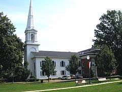
First Congregational Church of Cheshire |
|
000000001973-02-16-0000February 16, 1973
(#73001950) |
111 Church Dr.
41°29′53″N 72°54′13″W / 41.498056°N 72.903611°W / 41.498056; -72.903611 (First Congregational Church of Cheshire) |
Cheshire |
|
| 59 |
First Congregational Church of East Haven |
|
000000001982-03-25-0000March 25, 1982
(#82004349) |
251 Main St.
41°16′41″N 72°52′19″W / 41.278056°N 72.871944°W / 41.278056; -72.871944 (First Congregational Church of East Haven) |
East Haven |
|
| 60 |
Fourth District School |
Upload image |
000000001985-08-29-0000August 29, 1985
(#85001917) |
Old Post Rd.
41°23′32″N 72°47′32″W / 41.392222°N 72.792222°W / 41.392222; -72.792222 (Fourth District School) |
North Branford |
|
| 61 |
Edward Frisbie Homestead |
|
000000001985-05-16-0000May 16, 1985
(#85001058) |
240 Stony Creek Rd.
41°16′31″N 72°45′27″W / 41.275278°N 72.7575°W / 41.275278; -72.7575 (Edward Frisbie Homestead) |
Branford |
|
| 62 |
Edward Frisbie House |
|
000000001988-12-01-0000December 1, 1988
(#88002638) |
699 E. Main St.
41°18′15″N 72°45′22″W / 41.304167°N 72.756111°W / 41.304167; -72.756111 (Edward Frisbie House) |
Branford |
|
| 63 |
Lewis Fulton Memorial Park |
|
000000001990-12-27-0000December 27, 1990
(#90001951) |
Roughly bounded by Cook, Pine, Fern and Charlotte Sts.
41°34′10″N 73°01′54″W / 41.569444°N 73.031667°W / 41.569444; -73.031667 (Lewis Fulton Memorial Park) |
Waterbury |
|
| 64 |
Solomon Goffe House |
|
000000001979-01-16-0000January 16, 1979
(#79002645) |
677 N. Colony St.
41°33′10″N 72°47′19″W / 41.552778°N 72.788611°W / 41.552778; -72.788611 (Solomon Goffe House) |
Meriden |
Historic saltbox house
|
| 65 |
Griswold House |
|
000000001975-10-10-0000October 10, 1975
(#75001929) |
Boston St.
41°17′00″N 72°40′29″W / 41.283333°N 72.674722°W / 41.283333; -72.674722 (Griswold House) |
Guilford |
|
| 66 |
Guilford Historic Town Center |
|
000000001976-07-06-0000July 6, 1976
(#76001988) |
Bounded by West River, Interstate 95, East Creek and Long Island Sound
41°16′49″N 72°40′37″W / 41.280278°N 72.676944°W / 41.280278; -72.676944 (Guilford Historic Town Center) |
Guilford |
|
| 67 |
Hamden Bank & Trust Building |
Upload image |
000000001990-03-01-0000March 1, 1990
(#90000148) |
1 Circular Ave.
41°20′47″N 72°56′04″W / 41.346389°N 72.934444°W / 41.346389; -72.934444 (Hamden Bank & Trust Building) |
Hamden |
|
| 68 |
Hamden High School |
|
000000001994-12-12-0000December 12, 1994
(#94001378) |
2040 Dixwell Ave.
41°22′03″N 72°55′19″W / 41.3675°N 72.921944°W / 41.3675; -72.921944 (Hamden High School) |
Hamden |
|
| 69 |
Hamden Memorial Town Hall |
|
000000002001-04-12-0000April 12, 2001
(#01000355) |
2372 Whitney Ave.
41°23′02″N 72°54′09″W / 41.383889°N 72.9025°W / 41.383889; -72.9025 (Hamden Memorial Town Hall) |
Hamden |
|
| 70 |
Hamilton Park |
|
000000001996-08-15-0000August 15, 1996
(#96000846) |
Roughly bounded by Silver St., E. Main St., Idylwood Ave., Plank Rd., the Mad River, and Interstate 84
41°32′36″N 73°01′04″W / 41.543333°N 73.017778°W / 41.543333; -73.017778 (Hamilton Park) |
Waterbury |
|
| 71 |
Hammonasset Paper Mill Site |
|
000000001996-02-23-0000February 23, 1996
(#96000128) |
Green Hill Road at the Hammonasset River[6]
41°19′27″N 72°35′36″W / 41.3241°N 72.5932°W / 41.3241; -72.5932 (Hammonasset Paper Mill Site) |
Madison |
Extends into Killingworth in Middlesex County
|
| 72 |
Thomas Harrison House |
Upload image |
000000001988-12-01-0000December 1, 1988
(#88002644) |
23 N. Harbor St.
41°16′34″N 72°49′23″W / 41.276111°N 72.823056°W / 41.276111; -72.823056 (Thomas Harrison House) |
Branford |
|
| 73 |
Hebrew Congregation of Woodmont |
Upload image |
000000001995-07-21-0000July 21, 1995
(#95000860) |
15 and 17 Edgefield Ave.
41°13′33″N 73°00′05″W / 41.225833°N 73.001389°W / 41.225833; -73.001389 (Hebrew Congregation of Woodmont) |
Milford |
|
| 74 |
Enoch Hibbard House and Grannis |
Upload image |
000000001979-04-09-0000April 9, 1979
(#79002640) |
33 and 41 Church St.
41°33′20″N 73°01′55″W / 41.555556°N 73.031944°W / 41.555556; -73.031944 (Enoch Hibbard House and Grannis) |
Waterbury |
|
| 75 |
Hillside Historic District |
Upload image |
000000001987-08-20-0000August 20, 1987
(#87001384) |
Roughly bounded by Woodlawn Terrace, W. Main, and Willow
41°33′37″N 73°02′28″W / 41.560278°N 73.041111°W / 41.560278; -73.041111 (Hillside Historic District) |
Waterbury |
|
| 76 |
Isaac Hoadley House |
Upload image |
000000001988-12-01-0000December 1, 1988
(#88002647) |
9 Totoket Rd.
41°16′52″N 72°46′32″W / 41.281111°N 72.775556°W / 41.281111; -72.775556 (Isaac Hoadley House) |
Branford |
|
| 77 |
John Hoadley House |
|
000000001988-12-01-0000December 1, 1988
(#88002674) |
213 Leete's Island Rd.
41°17′14″N 72°45′33″W / 41.287222°N 72.759167°W / 41.287222; -72.759167 (John Hoadley House) |
Branford |
|
| 78 |
Orrin Hoadley House |
|
000000001988-12-01-0000December 1, 1988
(#88002646) |
15 Sunset Hill Rd.
41°17′00″N 72°46′53″W / 41.283333°N 72.781389°W / 41.283333; -72.781389 (Orrin Hoadley House) |
Branford |
|
| 79 |
Home Woolen Company |
|
000000001984-11-29-0000November 29, 1984
(#84000410) |
Main St.
41°26′34″N 73°03′45″W / 41.442778°N 73.0625°W / 41.442778; -73.0625 (Home Woolen Company) |
Beacon Falls |
|
| 80 |
David Hotchkiss House |
|
000000001981-05-01-0000May 1, 1981
(#81000617) |
Waterbury Rd.
41°30′44″N 72°59′05″W / 41.512222°N 72.984722°W / 41.512222; -72.984722 (David Hotchkiss House) |
Prospect |
|
| 81 |
House at 161 Damascus Road |
|
000000001988-12-01-0000December 1, 1988
(#88002632) |
161 Damascus Rd.
41°17′07″N 72°46′53″W / 41.285278°N 72.781389°W / 41.285278; -72.781389 (House at 161 Damascus Road) |
Branford |
|
| 82 |
House at 29 Flat Rock Road |
|
000000001988-12-01-0000December 1, 1988
(#88002640) |
29 Flat Rock Rd.
41°16′32″N 72°45′22″W / 41.275556°N 72.756111°W / 41.275556; -72.756111 (House at 29 Flat Rock Road) |
Branford |
|
| 83 |
Eliphalet Howd House |
|
000000001988-12-01-0000December 1, 1988
(#88002637) |
675 E. Main St.
41°18′10″N 72°45′28″W / 41.302778°N 72.757778°W / 41.302778; -72.757778 (Eliphalet Howd House) |
Branford |
|
| 84 |
Howd-Linsley House |
Upload image |
000000001986-12-10-0000December 10, 1986
(#86003382) |
1795 Middletown Ave.
41°24′34″N 72°46′06″W / 41.409444°N 72.768333°W / 41.409444; -72.768333 (Howd-Linsley House) |
North Branford |
|
| 85 |
John I. Howe House |
|
000000001989-02-06-0000February 6, 1989
(#88003229) |
213 Caroline St.
41°19′24″N 73°05′16″W / 41.323333°N 73.087778°W / 41.323333; -73.087778 (John I. Howe House) |
Derby |
Home of pin manufacturing pioneer
|
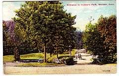
| 86 |
Hubbard Park |
|
000000001997-12-15-0000December 15, 1997
(#97001466) |
Roughly bounded by W. Main St., Interstate 691, CT 66, Reservoir Ave., Edgewood Dr., and Berlin and Southington town lines
41°33′45″N 72°50′05″W / 41.5625°N 72.834722°W / 41.5625; -72.834722 (Hubbard Park) |
Meriden and, in Hartford County, Berlin and Southington |
A park
|
| 87 |
Gen. David Humphreys House |
|
000000001972-03-17-0000March 17, 1972
(#72001321) |
37 Elm St.
41°19′52″N 73°04′30″W / 41.331111°N 73.075°W / 41.331111; -73.075 (Gen. David Humphreys House) |
Ansonia |
|
| 88 |
William Hurd House |
Upload image |
000000001993-07-29-0000July 29, 1993
(#93000659) |
327 Hulls Hill Rd.
41°27′25″N 73°10′29″W / 41.456944°N 73.174722°W / 41.456944; -73.174722 (William Hurd House) |
Southbury |
|
| 89 |
Hurley Road Historic District |
Upload image |
000000001993-07-29-0000July 29, 1993
(#93000662) |
6 and 17 Hurley Rd.
41°28′33″N 73°09′31″W / 41.475833°N 73.158611°W / 41.475833; -73.158611 (Hurley Road Historic District) |
Southbury |
|
| 90 |
Hyland-Wildman House |
|
000000001976-03-26-0000March 26, 1976
(#76001989) |
Boston St.
41°16′57″N 72°40′43″W / 41.2825°N 72.678611°W / 41.2825; -72.678611 (Hyland-Wildman House) |
Guilford |
|
| 91 |
Ives-Baldwin House |
Upload image |
000000002003-05-01-0000May 1, 2003
(#03000308) |
474 Baldwin Ave.
41°32′42″N 72°46′34″W / 41.545°N 72.776111°W / 41.545; -72.776111 (Ives-Baldwin House) |
Meriden |
|
| 92 |
Elam Ives House |
|
000000002010-10-12-0000October 12, 2010
(#10000832) |
95 Ives St.
41°24′13″N 72°53′43″W / 41.403611°N 72.895278°W / 41.403611; -72.895278 (Elam Ives House) |
Hamden |
|
| 93 |
Alphonso Johnson House |
Upload image |
000000001992-01-17-0000January 17, 1992
(#91001922) |
1 Gilbert Ave.
41°21′26″N 72°56′15″W / 41.357222°N 72.9375°W / 41.357222; -72.9375 (Alphonso Johnson House) |
Hamden |
|
| 94 |
Franklin Johnson House |
|
000000001998-11-23-0000November 23, 1998
(#98001420) |
153 S. Main St.
41°27′06″N 72°49′15″W / 41.451667°N 72.820833°W / 41.451667; -72.820833 (Franklin Johnson House) |
Wallingford |
|
| 95 |
Theophilus Jones House |
|
000000001992-01-30-0000January 30, 1992
(#91001981) |
40 Jones Rd.
41°26′51″N 72°51′10″W / 41.4475°N 72.852778°W / 41.4475; -72.852778 (Theophilus Jones House) |
Wallingford |
|
| 96 |
John Kendrick House |
|
000000001982-04-12-0000April 12, 1982
(#82004360) |
119 W. Main St.
41°33′22″N 73°02′36″W / 41.556111°N 73.043333°W / 41.556111; -73.043333 (John Kendrick House) |
Waterbury |
1865 brick Italianate house is one of the few remaining residential structures on Waterbury Green
|
| 97 |
Kraus Corset Factory |
|
000000001987-02-12-0000February 12, 1987
(#87000128) |
Roosevelt Dr. and 3rd St.
41°19′13″N 73°05′29″W / 41.320278°N 73.091389°W / 41.320278; -73.091389 (Kraus Corset Factory) |
Derby |
|
| 98 |
Pelatiah Leete House |
Upload image |
000000001974-10-01-0000October 1, 1974
(#74002048) |
Southwest of Guilford off CT 146
41°15′55″N 72°43′28″W / 41.265278°N 72.724444°W / 41.265278; -72.724444 (Pelatiah Leete House) |
Guilford |
|
| 99 |
Isaac C. Lewis Cottage |
|
000000001997-07-25-0000July 25, 1997
(#97000811) |
255 Thimble Islands Rd.
41°15′46″N 72°45′00″W / 41.262778°N 72.75°W / 41.262778; -72.75 (Isaac C. Lewis Cottage) |
Branford |
|
| 100 |
Little Pootatuck Brook Archeological Site |
|
000000001990-06-28-0000June 28, 1990
(#90000980) |
Address Restricted
|
Southbury |
|
| 101 |
Madison Green Historic District |
|
000000001982-06-28-0000June 28, 1982
(#82004353) |
446-589 Boston Post Rd. and structures surrounding the green
41°16′41″N 72°36′19″W / 41.278056°N 72.605278°W / 41.278056; -72.605278 (Madison Green Historic District) |
Madison |
|
| 102 |
Maltby-Stevens Factory Site |
Upload image |
000000002000-01-27-0000January 27, 2000
(#99001668) |
Address Restricted
|
North Branford |
|
| 103 |
Marion Historic District |
|
000000001988-12-21-0000December 21, 1988
(#88001423) |
Along Marion Ave. and Meriden-Waterbury Turnpike
41°33′50″N 72°55′29″W / 41.563889°N 72.924722°W / 41.563889; -72.924722 (Marion Historic District) |
Cheshire |
Extends into Southington; see the Hartford County list.
|
| 104 |
Richard Mansfield House |
Upload image |
000000001971-03-11-0000March 11, 1971
(#71000906) |
35 Jewett St.
41°20′23″N 73°04′14″W / 41.339722°N 73.070556°W / 41.339722; -73.070556 (Richard Mansfield House) |
Ansonia |
|
| 105 |
Matthews and Willard Factory |
Upload image |
000000001988-01-14-0000January 14, 1988
(#87002419) |
16 Cherry Ave.
41°33′24″N 73°02′10″W / 41.556667°N 73.036111°W / 41.556667; -73.036111 (Matthews and Willard Factory) |
Waterbury |
|
| 106 |
Medad Stone Tavern |
Upload image |
000000002009-01-30-0000January 30, 2009
(#08001378) |
197 Three Mile Course
41°17′03″N 72°41′46″W / 41.284167°N 72.696111°W / 41.284167; -72.696111 (Medad Stone Tavern) |
Guilford |
|
| 107 |
Meeting House Hill Historic District |
Upload image |
000000001987-12-14-0000December 14, 1987
(#87002132) |
Roughly bounded by Long Hill, Great Hill, and Ledge Hill Rds.
41°22′00″N 72°43′42″W / 41.366667°N 72.728333°W / 41.366667; -72.728333 (Meeting House Hill Historic District) |
Guilford |
|
| 108 |
Meigs-Bishop House |
|
000000001988-06-16-0000June 16, 1988
(#88000745) |
45 Wall St.
41°16′52″N 72°35′40″W / 41.281111°N 72.594444°W / 41.281111; -72.594444 (Meigs-Bishop House) |
Madison |
|
| 109 |
Meriden Curtain Fixture Company Factory |
Upload image |
000000001986-12-04-0000December 4, 1986
(#86003290) |
122 Charles St.
41°31′52″N 72°47′30″W / 41.531111°N 72.791667°W / 41.531111; -72.791667 (Meriden Curtain Fixture Company Factory) |
Meriden |
|
| 110 |
Middlebury Center Historic District |
|
000000001985-05-09-0000May 9, 1985
(#85001019) |
Roughly bounded by Library Rd., North and South Sts., and Whittemore Rd.
41°31′35″N 73°07′33″W / 41.526389°N 73.125833°W / 41.526389; -73.125833 (Middlebury Center Historic District) |
Middlebury |
|
| 111 |
Milford Point Hotel |
Upload image |
000000001988-01-22-0000January 22, 1988
(#87002417) |
Milford Point Rd.
41°10′33″N 73°06′07″W / 41.175833°N 73.101944°W / 41.175833; -73.101944 (Milford Point Hotel) |
Milford |
|
| 112 |
Henry F. Miller House |
|
000000002001-04-25-0000April 25, 2001
(#01000399) |
30 Derby Ave.
41°18′02″N 72°59′15″W / 41.300556°N 72.9875°W / 41.300556; -72.9875 (Henry F. Miller House) |
Orange |
International style house
|
| 113 |
Mount Carmel Congregational Church and Parish House |
Upload image |
000000001991-12-27-0000December 27, 1991
(#91001847) |
3280 and 3284 Whitney Ave., 195 Sherman Ave.
41°24′50″N 72°54′09″W / 41.413889°N 72.9025°W / 41.413889; -72.9025 (Mount Carmel Congregational Church and Parish House) |
Hamden |
|
| 114 |
Jonathan Murray House |
|
000000001982-04-12-0000April 12, 1982
(#82004354) |
76 Scotland Rd.
41°17′11″N 72°34′49″W / 41.286389°N 72.580278°W / 41.286389; -72.580278 (Jonathan Murray House) |
Madison |
|
| 115 |
Naugatuck Center Historic District |
|
000000001999-07-30-0000July 30, 1999
(#99000859) |
Roughly bounded by Fairview Ave., Hillside Ave., Terrace Ave., Water St., and Pleasant View St.
41°29′29″N 73°03′27″W / 41.491389°N 73.0575°W / 41.491389; -73.0575 (Naugatuck Center Historic District) |
Naugatuck |
|
| 116 |
Nehemiah Royce House |
|
000000001998-08-24-0000August 24, 1998
(#98000966) |
538 N. Main St.
41°27′59″N 72°48′48″W / 41.466389°N 72.813333°W / 41.466389; -72.813333 (Nehemiah Royce House) |
Wallingford |
|
| 117 |
New England Cement Company Kiln and Quarry |
Upload image |
000000002001-04-25-0000April 25, 2001
(#00001454) |
Address Restricted
41°22′36″N 72°58′40″W / 41.376667°N 72.977778°W / 41.376667; -72.977778 (New England Cement Company Kiln and Quarry) |
Woodbridge |
|
| 118 |
Norcross Brothers Granite Quarry |
|
000000002003-06-06-0000June 6, 2003
(#03000315) |
Quarry Rd.
41°17′01″N 72°44′32″W / 41.283611°N 72.742222°W / 41.283611; -72.742222 (Norcross Brothers Granite Quarry) |
Branford |
|
| 119 |
North Branford Center Historic District |
|
000000001999-12-09-0000December 9, 1999
(#99001472) |
Roughly along Church and North Sts.
41°19′46″N 72°45′52″W / 41.329444°N 72.764444°W / 41.329444; -72.764444 (North Branford Center Historic District) |
North Branford |
|
| 120 |
Northford Center Historic District |
|
000000002002-12-31-0000December 31, 2002
(#02001629) |
Roughly along Middletown Ave. and parts of Old Post Rd.
41°24′00″N 72°46′59″W / 41.4°N 72.783056°W / 41.4; -72.783056 (Northford Center Historic District) |
North Branford |
|
| 121 |
Norton House |
|
000000001988-12-01-0000December 1, 1988
(#88002645) |
200 Pine Orchard Rd.
41°16′38″N 72°47′44″W / 41.277222°N 72.795556°W / 41.277222; -72.795556 (Norton House) |
Branford |
|
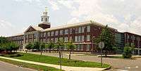
| 122 |
Old West Haven High School |
|
000000001985-10-24-0000October 24, 1985
(#85003368) |
278 Main St.
41°16′23″N 72°56′49″W / 41.2731°N 72.9469°W / 41.2731; -72.9469 (Old West Haven High School) |
West Haven |
Also formerly the Giannotti Junior High School.
|
| 123 |
Orange Center Historic District |
|
000000001989-08-10-0000August 10, 1989
(#89001089) |
Roughly Orange Center Rd. from Orange Cemetery to Nan Dr.
41°16′36″N 73°01′40″W / 41.276667°N 73.027778°W / 41.276667; -73.027778 (Orange Center Historic District) |
Orange |
Includes the federal style 1810 Orange Congregational Church by David Hoadley and the 1878 stick style Academy schoolhouse
|
| 124 |
Osbornedale |
|
000000001986-06-13-0000June 13, 1986
(#86001256) |
500 Hawthorne Ave.
41°19′51″N 73°06′27″W / 41.330833°N 73.1075°W / 41.330833; -73.1075 (Osbornedale) |
Derby |
Historic nineteenth-century farmhouse
|
| 125 |
Overlook Historic District |
Upload image |
000000001988-06-07-0000June 7, 1988
(#88000662) |
Roughly bounded by Hecla St., Farmington and Columbia Boulevard, Cables Ave. and Clowes Terrace, and Lincoln and Fiske Sts.
41°34′13″N 73°02′54″W / 41.570278°N 73.048333°W / 41.570278; -73.048333 (Overlook Historic District) |
Waterbury |
|
| 126 |
Palace Theater |
|
000000001983-06-30-0000June 30, 1983
(#83001284) |
86-110 E. Main St.
41°33′19″N 73°02′23″W / 41.555278°N 73.039722°W / 41.555278; -73.039722 (Palace Theater) |
Waterbury |
|
| 127 |
Hezekiah Palmer House |
|
000000001988-12-01-0000December 1, 1988
(#88002641) |
340-408 Leete's Island Rd.
41°16′30″N 72°45′25″W / 41.275°N 72.756944°W / 41.275; -72.756944 (Hezekiah Palmer House) |
Branford |
|
| 128 |
Isaac Palmer House |
|
000000001988-12-01-0000December 1, 1988
(#88002643) |
736-756 Main St.
41°16′47″N 72°48′57″W / 41.279722°N 72.815833°W / 41.279722; -72.815833 (Isaac Palmer House) |
Branford |
|
| 129 |
Samuel Parsons House |
|
000000001982-04-12-0000April 12, 1982
(#82004358) |
180 S. Main St.
41°27′04″N 72°49′14″W / 41.451111°N 72.820556°W / 41.451111; -72.820556 (Samuel Parsons House) |
Wallingford |
|
| 130 |
Pine Orchard Union Chapel |
|
000000002000-07-19-0000July 19, 2000
(#00000815) |
25 Chapel Dr.
41°15′57″N 72°44′25″W / 41.265833°N 72.740278°W / 41.265833; -72.740278 (Pine Orchard Union Chapel) |
Branford |
|
| 131 |
Pines Bridge Historic District |
Upload image |
000000001988-05-27-0000May 27, 1988
(#88000577) |
3-17 Bishop St., 70-99 Old Broadway, 2-10 Philip Pl., and 9-56 State St.
41°23′15″N 72°52′23″W / 41.3875°N 72.873056°W / 41.3875; -72.873056 (Pines Bridge Historic District) |
North Haven |
|
| 132 |
Pistol Factory Dwelling |
Upload image |
000000001991-12-27-0000December 27, 1991
(#91001846) |
1322 Whitney Ave.
41°20′57″N 72°54′51″W / 41.349167°N 72.914167°W / 41.349167; -72.914167 (Pistol Factory Dwelling) |
Hamden |
|
| 133 |
Elisha Pitkin House |
Upload image |
000000001979-04-06-0000April 6, 1979
(#79002646) |
173 High Woods Dr.
41°18′56″N 72°42′07″W / 41.315556°N 72.701944°W / 41.315556; -72.701944 (Elisha Pitkin House) |
Guilford |
|
| 134 |
Plaster House |
|
000000001993-07-29-0000July 29, 1993
(#93000660) |
117 Plaster House Rd.
41°27′00″N 73°10′01″W / 41.45°N 73.166944°W / 41.45; -73.166944 (Plaster House) |
Southbury |
|
| 135 |
Col. Asa Platt House |
|
000000002002-12-31-0000December 31, 2002
(#02001630) |
2 Tyler City Rd.
41°17′12″N 73°00′41″W / 41.286667°N 73.011389°W / 41.286667; -73.011389 (Col. Asa Platt House) |
Orange |
Federal-style house from 1810
|
| 136 |
Prospect Green Historic District |
|
000000002000-06-16-0000June 16, 2000
(#00000560) |
2, 8, 10, 12, 17, 19, 21, 23, 25, 27, and 30 Center St.
41°30′04″N 72°58′42″W / 41.501111°N 72.978333°W / 41.501111; -72.978333 (Prospect Green Historic District) |
Prospect |
|
| 137 |
Quaker Farms Historic District |
|
000000001991-08-09-0000August 9, 1991
(#91000993) |
467-511 Quaker Farms Rd.
41°25′34″N 73°09′24″W / 41.426111°N 73.156667°W / 41.426111; -73.156667 (Quaker Farms Historic District) |
Oxford |
|
| 138 |
Red Bridge |
|
000000001993-12-10-0000December 10, 1993
(#93001345) |
Near Oregon Rd. over the Quinnipiac River
41°31′20″N 72°50′20″W / 41.522222°N 72.838889°W / 41.522222; -72.838889 (Red Bridge) |
Meriden |
|
| 139 |
Nathaniel Richardson House |
Upload image |
000000001977-09-19-0000September 19, 1977
(#77001405) |
Northeast of Middlebury on Kelly Rd.
41°32′40″N 73°05′37″W / 41.544444°N 73.093611°W / 41.544444; -73.093611 (Nathaniel Richardson House) |
Middlebury |
|
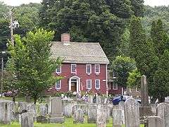
| 140 |
Rising Sun Tavern |
Upload image |
000000001979-08-21-0000August 21, 1979
(#79002638) |
Old Tavern Lane
41°22′20″N 72°49′27″W / 41.372222°N 72.824167°W / 41.372222; -72.824167 (Rising Sun Tavern) |
North Haven |
|
| 141 |
River Park Historic District |
|
000000001986-08-14-0000August 14, 1986
(#86002648) |
Roughly bounded by Boston Post Rd., Cherry St. and Amtrak line, and High St.
41°13′38″N 73°03′30″W / 41.227222°N 73.058333°W / 41.227222; -73.058333 (River Park Historic District) |
Milford |
|
| 142 |
Riverside Cemetery |
|
000000001988-09-20-0000September 20, 1988
(#88001525) |
Riverside St. from Sunnyside to Summit Sts.
41°32′52″N 73°02′57″W / 41.547778°N 73.049167°W / 41.547778; -73.049167 (Riverside Cemetery) |
Waterbury |
|
| 143 |
John Rogers House |
|
000000001988-12-01-0000December 1, 1988
(#88002642) |
690 Leete's Island Rd.
41°16′12″N 72°44′14″W / 41.27°N 72.737222°W / 41.27; -72.737222 (John Rogers House) |
Branford |
|
| 144 |
Route 146 Historic District |
Upload image |
000000001990-04-05-0000April 5, 1990
(#90000569) |
Route 146 between Flat Rock Rd. and West River bridge
41°16′07″N 72°42′50″W / 41.268611°N 72.713889°W / 41.268611; -72.713889 (Route 146 Historic District) |
Branford and Guilford |
|
| 145 |
Russian Village Historic District |
|
000000001988-12-08-0000December 8, 1988
(#88002687) |
Roughly Kiev Dr. and Russian Village Rd. between U.S. Route 6 and the Pomperaug River
41°26′56″N 73°15′10″W / 41.448889°N 73.252778°W / 41.448889; -73.252778 (Russian Village Historic District) |
Southbury |
|
| 146 |
Sabbathday House |
|
000000001975-10-10-0000October 10, 1975
(#75001931) |
19 Union St.
41°17′07″N 72°40′50″W / 41.285278°N 72.680556°W / 41.285278; -72.680556 (Sabbathday House) |
Guilford |
|
| 147 |
Salem School |
|
000000001983-11-03-0000November 3, 1983
(#83003582) |
124 Meadow St.
41°29′26″N 73°03′27″W / 41.490556°N 73.0575°W / 41.490556; -73.0575 (Salem School) |
Naugatuck |
|
| 148 |
Sanford Road Historic District |
|
000000001993-07-29-0000July 29, 1993
(#93000657) |
480 and 487 Sanford Rd.
41°27′41″N 73°11′05″W / 41.461389°N 73.184722°W / 41.461389; -73.184722 (Sanford Road Historic District) |
Southbury |
|
| 149 |
Sanford-Humphreys House |
Upload image |
000000001982-05-11-0000May 11, 1982
(#82004357) |
61-63 West St.
41°23′39″N 73°04′47″W / 41.394167°N 73.079722°W / 41.394167; -73.079722 (Sanford-Humphreys House) |
Seymour |
|
| 150 |
Seymour High School and Annex |
|
000000001983-11-17-0000November 17, 1983
(#83003583) |
100 Bank St.
41°23′51″N 73°04′36″W / 41.3975°N 73.076667°W / 41.3975; -73.076667 (Seymour High School and Annex) |
Seymour |
Former high school, later an elementary school, now offices including medical offices
|
| 151 |
Sheffield Street Bridge |
|
000000002001-04-12-0000April 12, 2001
(#01000353) |
Sheffield St. over Hancock Brook
41°35′50″N 73°02′52″W / 41.597222°N 73.047778°W / 41.597222; -73.047778 (Sheffield Street Bridge) |
Waterbury |
|
| 152 |
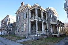
Shelley House |
Upload image |
000000001989-02-09-0000February 9, 1989
(#89000017) |
248 Boston Post Rd.
41°16′42″N 72°37′45″W / 41.278333°N 72.629167°W / 41.278333; -72.629167 (Shelley House) |
Madison |
|
| 153 |
Samuel Simpson House |
Upload image |
000000001986-06-18-0000June 18, 1986
(#86001334) |
216 N. Main St.
41°27′27″N 72°49′02″W / 41.4575°N 72.817222°W / 41.4575; -72.817222 (Samuel Simpson House) |
Wallingford |
Moved to Scard Road in Wallingford.
|
| 154 |
Sleeping Giant Tower |
|
000000001986-09-04-0000September 4, 1986
(#86001754) |
200 Mt. Carmel Ave. at Mt. Carmel summit, Sleeping Giant State Park
41°25′50″N 72°53′27″W / 41.430556°N 72.890833°W / 41.430556; -72.890833 (Sleeping Giant Tower) |
Hamden |
|
| 155 |
South Britain Historic District |
|
000000001987-02-12-0000February 12, 1987
(#87000125) |
E. Flat Hill, Hawkins, Library, and Middle Rds., and 497-864 S. Britain Rd.
41°28′09″N 73°15′03″W / 41.469167°N 73.250833°W / 41.469167; -73.250833 (South Britain Historic District) |
Southbury |
|
| 156 |
Southbury Historic District No. 1 |
|
000000001971-03-11-0000March 11, 1971
(#71000917) |
Main St. from Woodbury town line to Old Waterbury Rd.
41°29′42″N 73°12′37″W / 41.495°N 73.210278°W / 41.495; -73.210278 (Southbury Historic District No. 1) |
Southbury |
|
| 157 |
Southbury Training School |
|
000000001992-05-01-0000May 1, 1992
(#92000368) |
1484 S. Britain Rd.
41°27′49″N 73°16′23″W / 41.463611°N 73.273056°W / 41.463611; -73.273056 (Southbury Training School) |
Southbury |
Extends into Roxbury; see the Litchfield County list.
|
| 158 |
Southwest District School |
|
000000001982-04-02-0000April 2, 1982
(#82004363) |
155 Nichols Rd.
41°34′49″N 72°59′10″W / 41.580278°N 72.986111°W / 41.580278; -72.986111 (Southwest District School) |
Wolcott |
|
| 159 |
St. Peter's Episcopal Church |
|
000000001979-08-21-0000August 21, 1979
(#79002644) |
61, 71, 81 River St.
41°13′27″N 73°03′27″W / 41.224167°N 73.0575°W / 41.224167; -73.0575 (St. Peter's Episcopal Church) |
Milford |
|
| 160 |
Stapleton Building |
Upload image |
000000001988-01-14-0000January 14, 1988
(#87002421) |
751 N. Main St.
41°33′49″N 73°01′58″W / 41.563611°N 73.032778°W / 41.563611; -73.032778 (Stapleton Building) |
Waterbury |
|
| 161 |
State Park Supply Yard |
Upload image |
000000001986-09-04-0000September 4, 1986
(#86001757) |
51 Mill Rd.
41°16′37″N 72°33′39″W / 41.276944°N 72.560833°W / 41.276944; -72.560833 (State Park Supply Yard) |
Madison |
|
| 162 |
Sterling Opera House |
|
000000001968-11-08-0000November 8, 1968
(#68000040) |
Northwestern corner of 4th and Elizabeth Sts.
41°19′18″N 73°05′24″W / 41.321667°N 73.09°W / 41.321667; -73.09 (Sterling Opera House) |
Derby |
Amelia Earhart, John L. Sullivan, Harry Houdini, George Burns, Lionel Barrymore, Ethel Barrymore, Red Skelton, and John Philip Sousa appeared on this stage.
|
| 163 |
Stevenson Dam Hydroelectric Plant |
|
000000002000-09-29-0000September 29, 2000
(#00001073) |
CT 34
41°23′03″N 73°10′16″W / 41.384167°N 73.171111°W / 41.384167; -73.171111 (Stevenson Dam Hydroelectric Plant) |
Oxford and Monroe (in Fairfield County) |
Dam, bridge, and powerhouse built in 1917 on the Housatonic River
|
| 164 |
Stick Style House at Stony Creek |
|
000000001972-12-27-0000December 27, 1972
(#72001322) |
34 Prospect Hill
41°15′56″N 72°44′44″W / 41.265556°N 72.745556°W / 41.265556; -72.745556 (Stick Style House at Stony Creek) |
Branford |
|
| 165 |
Stony Creek-Thimble Islands Historic District |
|
000000001988-12-16-0000December 16, 1988
(#88002844) |
Roughly Thimble Islands Rd. between Route 146 and Long Island Sound and the Thimble Islands
41°15′33″N 72°45′18″W / 41.259167°N 72.755°W / 41.259167; -72.755 (Stony Creek-Thimble Islands Historic District) |
Branford |
|
| 166 |
Swain-Harrison House |
|
000000001975-10-10-0000October 10, 1975
(#75001924) |
124 W. Main St.
41°16′41″N 72°49′34″W / 41.278056°N 72.826111°W / 41.278056; -72.826111 (Swain-Harrison House) |
Branford |
|
| 167 |
Taylor Memorial Library |
|
000000001979-08-21-0000August 21, 1979
(#79002642) |
5 Broad St.
41°13′20″N 73°03′27″W / 41.222222°N 73.0575°W / 41.222222; -73.0575 (Taylor Memorial Library) |
Milford |
|
| 168 |
Orrin Todd House |
Upload image |
000000001991-12-26-0000December 26, 1991
(#91001845) |
3369 Whitney Ave.
41°25′02″N 72°54′11″W / 41.417222°N 72.903056°W / 41.417222; -72.903056 (Orrin Todd House) |
Hamden |
|
| 169 |
Tranquility Farm |
Upload image |
000000001982-09-23-0000September 23, 1982
(#82004355) |
West of Middlebury on CT 64
41°31′54″N 73°08′16″W / 41.531667°N 73.137778°W / 41.531667; -73.137778 (Tranquility Farm) |
Middlebury |
|
| 170 |
Bronson B. Tuttle House |
Upload image |
000000001990-11-29-0000November 29, 1990
(#90001803) |
380 Church St.
41°29′43″N 73°03′19″W / 41.495278°N 73.055278°W / 41.495278; -73.055278 (Bronson B. Tuttle House) |
Naugatuck |
|
| 171 |
John Tyler House |
|
000000001988-12-01-0000December 1, 1988
(#88002635) |
242-250 E. Main St.
41°17′29″N 72°47′46″W / 41.291362°N 72.796010°W / 41.291362; -72.796010 (John Tyler House) |
Branford |
|
| 172 |
Solomon Tyler House |
|
000000001988-12-01-0000December 1, 1988
(#88002636) |
260-268 E. Main St.
41°17′31″N 72°47′41″W / 41.291819°N 72.794731°W / 41.291819; -72.794731 (Solomon Tyler House) |
Branford |
|
| 173 |
Union School |
Upload image |
000000001987-11-13-0000November 13, 1987
(#87001899) |
174 Center St.
41°16′29″N 72°56′49″W / 41.274722°N 72.946944°W / 41.274722; -72.946944 (Union School) |
West Haven |
|
| 174 |
Upper Main Street Historic District |
|
000000001982-12-02-0000December 2, 1982
(#82001004) |
36-100 and 85-117 Main St.
41°20′41″N 73°04′47″W / 41.344722°N 73.079722°W / 41.344722; -73.079722 (Upper Main Street Historic District) |
Ansonia |
|
| 175 |
US Post Office-Ansonia Main |
|
000000001985-12-12-0000December 12, 1985
(#85003327) |
237 Main St.
41°20′35″N 73°04′43″W / 41.343056°N 73.078611°W / 41.343056; -73.078611 (US Post Office-Ansonia Main) |
Ansonia |
|
| 176 |
US Post Office-Meriden Main |
|
000000001986-01-21-0000January 21, 1986
(#86000129) |
39 N. Colony St.
41°32′41″N 72°48′04″W / 41.544722°N 72.801111°W / 41.544722; -72.801111 (US Post Office-Meriden Main) |
Meriden |
|
| 177 |
US Post Office-Milford Main |
|
000000001986-09-25-0000September 25, 1986
(#86002959) |
6 W. River St.
41°13′27″N 73°03′30″W / 41.224167°N 73.058333°W / 41.224167; -73.058333 (US Post Office-Milford Main) |
Milford |
|
| 178 |
US Post Office-Naugatuck Main |
|
000000001986-01-21-0000January 21, 1986
(#86000130) |
Church and Cedar Sts.
41°29′32″N 73°03′23″W / 41.492222°N 73.056389°W / 41.492222; -73.056389 (US Post Office-Naugatuck Main) |
Naugatuck |
|
| 179 |
Wallingford Center Historic District |
|
000000001993-12-02-0000December 2, 1993
(#93001242) |
Roughly Main St. from Ward St. to Church St.
41°27′11″N 72°49′14″W / 41.453056°N 72.820556°W / 41.453056; -72.820556 (Wallingford Center Historic District) |
Wallingford |
|
| 180 |
Wallingford Railroad Station |
|
000000001993-11-19-0000November 19, 1993
(#93001245) |
51 Quinnipiac St. (37 Hall Ave.)
41°27′24″N 72°49′32″W / 41.456667°N 72.825556°W / 41.456667; -72.825556 (Wallingford Railroad Station) |
Wallingford |
|
| 181 |
Ward-Heitman House |
|
000000002003-01-08-0000January 8, 2003
(#02001691) |
277 Elm St.
41°16′34″N 72°57′08″W / 41.276111°N 72.952222°W / 41.276111; -72.952222 (Ward-Heitman House) |
West Haven |
|
| 182 |
Washington Avenue Bridge |
|
000000002001-04-12-0000April 12, 2001
(#01000354) |
Washington Ave. over the Mad River
41°32′38″N 73°02′18″W / 41.543889°N 73.038333°W / 41.543889; -73.038333 (Washington Avenue Bridge) |
Waterbury |
|
| 183 |
Washington Bridge |
|
000000002004-09-29-0000September 29, 2004
(#04001093) |
U.S. Route 1 at the Housatonic River
41°12′01″N 73°06′39″W / 41.200278°N 73.110833°W / 41.200278; -73.110833 (Washington Bridge) |
Milford and Stratford (in Fairfield County) |
A moveable bridge
|
| 184 |
Waterbury Brass Mill |
Upload image |
000000001975-09-05-0000September 5, 1975
(#75001943) |
Idlewood Ave. in Hamilton Park
41°32′26″N 73°01′04″W / 41.540556°N 73.017778°W / 41.540556; -73.017778 (Waterbury Brass Mill) |
Waterbury |
|
| 185 |
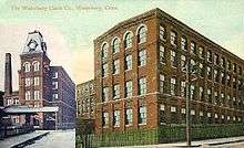
Waterbury Clock Company |
|
000000001982-11-30-0000November 30, 1982
(#82001005) |
N. Elm and Cherry Sts. and Cherry Ave.
41°33′30″N 73°02′06″W / 41.558333°N 73.035°W / 41.558333; -73.035 (Waterbury Clock Company) |
Waterbury |
|
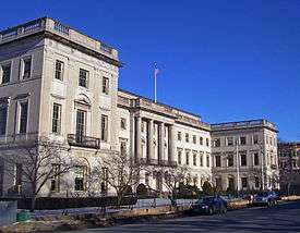
| 186 |
Waterbury Municipal Center Complex |
|
000000001978-10-10-0000October 10, 1978
(#78002882) |
195, 235, and 236 Grand St. and 7, 35, and 43 Field St.
41°33′13″N 73°02′36″W / 41.553611°N 73.043333°W / 41.553611; -73.043333 (Waterbury Municipal Center Complex) |
Waterbury |
Cass Gilbert-designed complex from 1910s meant to create one unified complex of city government, corporate headquarters and charitable office in accord with City Beautiful movement principles.
|
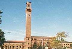
| 187 |
Waterbury Union Station |
|
000000001978-03-08-0000March 8, 1978
(#78002881) |
389 Meadow St.
41°33′18″N 73°02′51″W / 41.555°N 73.0475°W / 41.555; -73.0475 (Waterbury Union Station) |
Waterbury |
1908 station meant to be grand entrance to city being rebuilt after fire; clock tower has become symbol of the city
|
| 188 |
Webster School |
Upload image |
000000001982-06-14-0000June 14, 1982
(#82004365) |
Easton Ave. at Aetna St.
41°34′00″N 73°01′53″W / 41.566667°N 73.031389°W / 41.566667; -73.031389 (Webster School) |
Waterbury |
|
| 189 |
West Haven Green Historic District |
|
000000002000-08-11-0000August 11, 2000
(#00000832) |
Roughly along Main St., Campbell St., Church St., and Savin St.
41°16′15″N 72°57′01″W / 41.270833°N 72.950278°W / 41.270833; -72.950278 (West Haven Green Historic District) |
West Haven |
|
| 190 |
Adin Wheeler House and Theodore F. Wheeler Wheelwright Shop |
|
000000001993-07-29-0000July 29, 1993
(#93000661) |
125 Quaker Farms Rd.
41°27′37″N 73°09′49″W / 41.460278°N 73.163611°W / 41.460278; -73.163611 (Adin Wheeler House and Theodore F. Wheeler Wheelwright Shop) |
Southbury |
|
| 191 |
Wheeler-Beecher House |
|
000000001977-07-15-0000July 15, 1977
(#77001400) |
562 Amity Rd.
41°25′42″N 72°59′44″W / 41.428333°N 72.995556°W / 41.428333; -72.995556 (Wheeler-Beecher House) |
Bethany |
|
| 192 |
Henry Whitfield House |
|
000000001997-09-25-0000September 25, 1997
(#72001327) |
248 Old Whitfield St.
41°16′40″N 72°40′31″W / 41.277778°N 72.675278°W / 41.277778; -72.675278 (Henry Whitfield House) |
Guilford |
The oldest house in Connecticut, built in 1639
|
| 193 |
Eli Whitney Gun Factory |
|
000000001974-08-13-0000August 13, 1974
(#74002049) |
915-940 Whitney Ave.
41°20′09″N 72°54′38″W / 41.335735°N 72.910638°W / 41.335735; -72.910638 (Eli Whitney Gun Factory) |
Hamden |
|
| 194 |
Whitneyville Congregational Church |
|
000000001995-07-28-0000July 28, 1995
(#95000906) |
1247-1253 Whitney Ave.
41°20′48″N 72°54′47″W / 41.346667°N 72.913056°W / 41.346667; -72.913056 (Whitneyville Congregational Church) |
Hamden |
|
| 195 |
Wilby High School |
|
000000001982-06-14-0000June 14, 1982
(#82004366) |
260 Grove St.
41°33′36″N 73°02′45″W / 41.56°N 73.045833°W / 41.56; -73.045833 (Wilby High School) |
Waterbury |
|
| 196 |
Warham Williams House |
Upload image |
000000001971-03-11-0000March 11, 1971
(#71000915) |
Old Post Rd. and CT 17 and 22
41°23′33″N 72°47′31″W / 41.3925°N 72.791944°W / 41.3925; -72.791944 (Warham Williams House) |
North Branford |
|
| 197 |
Wolcott Green Historic District |
|
000000002000-03-31-0000March 31, 2000
(#00000297) |
Roughly bounding Wolcott Green
41°36′05″N 72°58′33″W / 41.601389°N 72.975833°W / 41.601389; -72.975833 (Wolcott Green Historic District) |
Wolcott |
|
| 198 |
Harcourt Wood Memorial Library |
|
000000001982-01-04-0000January 4, 1982
(#82004348) |
313 Elizabeth St.
41°19′36″N 73°05′20″W / 41.326667°N 73.088889°W / 41.326667; -73.088889 (Harcourt Wood Memorial Library) |
Derby |
|
| 199 |
Woodbridge Green Historic District |
|
000000002003-04-18-0000April 18, 2003
(#03000233) |
3, 4, 7, 11 Meetinghouse Ln. and 4 and 10 Newton Rd.
41°21′14″N 73°00′46″W / 41.353889°N 73.012778°W / 41.353889; -73.012778 (Woodbridge Green Historic District) |
Woodbridge |
|
| 200 |
Wooster Sawmill and Gristmill Site |
Upload image |
000000002001-08-17-0000August 17, 2001
(#01000879) |
Address Restricted
|
Oxford |
|


.png)








.jpg)


































.jpg)
