| [3] |
Name on the Register[4] |
Image |
Date listed[5] |
Location |
City or town |
Description |
|---|
| 1 |
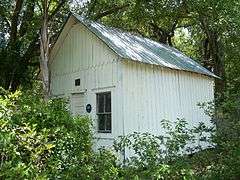
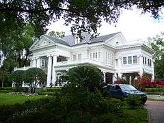
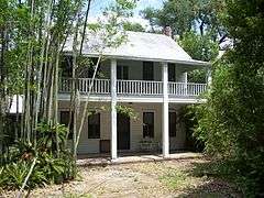
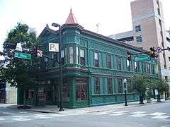
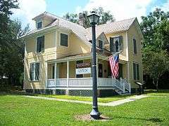
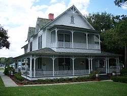
1890 Windermere School |
|
000000002003-06-05-0000June 5, 2003
(#03000509) |
113 West Seventh Avenue
28°29′35″N 81°32′07″W / 28.493056°N 81.535278°W / 28.493056; -81.535278 (1890 Windermere School) |
Windermere |
|
| 2 |
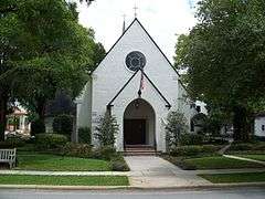
All Saints Episcopal Church |
|
000000002000-01-07-0000January 7, 2000
(#99001647) |
338 East Lyman Avenue
28°35′40″N 81°20′55″W / 28.594444°N 81.348611°W / 28.594444; -81.348611 (All Saints Episcopal Church) |
Winter Park |
|
| 3 |
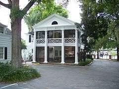
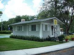
Apopka Seaboard Air Line Railway Depot |
|
000000001993-03-15-0000March 15, 1993
(#93000134) |
36 East Station Street
28°40′11″N 81°30′39″W / 28.669722°N 81.510833°W / 28.669722; -81.510833 (Apopka Seaboard Air Line Railway Depot) |
Apopka |
|
| 4 |
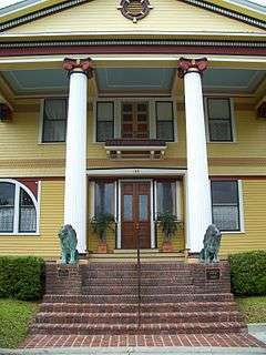
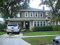
S. Howard Atha House |
|
000000002009-09-02-0000September 2, 2009
(#09000672) |
1101 West Princeton Street
28°34′17″N 81°23′41″W / 28.571389°N 81.394722°W / 28.571389; -81.394722 (S. Howard Atha House) |
Orlando |
|
| 5 |
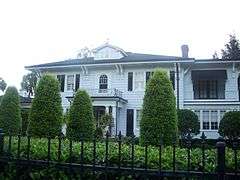
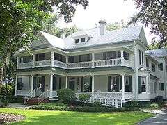
Robert Bruce Barbour House |
|
000000002008-12-31-0000December 31, 2008
(#08001244) |
656 Park Avenue North
28°36′10″N 81°21′04″W / 28.602667°N 81.351056°W / 28.602667; -81.351056 (Robert Bruce Barbour House) |
Winter Park |
|
| 6 |
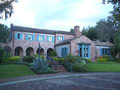
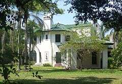
Edward Hill Brewer House |
|
000000001982-04-22-0000April 22, 1982
(#82002378) |
240 Trismen Terrace
28°36′03″N 81°20′33″W / 28.600833°N 81.3425°W / 28.600833; -81.3425 (Edward Hill Brewer House) |
Winter Park |
|
| 7 |
J. J. Bridges House |
|
000000001984-01-26-0000January 26, 1984
(#84000932) |
704 South Kuhl Avenue
28°31′59″N 81°22′38″W / 28.533056°N 81.377222°W / 28.533056; -81.377222 (J. J. Bridges House) |
Orlando |
|
| 8 |
Carroll Building |
|
000000001993-03-04-0000March 4, 1993
(#93000135) |
407-409 South Park Avenue
28°40′17″N 81°30′34″W / 28.671389°N 81.509444°W / 28.671389; -81.509444 (Carroll Building) |
Apopka |
|
| 9 |
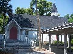
Church of the Good Shepherd |
|
000000002011-03-28-0000March 28, 2011
(#11000144) |
331 Lake Avenue
28°37′11″N 81°22′05″W / 28.619722°N 81.368056°W / 28.619722; -81.368056 (Church of the Good Shepherd) |
Maitland |
part of the Florida's Carpenter Gothic Churches MPS
|
| 10 |
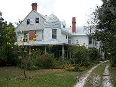
Comstock-Harris House |
|
000000001983-01-13-0000January 13, 1983
(#83001432) |
724 Bonita Drive
28°36′19″N 81°20′08″W / 28.605278°N 81.335556°W / 28.605278; -81.335556 (Comstock-Harris House) |
Winter Park |
|
| 11 |
Downtown Winter Park Historic District |
|
000000002011-05-03-0000May 3, 2011
(#11000158) |
Roughly Canton Ave, Center St, Comstock Ave, New York Ave,
28°35′50″N 81°21′07″W / 28.597222°N 81.351944°W / 28.597222; -81.351944 (Downtown Winter Park Historic District) |
Winter Park |
|
| 12 |
Eatonville Historic District |
|
000000001998-02-03-0000February 3, 1998
(#97001214) |
Roughly bounded by Wymore Road, Eaton Street, Fords and East Avenues, and Ruffel and Clark Streets
28°37′04″N 81°22′52″W / 28.617778°N 81.381111°W / 28.617778; -81.381111 (Eatonville Historic District) |
Eatonville |
|
| 13 |
First Church of Christ Scientist |
|
000000001980-06-03-0000June 3, 1980
(#80000956) |
24 North Rosalind Avenue
28°32′34″N 81°22′35″W / 28.542778°N 81.376389°W / 28.542778; -81.376389 (First Church of Christ Scientist) |
Orlando |
|
| 14 |
Gary-Morgan House |
Upload image |
000000002015-03-02-0000March 2, 2015
(#15000062) |
1041 Osceola Ave.
28°35′52″N 81°20′18″W / 28.5979°N 81.3384°W / 28.5979; -81.3384 (Gary-Morgan House) |
Winter Park |
|
| 15 |
Griffin Park Historic District |
|
000000001996-07-18-0000July 18, 1996
(#96000784) |
Roughly bounded by Avondale and South Division Avenues, Carter Street, and Interstate 4
28°31′58″N 81°23′10″W / 28.532778°N 81.386111°W / 28.532778; -81.386111 (Griffin Park Historic District) |
Orlando |
|
| 16 |
Holden-Parramore Historic District |
|
000000002009-09-23-0000September 23, 2009
(#09000746) |
Bounded by West Church Street, South Division Avenue, Long Street, McFall Avenue, and South Parramore Avenue
28°32′18″N 81°23′13″W / 28.538322°N 81.386917°W / 28.538322; -81.386917 (Holden-Parramore Historic District) |
Orlando |
|
| 17 |
John N. Huttig Estate |
|
000000001993-01-21-0000January 21, 1993
(#91001776) |
435 Peachtree Road
28°33′14″N 81°23′10″W / 28.553889°N 81.386111°W / 28.553889; -81.386111 (John N. Huttig Estate) |
Orlando |
Demolished in 2005, entry gate and garden cottage remain
|
| 18 |
Interlachen Avenue Historic District |
|
000000002011-11-30-0000November 30, 2011
(#11000861) |
Roughly bounded by S. Knowles, E. New England, S. Interlachen Aves., E. Morse Blvd., Lincoln & E. Canton Aves.
28°35′58″N 81°20′55″W / 28.599444°N 81.348611°W / 28.599444; -81.348611 (Interlachen Avenue Historic District) |
Winter Park |
|
| 19 |
Jack Kerouac House |
|
000000002013-02-06-0000February 6, 2013
(#12001254) |
1418 Clouser Ave.
28°33′52″N 81°23′30″W / 28.564528°N 81.391547°W / 28.564528; -81.391547 (Jack Kerouac House) |
Orlando |
|
| 20 |
Knowles Memorial Chapel |
|
000000001997-12-08-0000December 8, 1997
(#97001448) |
1000 Holt Avenue
28°35′32″N 81°20′54″W / 28.592222°N 81.348333°W / 28.592222; -81.348333 (Knowles Memorial Chapel) |
Winter Park |
On the Rollins College campus
|
| 21 |
Lake Adair-Lake Concord Historic District |
|
000000002011-12-30-0000December 30, 2011
(#11000958) |
Roughly Golfview St., Edgewater Ct., Alameda St., & Peachtree Rd.
28°33′23″N 81°23′28″W / 28.556349°N 81.391053°W / 28.556349; -81.391053 (Lake Adair-Lake Concord Historic District) |
Orlando |
|
| 22 |
Lake Eola Heights Historic District |
|
000000001992-01-16-0000January 16, 1992
(#91001912) |
Roughly bounded by Hillcrest Street, North Hyer Avenue, Ridgewood Street, and North Magnolia Avenue
28°32′57″N 81°22′15″W / 28.549167°N 81.370833°W / 28.549167; -81.370833 (Lake Eola Heights Historic District) |
Orlando |
|
| 23 |
Lake Ivanhoe Historic Residential District |
|
000000002010-12-20-0000December 20, 2010
(#10001042) |
Roughly Orlando St., Interstate 4, Lakeview St., Edgewater Dr.
28°34′01″N 81°22′55″W / 28.566944°N 81.381944°W / 28.566944; -81.381944 (Lake Ivanhoe Historic Residential District) |
Orlando |
|
| 24 |
James Laughlin House |
Upload image |
000000002016-06-28-0000June 28, 2016
(#16000423) |
5538 Sydonie Dr.
28°44′30″N 81°36′04″W / 28.741803°N 81.601101°W / 28.741803; -81.601101 (James Laughlin House) |
Zellwood |
|
| 25 |
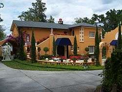
Maitland Art Center |
|
000000001982-11-17-0000November 17, 1982
(#82001036) |
231 West Packwood Avenue
28°37′32″N 81°22′03″W / 28.625556°N 81.3675°W / 28.625556; -81.3675 (Maitland Art Center) |
Maitland |
1937 art gallery is one of the few examples of Mayan Revival architecture in the Southeast
|
| 26 |
Mitchell-Tibbetts House |
|
000000001991-11-07-0000November 7, 1991
(#91001661) |
21 East Orange Street
28°40′40″N 81°30′40″W / 28.677778°N 81.511111°W / 28.677778; -81.511111 (Mitchell-Tibbetts House) |
Apopka |
|
| 27 |
Mizell-Leu House Historic District |
|
000000001994-12-29-0000December 29, 1994
(#94001495) |
1730 North Forest Avenue
28°34′03″N 81°21′26″W / 28.5675°N 81.357222°W / 28.5675; -81.357222 (Mizell-Leu House Historic District) |
Orlando |
|
| 28 |
Ocoee Christian Church |
|
000000001997-03-28-0000March 28, 1997
(#97000277) |
15 South Bluford Avenue
28°34′07″N 81°32′40″W / 28.568611°N 81.544444°W / 28.568611; -81.544444 (Ocoee Christian Church) |
Ocoee |
|
| 29 |
Old Orlando Railroad Depot |
|
000000001976-04-22-0000April 22, 1976
(#76000604) |
Depot Place and West Church Street
28°32′22″N 81°22′50″W / 28.539444°N 81.380556°W / 28.539444; -81.380556 (Old Orlando Railroad Depot) |
Orlando |
|
| 30 |
Orlando Utilities Commission Administration Building |
|
000000002012-06-07-0000June 7, 2012
(#12000321) |
500 S. Orange St.
28°32′12″N 81°22′43″W / 28.536609°N 81.378688°W / 28.536609; -81.378688 (Orlando Utilities Commission Administration Building) |
Orlando |
Now the Aloft Hotel
|
| 31 |
Palm Cottage Gardens |
|
000000002000-11-07-0000November 7, 2000
(#00000982) |
2267 Hempel Avenue
28°32′01″N 81°31′20″W / 28.533611°N 81.522222°W / 28.533611; -81.522222 (Palm Cottage Gardens) |
Gotha |
|
| 32 |
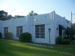
Cal Palmer Memorial Building |
|
000000001995-11-29-0000November 29, 1995
(#95001364) |
502 Main Street
28°29′43″N 81°32′07″W / 28.495278°N 81.535278°W / 28.495278; -81.535278 (Cal Palmer Memorial Building) |
Windermere |
|
| 33 |
Dr. P. Phillips House |
|
000000001979-07-10-0000July 10, 1979
(#79000685) |
135 Lucerne Circle, Northeast
28°32′08″N 81°22′34″W / 28.535556°N 81.376111°W / 28.535556; -81.376111 (Dr. P. Phillips House) |
Orlando |
|
| 34 |
Albin Polasek House and Studio |
|
000000002000-05-02-0000May 2, 2000
(#99000767) |
633 Osceola Avenue
28°35′47″N 81°20′39″W / 28.596389°N 81.344167°W / 28.596389; -81.344167 (Albin Polasek House and Studio) |
Winter Park |
|
| 35 |
Rogers Building |
|
000000001983-07-07-0000July 7, 1983
(#83001433) |
37-39 South Magnolia Avenue
28°32′34″N 81°22′14″W / 28.542778°N 81.370556°W / 28.542778; -81.370556 (Rogers Building) |
Orlando |
|
| 36 |
Rosemere Historic District |
|
000000002009-10-21-0000October 21, 2009
(#09000844) |
Roughly bounded by East Harvard Street, North Orange Avenue, Cornell Avenue, and East Vanderbilt Street
28°34′10″N 81°22′26″W / 28.569444°N 81.373889°W / 28.569444; -81.373889 (Rosemere Historic District) |
Orlando |
|
| 37 |
Annie Russell Theatre |
|
000000001998-07-15-0000July 15, 1998
(#98000863) |
1000 Holt Avenue
28°35′33″N 81°20′53″W / 28.5925°N 81.348056°W / 28.5925; -81.348056 (Annie Russell Theatre) |
Winter Park |
On the Rollins College campus
|
| 38 |
Ryan & Company Lumber Yard |
|
000000001993-02-25-0000February 25, 1993
(#93000074) |
215 East Fifth Street
28°40′18″N 81°30′27″W / 28.671667°N 81.5075°W / 28.671667; -81.5075 (Ryan & Company Lumber Yard) |
Apopka |
|
| 39 |
Luther F. Tilden House |
|
000000001996-11-15-0000November 15, 1996
(#96001337) |
940 Tildenville School Road
28°33′28″N 81°36′37″W / 28.557778°N 81.610278°W / 28.557778; -81.610278 (Luther F. Tilden House) |
Winter Garden |
|
| 40 |
Tinker Building |
|
000000001980-07-17-0000July 17, 1980
(#80000957) |
16-18 West Pine Street
28°32′27″N 81°22′47″W / 28.540833°N 81.379722°W / 28.540833; -81.379722 (Tinker Building) |
Orlando |
|
| 41 |
Tinker Field |
|
000000002004-05-14-0000May 14, 2004
(#04000456) |
1610 West Church Street
28°32′27″N 81°24′16″W / 28.540833°N 81.404444°W / 28.540833; -81.404444 (Tinker Field) |
Orlando |
|
| 42 |
Twin Mounds Archeological District |
Upload image |
000000001992-01-19-0000January 19, 1992
(#91001957) |
Address Restricted
|
Sorrento |
|
| 43 |
Waite-Davis House |
|
000000001990-08-02-0000August 2, 1990
(#90001127) |
5 South Central Avenue
28°40′39″N 81°30′41″W / 28.6775°N 81.511389°W / 28.6775; -81.511389 (Waite-Davis House) |
Apopka |
|
| 44 |
Thomas Picton Warlow, Sr., House |
|
000000002009-10-08-0000October 8, 2009
(#09000808) |
701 Driver Avenue
28°35′30″N 81°23′05″W / 28.591667°N 81.384722°W / 28.591667; -81.384722 (Thomas Picton Warlow, Sr., House) |
Winter Park |
|
| 45 |
William H. Waterhouse House |
|
000000001983-02-02-0000February 2, 1983
(#83001434) |
820 South Lake Lily Drive
28°37′15″N 81°22′02″W / 28.620833°N 81.367222°W / 28.620833; -81.367222 (William H. Waterhouse House) |
Maitland |
|
| 46 |
Well'sbuilt Hotel |
|
000000002000-02-04-0000February 4, 2000
(#00000006) |
511 West South Street
28°32′17″N 81°23′09″W / 28.538056°N 81.385833°W / 28.538056; -81.385833 (Well'sbuilt Hotel) |
Orlando |
|
| 47 |
Windermere Town Hall |
|
000000001994-06-03-0000June 3, 1994
(#94000539) |
520 Main Street
28°29′42″N 81°32′10″W / 28.495°N 81.536111°W / 28.495; -81.536111 (Windermere Town Hall) |
Windermere |
|
| 48 |
Winter Garden Downtown Historic District |
|
000000001996-08-01-0000August 1, 1996
(#96000850) |
Roughly bounded by Woodland, Tremaine, Henderson, and Lake View Streets
28°33′56″N 81°35′08″W / 28.565556°N 81.585556°W / 28.565556; -81.585556 (Winter Garden Downtown Historic District) |
Winter Garden |
|
| 49 |
Winter Garden Historic Residential District |
|
000000001996-08-01-0000August 1, 1996
(#96000849) |
Roughly bounded by Plant, Boyd, Tilden, and Central Streets
28°34′01″N 81°35′25″W / 28.566944°N 81.590278°W / 28.566944; -81.590278 (Winter Garden Historic Residential District) |
Winter Garden |
|
| 50 |
Winter Park Country Club and Golf Course |
|
000000001999-09-17-0000September 17, 1999
(#99001148) |
761 Old England Avenue
28°36′15″N 81°21′12″W / 28.604167°N 81.353333°W / 28.604167; -81.353333 (Winter Park Country Club and Golf Course) |
Winter Park |
|
| 51 |
Withers-Maguire House |
|
000000001987-04-02-0000April 2, 1987
(#87000579) |
16 East Oakland Avenue
28°34′15″N 81°32′38″W / 28.570833°N 81.543889°W / 28.570833; -81.543889 (Withers-Maguire House) |
Ocoee |
|
| 52 |
Woman's Club of Ocoee |
|
000000002011-02-14-0000February 14, 2011
(#11000002) |
10 North Lakewood Avenue
28°34′11″N 81°32′33″W / 28.569722°N 81.5425°W / 28.569722; -81.5425 (Woman's Club of Ocoee) |
Ocoee |
Clubhouses of Florida's Woman's Clubs MPS
|
| 53 |
Woman's Club of Winter Park |
|
000000001995-05-04-0000May 4, 1995
(#95000537) |
419 Interlachen Avenue
28°35′39″N 81°20′57″W / 28.594167°N 81.349167°W / 28.594167; -81.349167 (Woman's Club of Winter Park) |
Winter Park |
|

