List of listed buildings in Glasgow/4
This is a list of listed buildings in Glasgow, Scotland.
List
| Name | Location | Date Listed | Grid Ref. [note 1] | Geo-coordinates | Notes | HB Number [note 2] | Image |
|---|---|---|---|---|---|---|---|
| 40 Newlands Road And Lubnaig Road, The Oaks Including Garden Walls And Gatepiers | 55°49′12″N 4°16′52″W / 55.820062°N 4.281221°W | Category B | 33948 | 
| |||
| 42 Newlands Road And 7 Lubnaig Road, Brackley, Including Walls And Gatepiers | 55°49′12″N 4°16′49″W / 55.819945°N 4.280256°W | Category B | 33949 | 
| |||
| 988-1006 (Even Nos) Pollokshaws Road, Camphill Gate | 55°49′56″N 4°16′42″W / 55.832294°N 4.278296°W | Category B | 33954 | 
| |||
| 95 Morrison Street, 34-44 (Even Nos) Dalintober Street, 19-37 (Odd Nos) Carnoustie Street, "Co-Operative House" | 55°51′13″N 4°16′10″W / 55.853515°N 4.269504°W | Category B | 33971 | 
| |||
| 19,21 Broompark Drive, Including Gatepiers | 55°51′41″N 4°13′27″W / 55.861396°N 4.224291°W | Category B | 33888 | 
| |||
| 164, 166 Craigpark, Snooker Club Including Gatepiers | 55°51′49″N 4°13′17″W / 55.863732°N 4.221324°W | Category B | 33895 | 
| |||
| 35, 37 Westercraigs, 36,38 Broompark Drive | 55°51′39″N 4°13′26″W / 55.860936°N 4.223865°W | Category B | 33910 | 
| |||
| 17-23 (Odd Nos) Whitevale Street, St Anne's Church And Presbytery | 55°51′27″N 4°12′58″W / 55.857636°N 4.215974°W | Category A | 33912 | 
| |||
| 230 Auldhouse Road Including Gatepiers | 55°49′08″N 4°17′58″W / 55.81877°N 4.299455°W | Category C(S) | 33914 | 
| |||
| 443 Clarkston Road, Gartly Street, Muirend Trustee Savings Bank, Originally Savings Bank Of Glasgow | 55°48′37″N 4°16′14″W / 55.810211°N 4.270573°W | Category B | 33917 | 
| |||
| 84, 86 Clarkston Road, Couper Institute And Library | 55°48′57″N 4°15′53″W / 55.815898°N 4.264823°W | Category B | 33918 | 
| |||
| 90, 92 Clarkston Road, Cathcart South Church Of Scotland, Including Hall | 55°48′55″N 4°15′56″W / 55.815416°N 4.265641°W | Category B | 33919 | 
| |||
| 45 Netherlee Road, "Cartbank" | 55°48′45″N 4°15′29″W / 55.812411°N 4.257965°W | Category B | 33943 | 
| |||
| 61, 63 Netherlee Road, "Holmwood" | 55°48′35″N 4°15′34″W / 55.809735°N 4.259358°W | Category A | 33944 | 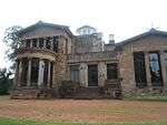
| |||
| Graham Square/Bellgrove Street/14-28 Melbourne Street/Moore Street Meat And Cattle Markets,And Associated Buildings | 55°51′28″N 4°13′36″W / 55.857784°N 4.226721°W | Category B | 33842 | 
| |||
| 88 Green Street, St James Public School Including Janitor's House And Railings | 55°51′10″N 4°13′59″W / 55.85285°N 4.233165°W | Category B | 33843 | 
| |||
| 50-56 (Even Nos) Old Dalmarnock Road, Church Of The Sacred Heart Including Gatepiers And Presbytery | 55°50′46″N 4°13′24″W / 55.84619°N 4.223246°W | Category A | 33855 | 
| |||
| Gartloch Road, Gartloch Hospital, Asylum Section, Hospital Section And Original Nurses' Home | 55°52′46″N 4°06′21″W / 55.879324°N 4.105855°W | Category A | 33868 | 
| |||
| Alexandra Parade, Alexandra Park, Cast-Iron Fountain | 55°51′52″N 4°12′30″W / 55.864524°N 4.20828°W | Category A | 33880 | 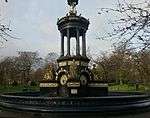
| |||
| 1208-1220, (Even Nos) Cathcart Road, Battlefield East Church And Hall, Including Gatepiers | 55°49′25″N 4°15′32″W / 55.823745°N 4.258909°W | Category B | 33803 | 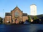
| |||
| 70-74 (Even Nos) Mount Annan Drive Including Boundary Walls | 55°49′26″N 4°15′23″W / 55.823884°N 4.256267°W | Category B | 33808 | 
| |||
| Bridgeton Cross, Shelter | 55°50′56″N 4°13′35″W / 55.849008°N 4.226426°W | Category A | 33818 | 
| |||
| 103-111 (Odd Nos) French Street, 34-66 (Even Nos) Dora Street, (Former Barrowfield Weaving Factory) | 55°50′31″N 4°13′20″W / 55.841811°N 4.222341°W | Category B | 33830 | 
| |||
| Glasgow Green, Nelson Monument, Including Railings | 55°51′05″N 4°14′27″W / 55.85149°N 4.240708°W | Category A | 33837 | 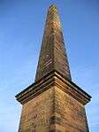
| |||
| 263-273 (Odd Nos) Garrioch Road And Railings | 55°52′56″N 4°17′19″W / 55.882306°N 4.288693°W | Category C(S) | 33762 | 
| |||
| Kelvinside Terrace, West Steps And Retaining Walls | 55°52′45″N 4°17′03″W / 55.879244°N 4.284164°W | Category B | 33772 | 
| |||
| 2-14 (Even Nos) Possil Road And Farnell Street, Tower Buildings | 55°52′28″N 4°15′40″W / 55.874421°N 4.261148°W | Category B | 33776 | 
| |||
| 361-367 (Odd Nos) St George's Road, Lampost And Railings | 55°52′20″N 4°16′01″W / 55.872272°N 4.267034°W | Category B | 33781 | 
| |||
| 67 Coplaw Street, 134 Butterbiggins Road, Former Glasgow Samaritan Hospital For Women Including Boundary Walls Gatepiers And Railings | 55°50′25″N 4°15′44″W / 55.840231°N 4.262213°W | Category B | 33689 | 
| |||
| 44 Kingarth Street, Calder Street, Hutcheson's Grammar School Annexe, Janitors Lodge And Gymnasium Block | 55°50′19″N 4°15′56″W / 55.838532°N 4.265628°W | Category B | 33694 | 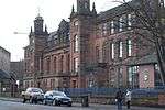
| |||
| 23, 25 And 27 Snuff Mill Road, Snuff Mill, Cathcart | 55°48′49″N 4°15′32″W / 55.813552°N 4.258973°W | Category C(S) | 33725 | 
| |||
| 393 Ashgill Road, St Augustine`S Rc Church And Presbytery | 55°53′46″N 4°14′21″W / 55.896192°N 4.239286°W | Category B | 33736 | 
| |||
| 11 - 29 (Odd Nos) Canal Bank, With Bank Openings | 55°53′50″N 4°15′55″W / 55.897242°N 4.265403°W | Category B | 33739 | 
| |||
| 862 Shettleston Road And Wellshot Road, Carntyne Old Church And Hall, Gates And Railings | 55°51′06″N 4°10′30″W / 55.851647°N 4.174877°W | Category C(S) | 33646 | 
| |||
| 64-80 (Even Nos) Tollcross Road And Helenvale Street, Parkhead Library Including Public Baths And Washhouse | 55°51′01″N 4°11′44″W / 55.85032°N 4.195444°W | Category B | 33653 | 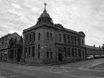
| |||
| 1-15 (Odd Nos) Westmuir Street And 1361 Duke Street | 55°51′04″N 4°11′51″W / 55.851013°N 4.197432°W | Category B | 33656 | 
| |||
| 135 Westmuir Street, Parkhead Careers Office Including Gatepiers And Railings | 55°51′07″N 4°11′34″W / 55.851921°N 4.192866°W | Category B | 33657 | 
| |||
| 138 Carmyle Avenue, Carmyle House, Gates And Gatepiers | 55°49′52″N 4°09′37″W / 55.831196°N 4.160385°W | Category B | 33662 | 
| |||
| 50 And 52 Church Street, Baillieston, Old St Andrew's Church Including Boundary Walls, Gatepiers, Gates And Railings | 55°50′59″N 4°06′30″W / 55.849851°N 4.108206°W | Category B | 33663 | 
| |||
| Manse Road, Bargeddie, Netherhouse Road, Bargeddie Parish Church Including Hall, Manse, Lodge And Perimeter Walls | 55°51′29″N 4°05′33″W / 55.858165°N 4.092374°W | Category B | 33672 | 
| |||
| 165, 171, 173 Butterbiggins Road, 48, 54, 60 Inglefield Street | 55°50′25″N 4°15′29″W / 55.840407°N 4.257975°W | Category C(S) | 33681 | 
| |||
| 176-194 (Even Nos) Butterbiggins Road, 65-73 (Odd Nos) Inglefield Street, 143, 145 Coplaw Street | 55°50′23″N 4°15′27″W / 55.839587°N 4.257608°W | Category B | 33682 | 
| |||
| 35 Coplaw Street, Leisure Centre | 55°50′25″N 4°15′52″W / 55.840386°N 4.264538°W | Category C(S) | 33688 | 
| |||
| 2141 Paisley Road West, Cardonald Parish Church Including Hall | 55°50′44″N 4°21′21″W / 55.845455°N 4.355872°W | Category B | 33603 | 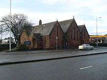
| |||
| Ralston Avenue 81, 85 (Struan) Including Boundary Walls And Gatepiers | 55°50′32″N 4°22′03″W / 55.842193°N 4.367575°W | Category B | 33604 | 
| |||
| 5 And 7 Applecross Street, Rockvilla House, Former Canal Lock Keeper`S House | 55°52′38″N 4°15′36″W / 55.877137°N 4.260027°W | Category C(S) | 33609 | 
| |||
| 40-50 (Even Nos) Speirs Wharf | 55°52′26″N 4°15′28″W / 55.873926°N 4.257715°W | Category B | 33620 | 
| |||
| 184-238A (Even Nos) Saracen Street | 55°53′00″N 4°15′14″W / 55.883297°N 4.253973°W | Category B | 33622 | 
| |||
| 98-100 (Even Nos) Pollokshaws Road And 3 Cavendish Street, Former Chalmer's Free Church | 55°50′48″N 4°15′28″W / 55.846556°N 4.257916°W | Category B | 33530 | 
| |||
| 191,193,195,197,199 Scotland Street, Former Howden's Works | 55°50′57″N 4°16′21″W / 55.849225°N 4.272561°W | Category B | 33533 | 
| |||
| 84 And 86 Craigie Street, 52 Allison Street (52 Allison Court) And 2-6 (Even Nos) Allison Place | 55°50′11″N 4°16′01″W / 55.836366°N 4.267083°W | Category B | 33542 | 
| |||
| 1226-1236 (Even Nos) Maryhill Road/Ruchill Street, Wyndford Club | 55°53′15″N 4°17′07″W / 55.887445°N 4.285366°W | Category C(S) | 33543 | 
| |||
| 167 Ashkirk Drive, Mosspark Parish Church (Church Of Scotland) | 55°50′29″N 4°19′32″W / 55.841423°N 4.325487°W | Category B | 33584 | 
| |||
| 1554 Barrhead Road, 17-20 (Inclusive) Hurlethill Court, East Hurlet House | 55°49′10″N 4°22′13″W / 55.819509°N 4.370331°W | Category B | 33585 | 
| |||
| 27, 29 Sherbrooke Avenue And 102 Springkell Avenue, Matheran, Including Driveway Gate And Boundary Walls | 55°50′24″N 4°17′57″W / 55.84004°N 4.299146°W | Category B | 33471 | 
| |||
| 31 Sherbrooke Avenue And 105 Springkell Avenue, Oaklands, Including Boundary Walls And Gatepiers | 55°50′21″N 4°17′57″W / 55.839293°N 4.299182°W | Category B | 33472 | 
| |||
| 39 Sherbrooke Avenue, Inchgarvie And Woodmailing, Including Boundary Walls And Gatepiers | 55°50′20″N 4°17′54″W / 55.838826°N 4.298196°W | Category B | 33474 | 
| |||
| 525-529 (Odd Nos) Shields Road And 274 Albert Drive, Pollokshields Church (C Of S) And Hall, Gates And Railings | 55°50′36″N 4°16′32″W / 55.84321°N 4.275612°W | Category B | 33477 | 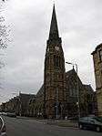
| |||
| 689-707 (Odd Nos) Shields Road, 16-20 (Even Nos) Glencairn Drive, 1-9 (Odd Nos) Newark Drive | 55°50′21″N 4°16′37″W / 55.839301°N 4.277045°W | Category B | 33480 | 
| |||
| 96 Springkell Avenue And 398 Albert Drive, Including Boundary Walls And Gatepiers | 55°50′22″N 4°17′48″W / 55.839574°N 4.29669°W | Category C(S) | 33484 | 
| |||
| 44-84 (Even Nos) Terregles Avenue And 733-745 (Odd Nos) Shields Road | 55°50′17″N 4°16′35″W / 55.838029°N 4.2763°W | Category C(S) | 33488 | 
| |||
| 40-61 (Inclusive) Carlton Place And 16 Nicholson Street | 55°51′13″N 4°15′19″W / 55.853739°N 4.255345°W | Category A | 33499 | 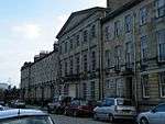
| |||
| 65-84 (Inclusive) Carlton Place And 4 South Portland Street | 55°51′16″N 4°15′27″W / 55.854426°N 4.257606°W | Category B | 33500 | 
| |||
| 38 Clyde Place And 18 Centre Street, Former Kingston House | 55°51′18″N 4°15′42″W / 55.854899°N 4.261676°W | Category B | 33501 | 
| |||
| 121 Eglinton Street And Bedford Street, New Bedford Picture House | 55°51′02″N 4°15′33″W / 55.850525°N 4.259105°W | Category B | 33508 | 
| |||
| 8-38 (Even Nos) Falfield Street, 14, 16, 20 Stromness Street And 39 Mauchline Street, Former Falfield Cotton Works | 55°50′51″N 4°15′46″W / 55.847617°N 4.262754°W | Category B | 33511 | 
| |||
| 162-170 (Even Nos) Gorbals Street | 55°51′00″N 4°15′16″W / 55.850064°N 4.254317°W | Category A | 33513 | 
| |||
| 40 And 44 Kilbirnie Street And Return Elevations To Ritchie Street And Francis Street | 55°50′49″N 4°15′46″W / 55.846985°N 4.262909°W | Category B | 33515 | 
| |||
| 53 Morrison Street, 33 Dalintober Street And Return Elevation To Laidlaw Street | 55°51′12″N 4°16′07″W / 55.853425°N 4.268524°W | Category B | 33519 | 
| |||
| 115-119 (Even Nos) Paisley Road, 120-130 (Even Nos) Morrison Street And 2, 4 Laidlaw Street And 1 Dalintober Street "Paisley Road Gusset" Scws | 55°51′15″N 4°16′05″W / 55.854038°N 4.267953°W | Category B | 33523 | 
| |||
| 656-674 (Even Nos) Eglinton Street And 2-28 (Even Nos) Maxwell Road | 55°50′36″N 4°15′47″W / 55.84321°N 4.262961°W | Category B | 33404 | 
| |||
| 19-63 (Odd Nos) Glencairn Drive And 719, 721 Shields Road | 55°50′18″N 4°16′36″W / 55.838472°N 4.276661°W | Category B | 33407 | 
| |||
| 97 Haggs Road Lodge At Pollok House | 55°50′02″N 4°17′58″W / 55.833875°N 4.29958°W | Category B | 33412 | 
| |||
| 110, 112 Hamilton Avenue And Springkell Avenue, Dunholme, Including Boundary Walls And Gatepiers | 55°50′21″N 4°18′13″W / 55.83914°N 4.303549°W | Category B | 33414 | 
| |||
| 165-189 (Odd Nos) Kenmure Street | 55°50′30″N 4°16′21″W / 55.841738°N 4.272587°W | Category B | 33415 | 
| |||
| 11 Melville Street, Pollokshields Primary School Annexe, Former Pollockshields Public School Including Janitor's Lodge, Gatepiers And Railings | 55°50′23″N 4°16′18″W / 55.839858°N 4.271727°W | Category B | 33428 | 
| |||
| 10 Newark Drive, Newark Drive Nursery School And 159 Nithsdale Road, Kilspindie, Including Boundary Walls And Gatepiers | 55°50′24″N 4°16′41″W / 55.839876°N 4.277989°W | Category C(S) | 33434 | 
| |||
| 161 Nithsdale Road, Including Boundary Walls, Gatepiers And Railings | 55°50′24″N 4°16′42″W / 55.840078°N 4.278288°W | Category B | 33438 | 
| |||
| 116-170 (Even Nos) Nithsdale Road, 2, 3, 4, Nithsdale Place, Kenmure Street And Leven Street | 55°50′21″N 4°16′31″W / 55.839111°N 4.275149°W | Category B | 33445 | 
| |||
| 178 Nithsdale Road, Helenslea, Including Boundary Walls And Gatepiers | 55°50′30″N 4°16′51″W / 55.841649°N 4.280776°W | Category B | 33447 | 
| |||
| 196 Nithsdale Road, Glengowan, Including Boundary Walls And Gatepiers | 55°50′31″N 4°17′06″W / 55.841983°N 4.28506°W | Category C(S) | 33448 | 
| |||
| 206 Nithsdale Road, Braehead, Including Boundary Walls And Gatepiers | 55°50′33″N 4°17′17″W / 55.842406°N 4.287945°W | Category C(S) | 33452 | 
| |||
| 2060 Pollokshaws Road, Pollok House, Bridge Over White Cart Water | 55°49′37″N 4°19′05″W / 55.826948°N 4.31814°W | Category A | 33456 | 
| |||
| 2060 Pollokshaws Road, Pollok House Sawmill, Power Station And Caul | 55°49′33″N 4°18′59″W / 55.825873°N 4.316496°W | Category B | 33458 | 
| |||
| Carmunnock 652 Carmunnock Road, Mid Netherton Farmhouse And Steading | 55°47′49″N 4°15′02″W / 55.796866°N 4.250428°W | Category C(S) | 33318 | 
| |||
| Carmunnock, 1 Greenside | 55°47′28″N 4°14′03″W / 55.791079°N 4.234142°W | Category C(S) | 33319 | 
| |||
| Carmunnock, 2, 4 Kirk Road | 55°47′28″N 4°14′09″W / 55.791248°N 4.235747°W | Category C(S) | 33320 | 
| |||
| Carmunnock, Kirk Road, Carmunnock Parish Church And Churchyard Including Gatepiers And Watch House | 55°47′25″N 4°14′09″W / 55.790321°N 4.235789°W | Category B | 33322 | .jpg)
| |||
| Carmunnock, 34 Kirk Road | 55°47′23″N 4°14′09″W / 55.789689°N 4.235944°W | Category B | 33327 | 
| |||
| 65-69 (Odd Nos) Golspie Street, Former Hill's Trust School | 55°51′43″N 4°19′01″W / 55.86197°N 4.31687°W | Category B | 33339 | 
| |||
| 705, 707 Govan Road, Return Elevations To Broomloan Road, Former Savings Bank, Govan Branch | 55°51′42″N 4°18′32″W / 55.861718°N 4.308753°W | Category B | 33342 | 
| |||
| 801, 805 Govan Road, 2, 4 Burleigh Street, Cardell Halls And Public House | 55°51′48″N 4°18′47″W / 55.863325°N 4.313131°W | Category B | 33344 | 
| |||
| 18,20 Orkney Street Govan Police Building, Former Govan Municipal Buildings | 55°51′40″N 4°18′31″W / 55.861027°N 4.308696°W | Category B | 33361 | 
| |||
| 143 Woodville Street. Now Maritime House, Former Glasgow Engineering Works | 55°51′18″N 4°18′24″W / 55.855043°N 4.306679°W | Category B | 33363 | 
| |||
| 241 Albert Drive And Herriet Street, (Including Academy Building To Herriet Street), Pollokshields Primary School Including Gatepiers, Playground Walls And Railings | 55°50′32″N 4°16′29″W / 55.842266°N 4.274631°W | Category B | 33370 | 
| |||
| 312 Albert Drive, Including Gatepiers And Boundary Walls | 55°50′37″N 4°16′46″W / 55.843473°N 4.279365°W | Category B | 33378 | 
| |||
| 18 Bruce Road, Including Boundary Walls And Gatepiers | 55°50′41″N 4°16′54″W / 55.844717°N 4.281595°W | Category B | 33392 | 
| |||
| 28, 30 Dalziel Drive And 69 St Andrew's Drive, The Moss, Including Boundary Walls And Gatepiers | 55°50′28″N 4°17′21″W / 55.841107°N 4.289178°W | Category B | 33395 | 
| |||
| 40 Dalziel Drive, Dykeneuk House, Including Boundary Walls And Gatepiers | 55°50′30″N 4°17′30″W / 55.841781°N 4.291566°W | Category B | 33397 | 
| |||
| 46-50 (Even Nos) Darnley Street And 49-53 (Odd Nos) Forth Street, Miller And Lang Building, Pollokshields, Also Known As 50 Darnley Street | 55°50′35″N 4°16′10″W / 55.842938°N 4.269399°W | Category A | 33402 | 
| |||
| 166, 168 West George Street And 175 Hope Street | 55°51′46″N 4°15′30″W / 55.862754°N 4.258265°W | Category B | 33244 | 
| |||
| 188-194 (Even Nos) West George Street | 55°51′46″N 4°15′32″W / 55.862848°N 4.259005°W | Category B | 33245 | 
| |||
| 202-226 (Even Nos) West George Street 115, 117 Wellington Street And 114-118 (Even Nos) West Campbell Street | 55°51′47″N 4°15′36″W / 55.862965°N 4.259987°W | Category B | 33247 | 
| |||
| 141, 143 West Regent Street, 120-124 (Even Nos) West Campbell Street | 55°51′48″N 4°15′39″W / 55.863266°N 4.260708°W | Category B | 33268 | 
| |||
| 4, 4A West Regent Street, And 64-70 (Even Nos) Renfield Street, Victoria Buildings | 55°51′47″N 4°15′20″W / 55.863147°N 4.255443°W | Category B | 33269 | 
| |||
| 158-168 (Even Nos) West Regent Street And 237 West Campbell Street (Former John Ross Memorial Church For The Deaf And Institute For Adult Deaf And Dumb) | 55°51′50″N 4°15′40″W / 55.863958°N 4.261195°W | Category B | 33278 | 
| |||
| Renfield Street, William Annan Fountain | 55°51′57″N 4°15′18″W / 55.865906°N 4.254948°W | Category C(S) | 33287 | 
| |||
| 1378 Springburn Road, Colston Wellpark Church, Church Of Scotland | 55°53′42″N 4°13′51″W / 55.894924°N 4.230944°W | Category B | 33299 | 
| |||
| Carmunnock, 8, 10 Busby Road | 55°47′27″N 4°14′10″W / 55.790883°N 4.236029°W | Category B | 33314 | 
| |||
| 351-371 (Odd Nos) Sauchiehall Street, 97 Holland Street | 55°51′56″N 4°16′01″W / 55.86565°N 4.266968°W | Category B | 33178 | 
| |||
| 401-427 (Odd Nos) Sauchiehall Street And 67-73 (Odd Nos) Elmbank Street | 55°51′57″N 4°16′06″W / 55.865704°N 4.268393°W | Category B | 33180 | 
| |||
| 130-158 (Even Nos) Sauchiehall Street, The Savoy Centre | 55°51′54″N 4°15′28″W / 55.864991°N 4.257803°W | Category B | 33190 | 
| |||
| 254-290 (Even Nos) Sauchiehall Street, 5, 7 Rose Street, 2, 6 Dalhousie Street And 145, 147, 149 Renfrew Street, Mclellan Galleries | 55°51′58″N 4°15′44″W / 55.865979°N 4.262272°W | Category B | 33192 | 
| |||
| 73-77 (Odd Nos) Waterloo Street | 55°51′37″N 4°15′47″W / 55.860408°N 4.263162°W | Category C(S) | 33213 | 
| |||
| 40-60 (Even Nos) Wellington Street 1, 3 Cadogan Street And 102-108 (Even Nos) Holm Street, Baltic Chambers | 55°51′34″N 4°15′37″W / 55.85943°N 4.260165°W | Category B | 33218 | 
| |||
| 117, 121 West George Street And 38-42 (Even Nos) Renfield Street, (Former Sun Life Building) | 55°51′43″N 4°15′22″W / 55.862055°N 4.256195°W | Category A | 33223 | 
| |||
| 201-203 (Odd Nos) West George Street 101-107 (Odd Nos) Wellington Street And 98 West George Lane | 55°51′45″N 4°15′36″W / 55.86248°N 4.259943°W | Category B | 33227 | 
| |||
| 223-225A (Odd Nos) West George Street | 55°51′46″N 4°15′39″W / 55.862687°N 4.26093°W | Category B | 33230 | 
| |||
| 149 St Vincent Street | 55°51′42″N 4°15′37″W / 55.861681°N 4.260392°W | Category B | 33144 | 
| |||
| 80 St Vincent Street | 55°51′42″N 4°15′20″W / 55.861535°N 4.255605°W | Category B | 33152 | 
| |||
| 140, 142 St Vincent Street And 153, 155 Hope Street, Royal Bank Building | 55°51′43″N 4°15′31″W / 55.861869°N 4.258517°W | Category A | 33159 | 
| |||
| 142A, 144 St Vincent Street | 55°51′43″N 4°15′31″W / 55.861901°N 4.258679°W | Category A | 33160 | 
| |||
| 202-228 (Even Nos) St Vincent Street | 55°51′44″N 4°15′42″W / 55.86234°N 4.261725°W | Category B | 33163 | _ST_VINCENT_STREET.jpg)
| |||
| 219-233, (Odd Nos) Sauchiehall Street And 134-140 (Even Nos) Blythswood Street | 55°51′54″N 4°15′42″W / 55.864903°N 4.261618°W | Category B | 33174 | 
| |||
| 48-88 (Even Nos) Kent Road, 7-9 (Odd Nos) Granville Street, 100 Elderslie Street | 55°51′53″N 4°16′26″W / 55.864846°N 4.273985°W | Category B | 33080 | 
| |||
| 101, 103, New City Road | 55°52′09″N 4°15′47″W / 55.869164°N 4.263064°W | Category B | 33090 | 
| |||
| 55 North Street And 101, 121, William Street, St Patrick's Rc Church | 55°51′43″N 4°16′17″W / 55.862001°N 4.27131°W | Category B | 33093 | 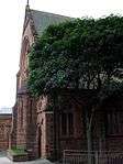
| |||
| 20, 26, 28 Renfield Lane And St Vincent Lane, Former Daily Record Building | 55°51′40″N 4°15′28″W / 55.861135°N 4.257819°W | Category A | 33099 | 
| |||
| 167 Renfrew Street And 11, 15 Dalhousie Street, Glasgow School Of Art | 55°51′58″N 4°15′49″W / 55.86605°N 4.263746°W | Category A | 33105 | 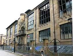
| |||
| 347-353 (Odd Nos) Renfrew Street, Albany Mansions | 55°52′00″N 4°16′12″W / 55.86679°N 4.269959°W | Category B | 33108 | 
| |||
| 16 Robertson Street, Clyde Navigation Trust | 55°51′25″N 4°15′39″W / 55.857054°N 4.26081°W | Category A | 33113 | 
| |||
| 60-64 (Even Nos) Robertson Street | 55°51′29″N 4°15′38″W / 55.858138°N 4.260522°W | Category B | 33114 | 
| |||
| 52, 56 Rose Street And 23 Buccleuch Street | 55°52′02″N 4°15′39″W / 55.86721°N 4.260777°W | Category B | 33119 | 
| |||
| 1-20 (Inclusive Nos) Royal Terrace, 11B-19 (Odd Nos) North Claremont Street And 66 Kelvingrove Street | 55°51′59″N 4°16′52″W / 55.86652°N 4.281115°W | Category B | 33121 | 
| |||
| 34, 36 St Enoch Square | 55°51′27″N 4°15′22″W / 55.857511°N 4.255995°W | Category B | 33124 | 
| |||
| 120, Elmbank Street With 71-83 (Odd Nos) Holland Street And Lodges, 59, 61 Holland Street, Gates And Retaining Walls | 55°51′52″N 4°16′04″W / 55.864314°N 4.267753°W | Category A | 33022 | 
| |||
| 97-113B (Odd Nos) Hill Street, Breadalbane Terrace | 55°52′01″N 4°15′56″W / 55.866996°N 4.265576°W | Category A | 33038 | 
| |||
| 114 Hill Street, Bilsland House | 55°52′03″N 4°16′00″W / 55.867562°N 4.2666°W | Category C(S) | 33045 | 
| |||
| 157-167 (Odd Nos) Hope Street And 169-175 (Odd Nos) West George Street | 55°51′44″N 4°15′31″W / 55.862326°N 4.258544°W | Category A | 33053 | 
| |||
| 217-225 (Odd Nos) Hope Street | 55°51′49″N 4°15′28″W / 55.863731°N 4.25789°W | Category C(S) | 33054 | 
| |||
| Jamaica Street, Glasgow Bridge | 55°51′20″N 4°15′28″W / 55.855508°N 4.257892°W | Category B | 33062 | 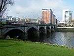
| |||
| 18-22 (Even Nos) Jamaica Street | 55°51′29″N 4°15′27″W / 55.857951°N 4.257475°W | Category B | 33063 | 
| |||
| 66-72 (Even Nos) James Watt Street (Known As 72 James Watt Street) | 55°51′30″N 4°15′50″W / 55.858266°N 4.263837°W | Category A | 33070 | 
| |||
| 182-200 (Even Nos) Bath Street Also Known As Athol Place | 55°51′53″N 4°15′45″W / 55.864789°N 4.262458°W | Category B | 32967 | 
| |||
| 264, 266 Bath Street And 150-160 (Even Nos) Elmbank Street And Sauchiehall Lane, Including The Griffin Public House | 55°51′56″N 4°16′05″W / 55.865479°N 4.267949°W | Category B | 32971 | 
| |||
| 14-20A (Inclusive Nos) Blythswood Square And 108 Douglas Street | 55°51′47″N 4°15′50″W / 55.86302°N 4.263858°W | Category B | 32977 | 
| |||
| 30 Bothwell Street And 100 Wellington Street | 55°51′41″N 4°15′35″W / 55.861341°N 4.259861°W | Category B | 32984 | 
| |||
| 36-44 (Even Nos) Bothwell Street 87, 89 Wellington Street | 55°51′41″N 4°15′38″W / 55.86141°N 4.260504°W | Category B | 32985 | _BOTHWELL_STREET_87%2C_89_WELLINGTON_STREET_LB32985.jpg)
| |||
| 54-62 (Even Nos) Bothwell Street | 55°51′41″N 4°15′41″W / 55.861486°N 4.261259°W | Category B | 32987 | 
| |||
| 91-99 (Odd Nos) Buccleuch Street, 72, 74 Garnet Street And 41, 43 Garnethill Street, Former High School For Girls | 55°52′04″N 4°16′00″W / 55.867886°N 4.266539°W | Category B | 32989 | 
|
Key
The scheme for classifying buildings in Scotland is:
- Category A: "buildings of national or international importance, either architectural or historic, or fine little-altered examples of some particular period, style or building type."[1]
- Category B: "buildings of regional or more than local importance, or major examples of some particular period, style or building type which may have been altered."[1]
- Category C(S): "buildings of local importance, lesser examples of any period, style, or building type, as originally constructed or moderately altered; and simple traditional buildings which group well with others in categories A and B."[1]
There are approximately 47,400 listed buildings in Scotland. Of these, around 8 per cent (some 3,800) are Category A, and 51 per cent (24,000) are Category B, with the rest listed at Category C(s).[2]
See also
Notes
- ↑ Sometimes known as OSGB36, the grid reference (where provided) is based on the British national grid reference system used by the Ordnance Survey.
• "Guide to National Grid". Ordnance Survey. Retrieved 2007-12-12.
• "Get-a-map". Ordnance Survey. Retrieved 2007-12-17. - ↑ The "HB Number" is a unique number assigned to each listed building by Historic Scotland.
References
- All entries, addresses and coordinates are based on data from Historic Scotland. This data falls under the Open Government Licence
- 1 2 3 "What is Listing?". Historic Scotland. Retrieved 2010-07-06.
- ↑ Guide to the Protection of Scotland’s Listed Buildings (PDF). Historic Scotland. 2009. p. 17. ISBN 978-1-84917-013-0. Retrieved 2010-07-06.
This article is issued from Wikipedia - version of the 11/8/2016. The text is available under the Creative Commons Attribution/Share Alike but additional terms may apply for the media files.