List of valleys of Arizona
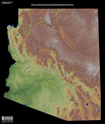
Shaded relief map, Arizona.
| Wikimedia Commons has media related to Valleys of Arizona. |
This is a list of valleys of Arizona. Valleys are ordered alphabetically, by county.
This list is incomplete; you can help by expanding it.
Apache County
B
- Beautiful Valley
C
M
R
- Red Rock Valley
W
- Windy Valley (Arizona)
Cochise County
C
S
- San Bernardino Valley
- San Pedro Valley (Arizona), San Pedro River (Arizona)
- San Simon Valley
- Sulphur Springs Valley
Coconino County
A
C
L
- Long Valley, Arizona
Gila County
S
Graham County
A
- Aravaipa Valley, Aravaipa Creek
G
W
- Whitlock Valley, Whitlock Mountains
La Paz County
|
B L |
M
P
|
Maricopa County
|
A
C
D |
G H K
|
M
P
|
R S T |
Mohave County
|
A
B
C
|
D H L
|
M
S |
U
V W
|
Navajo County
K
- Kletha Valley
M
Pima County
|
A B
|
C G |
L
O P
|
Q
V
|
Pinal County
F
- Falcon Valley
G
Santa Cruz County
C
G
S
Yavapai County
|
A
C
|
L |
P
|
V W |
Yuma County
|
D
G |
K |
L M |
P |
Valleys in the Gila River Valley corridor
(listed upriver-to-downriver)
- Gila Valley (Graham County)
- Pleasant Valley (Arizona)
- Rainbow Valley (Arizona)
- Citrus Valley
- Dendora Valley
- Hyder Valley
- Park Valley (Arizona)
- San Cristobal Valley
- Mohawk Valley (Arizona)
- Dome Valley
- Gila Valley (Yuma County)
Valleys in the Lower Colorado River Valley corridor, Arizona
(listed upriver-to-downriver)
- Sacramento Valley (Arizona)
- Mohave Valley
- Parker Valley
- Palo Verde Valley
- Gila Valley (Yuma County)
- Yuma Valley, (also in Baja California(state), Mexico?)
California
- Mohave Valley
- Chemehuevi Valley, Chemehuevi Wash
- Vidal Valley
- Parker Valley
- Palo Verde Valley
Alphabetic listing
See also
The Gila River, a tributary of the Colorado along the width of southern Arizona, and its valley can be traced on a map of Arizona. The Gila forms the boundary between various counties in Eastern Arizona.
This article is issued from Wikipedia - version of the 7/2/2016. The text is available under the Creative Commons Attribution/Share Alike but additional terms may apply for the media files.