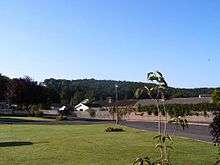
Llanllwch
Llanllwch is a small hamlet in Wales approximately two miles west of Carmarthen.
History
The name Llanllwch derives from a lake or pool nearby, the site of which is now a tract of boggy land west of Llanllwch known as Llanllwch bog.
The Parish of Llanllwch
The Parish of Llanllwch was originally a part of the historic Parish of St. Peter, which was divided into three districts by an Order of the Queen in Council dated 10 November 1843, whichn in July 1857 became separate parishes. The Borough of carmarthen ceased to exist after the local government reorganization of 1974, but Llanllwch still remains within the authority of Carmarthen Town Council.
The Manor of Llanllwch
The Llanllwch area formed part of the royal demesne manor of Carmarthen Castle between Norman times and the late thirteenth century when they were farmed out for rent to 'customary' tenants called "gabblers" (gabularii) or "gafol-men", who were still tied to the castle.[1] Other areas were let to local landowners. Eleven of the twelve gafol-men died from the Black Death between 1349 and 1350 and the other tenants abandoned their land, leaving the area uncultivated.[1] There were also several water mills for grinding corn, one of which was documented in 1300. The hamlet and the mills were "totally destroyed and devastated" according to acoounts of 1407-09 during the rebellion of Owain Glyn Dwr.[1]

Cors Goch
West of Llanllwch lies Cors Goch, a lowland raised mire and one of the last six large raised bogs in Wales, and a Site of Special Scientific Interest (SSSI).
See also
References
- Carmarthen and its Neighbourhood, (William Spurrell, 1860)
- A Genealogical and Heraldic Dictionary of the Landed Gentry of Great Britain and Ireland, (Sir Bernard Burke, 1862, Harrison, London.)
- The Story Of Carmarthen, By Joyce and Victor Lodwick
External links
- Llanllwch Aerial Map
- Llanllwch Map and Directions
- Carmarthen Veterinary Centre
- Carmarthenshire Cheese (Made in Llanllwch)
Coordinates: 51°51′N 4°21′W / 51.850°N 4.350°W