M5 motorway (Hungary)
| |
|---|---|
| M5 autópálya | |
 | |
| Route information | |
|
Part of | |
| Length: | 173 km (107 mi) |
| Major junctions | |
| From: | Budapest |
|
| |
| To: |
Röszke |
| Location | |
| Counties: | Pest, Bács-Kiskun, Csongrád (3) |
| Major cities: | Budapest, Kecskemét, Kiskunfélegyháza, Szeged |
| Highway system | |
| Motorways in Hungary | |

Old toll plaza in _Otszogletu_kek_tabla.svg.png) motorway
motorway
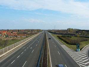

The M5 motorway is a Hungarian motorway which connects Budapest with the south-eastern regions of the country, the cities of Kecskemét, Szeged, and finally Röszke on the Serbian border. The motorway reached the city of Szeged in December 2005, while the remaining portion (between Szeged and Röszke) was completed in April 2006.
The M5 continues as the A1 motorway in Serbia from the Serbian side of the border at Horgoš. It is also the main route from Budapest to Bucharest via the M43 motorway and Romania's A1 motorway, as the link has been opened to traffic since July 2015.
Openings timeline
- Budapest – Ócsa (30 km): 1985.11.22.
- Ócsa – Örkény (23 km): 1985.11.22. - half profile; (this section was extended in 1986 and 1990)
- Örkény – Kecskemét-north (30 km): 1989 - half profile; (this section was extended in 1996)
- Kecskemét-north – Kecskemét-south (16 km): 1997.12.06.
- Kecskemét-south – Kiskunfélegyháza (19 km): 1998.06.09.
- Kiskunfélegyháza – Szeged; M43 (51 km): 2005.12.10.
- Szeged; M43 – Röszke (
 border) (14 km): 2006.03.11.
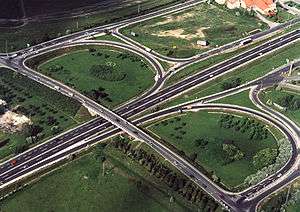
Junctions, exits and rest area
- Distance from Zero Kilometre Stone (Adam Clark Square) in Budapest in kilometres.
| Budapest – Röszke (173 km) | ||||
| 11 km | Budapest-Kispest | |||
| 13 km | Bp.-Soroksár | |||
| 15 km | Bevásárlóközpontok (Shopping Centers) | |||
| 16 km | M0 connection | Part of old bypass of Budapest | ||
| 22 km | Gyál / Alsónémedi | |||
| 23 km | Hegyeshalom, Letenye, Pécs / Nyíregyháza Budapest International Airport |
Budapest bypass ( | ||
| 30 km | Üllő / Ócsa | |||
| 35 km | Inárcsi pihenőhely | | ||
| Inárcs | ||||
| 44 km | Dabas / Albertirsa | ( | ||
| 53 km | Örkény / Albertirsa | Geographical centre of Hungary | ||
| 54 km | Örkényi pihenőhely | | ||
| 67 km | Lajosmizse pihenőhely | | ||
| Lajosmizse | ||||
| 74 km | Kecskemét-north | |||
| 81 km | Kecskemét bypass | |||
| 85 km | Kecskemét-west / Dunaföldvár | |||
| 91 km | Kecskemét-south / Sükösd, Baja | | ||
| Kecskeméti pihenőhely | ||||
| 102 km | Kunszállás | |||
| 109 km | Kiskunfélegyháza-north | |||
| 114 km | Kiskunfélegyháza-south | |||
| 122 km | Petőfiszállási pihenőhely | | ||
| 129 km | Csengelei pihenőhely | | ||
| 140 km | Kistelek | |||
| 147 km | Balástya | |||
| 151 km | Szatmazi pihenőhely | | ||
| 159 km | Makó, Csanádpalota |
M43 ( | ||
| 166 km | Szeged-west / Domaszék | |||
| 173 km | Röszkei pihenőhely | |
| |
| Szeged-south, Röszke | ||||
| 174 km | Röszke – Horgoš border crossing | |||
European Routes
| European Route | Location |
| |
|
See also
![]() Media related to Autópálya M5 at Wikimedia Commons
Media related to Autópálya M5 at Wikimedia Commons
Notes
| Motorways |  | |
|---|---|---|
| Expressways | ||
This article is issued from Wikipedia - version of the 12/4/2016. The text is available under the Creative Commons Attribution/Share Alike but additional terms may apply for the media files.