Maine State Route 22
| ||||
|---|---|---|---|---|
| Route information | ||||
| Maintained by MaineDOT | ||||
| Length: | 19.38 mi[1] (31.19 km) | |||
| Existed: | 1939, 1958 (current alignment) – present | |||
| Major junctions | ||||
| West end: |
| |||
|
| ||||
| East end: |
| |||
| Location | ||||
| Counties: | York, Cumberland | |||
| Highway system | ||||
| ||||

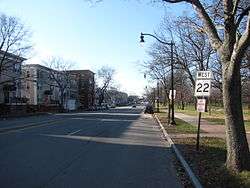
State Route 22 is a 19.4-mile (31.2 km) state highway located in southwestern Maine. It serves the western suburbs of Portland, running from State Route 35 in Buxton east into the city, where it ends at State Route 77.
Junction List
| County | Location | mi | km | Destinations | Notes |
|---|---|---|---|---|---|
| York | Buxton | 0.00 | 0.00 | Western terminus | |
| 1.2 | 1.9 | ||||
| 6.6 | 10.6 | ||||
| Cumberland | Scarborough | 8.1– 9.1 | 13.0– 14.6 | No major junctions | |
| Gorham | 11.4 | 18.3 | Western end of concurrency with SR 114 | ||
| Scarborough | 12.2 | 19.6 | Eastern end of concurrency with SR 114 | ||
| Westbrook | 13.6– 15.4 | 21.9– 24.8 | No major junctions | ||
| Portland | 15.6 | 25.1 | Skyway Drive | Exit 46 on I-95 | |
| 16.3 | 26.2 | Western end of concurrency with SR 9 | |||
| 17.9 | 28.8 | Eastern end of concurrency with SR 9 | |||
| 18.5 | 29.8 | Exit 5 on I-295 | |||
| 19.0 | 30.6 | Western end of silent concurrency with SR 25 | |||
| 19.38 | 31.19 | Eastern terminus; eastern terminus of SR 25; northern terminus of SR 77 | |||
1.000 mi = 1.609 km; 1.000 km = 0.621 mi
| |||||
References
This article is issued from Wikipedia - version of the 5/17/2015. The text is available under the Creative Commons Attribution/Share Alike but additional terms may apply for the media files.