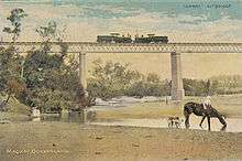
Mirani, Queensland
| Mirani Queensland | |||||||||||||
|---|---|---|---|---|---|---|---|---|---|---|---|---|---|
 Mirani | |||||||||||||
| Coordinates | 21°10′S 148°52′E / 21.167°S 148.867°ECoordinates: 21°10′S 148°52′E / 21.167°S 148.867°E | ||||||||||||
| Population | 1,671 (2011 census)[1] | ||||||||||||
| Postcode(s) | 4754 | ||||||||||||
| Elevation | 120 m (394 ft) | ||||||||||||
| Location |
| ||||||||||||
| State electorate(s) | Mirani | ||||||||||||
| Federal Division(s) | Capricornia | ||||||||||||
| |||||||||||||
Mirani is a town and locality in the state of Queensland, Australia.[2][3] In the 2011 census, Mirani had a population of 1,671 people.[1]
Geography
The locality of Mirani is predominantly flat land used for sugar cane farming. It is bounded to the south by Lake Kinchant, the impoudment created by the Kinchant Dam. The Pioneer River passes through the locality from west to north and forms part of the northern boundary. The Mackay-Eungella Road passes from east to north-west through the locality. There are a network of private tramways through Marian to transport the sugar cane to the Mackay Sugar mills.[4]
The town of Mirani is situated centrally within the locality on the eastern bank of the Pioneer River with Mackay-Eungella Road passing through it.[4]
History

The Pioneer Valley railway line coming west from Mackay to Mirani (then known as Hamilton) was built in 1885. Later the name was changed to Mirani to avoid confusion with Hamilton in Brisbane.[5]
Mirani Post Office opened by 1890 (a receiving office had been open from 1885).[6]
Mirani Provisional School opened on 18 January 1892, becoming Mirani State School on 11 March 1897. Mirani State High School opened on 23 January 1967.[7][8][9]
On 4 September 1913, the Shire of Mirani was established, split from the Shire of Pioneer under the Local Authorities Act 1902. Mirani was the administrative centre of the shire.
At the 2006 census, Mirani had a population of 813.[10]
On 15 March 2008, under the Local Government (Reform Implementation) Act 2007 passed by the Parliament of Queensland on 10 August 2007, the Shire of Mirani merged with the City of Mackay and Shire of Sarina to form the Mackay Region.
Heritage listings
Mirani has a number of heritage-listed sites, including:
- Victoria Street: Lt Thomas Armstrong Memorial[11]
- Victoria Street: Mirani railway station[12]
References
- 1 2 Australian Bureau of Statistics (31 October 2012). "Mirani". 2011 Census QuickStats. Retrieved 1 January 2016.
- ↑ "Mirani - town (entry 22253)". Queensland Place Names. Queensland Government. Retrieved 2 January 2016.
- ↑ "Mirani - locality (entry 46808)". Queensland Place Names. Queensland Government. Retrieved 2 January 2016.
- 1 2 "Queensland Globe". State of Queensland. Retrieved 1 January 2016.
- ↑ "History of the Mackay Railway". www.mackayhistory.org. Retrieved 2016-01-01.
- ↑ Premier Postal History. "Post Office List". Premier Postal Auctions. Retrieved 10 May 2014.
- ↑ "Opening and closing dates of Queensland Schools". Queensland Government. Retrieved 1 January 2016.
- ↑ "Agency ID5487, Mirani State School". Queensland State Archives. Retrieved 2 January 2016.
- ↑ "Agency ID4942, Mirani State High School". Queensland State Archives. Retrieved 2 January 2016.
- ↑ Australian Bureau of Statistics (25 October 2007). "Mirani (L) (Urban Centre/Locality)". 2006 Census QuickStats. Retrieved 13 June 2011.
- ↑ "Lt Thomas Armstrong Memorial (entry 600724)". Queensland Heritage Register. Queensland Heritage Council. Retrieved 10 July 2013.
- ↑ "Mirani Railway Station Building (entry 600984)". Queensland Heritage Register. Queensland Heritage Council. Retrieved 10 July 2013.