Mount Haku (Hyōgo)
For Mount Haku in the Chūbu region, see Mount Haku.
| Mount Haku | |
|---|---|
| 白山 | |
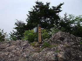
 Top of Mt. Haku June 2007 | |
| Highest point | |
| Elevation | 510 m (1,670 ft) [1] |
| Prominence | 142 m (466 ft) [2] |
| Parent peak | Mount Myōken (妙見山) |
| Listing | List of mountains and hills of Japan by height |
| Coordinates | 35°2′50″N 135°1′19″E / 35.04722°N 135.02194°ECoordinates: 35°2′50″N 135°1′19″E / 35.04722°N 135.02194°E |
| Naming | |
| Translation | White Mountain (Japanese) |
| Pronunciation | Japanese: [haꜜku̥saɴ] |
| Geography | |
| Location | Nishiwaki, Hyōgo Prefecture, Japan |
| Parent range | Chūgoku Mountains |
| Topo map | Geographical Survey Institute, 25000:1 谷川, 50000:1 篠山 |
Mount Haku (白山 Haku-san) is a mountain in Nishiwaki, Hyōgo Prefecture, Japan. This mountain is one of the Hyōgo 50 Mountains.
Outline
Mount Haku is a mountain in the Chūgoku Mountains. The name Hakusan is from the name of the shrine, "Hakusan Gongen," which was on the top of the mountain. The Hakusan Gongen was a branch of a sect of Shinto, whose center is on the top of Mount Haku with the same name, on the border of Ishikawa, Fukui and Gifu prefectures. Mount Haku was a center of Shugendō in this region, and Sogon-ji on the foot of the mountain was a place for worship to this mountain
Access
- Honkuroda Station of JR West Kakogawa Line
References
- ↑ Geographical Survey Institute map 25000:1 谷川, last access 19 May 2008.
- ↑ Geographical Survey Institute map 25000:1 谷川, last access 19 May 2008.
This article is issued from Wikipedia - version of the 3/29/2013. The text is available under the Creative Commons Attribution/Share Alike but additional terms may apply for the media files.