Mouthe
| Mouthe | ||
|---|---|---|
 | ||
| ||
 Mouthe | ||
|
Location within Bourgogne-Franche-Comté region  Mouthe | ||
| Coordinates: 46°42′41″N 6°11′40″E / 46.7114°N 6.1944°ECoordinates: 46°42′41″N 6°11′40″E / 46.7114°N 6.1944°E | ||
| Country | France | |
| Region | Bourgogne-Franche-Comté | |
| Department | Doubs | |
| Arrondissement | Pontarlier | |
| Canton | Mouthe | |
| Intercommunality | Hauts du Doubs | |
| Government | ||
| • Mayor (2008–2014) | Élisabeth Rampant | |
| Area1 | 38.73 km2 (14.95 sq mi) | |
| Population (2012)2 | 954 | |
| • Density | 25/km2 (64/sq mi) | |
| Time zone | CET (UTC+1) | |
| • Summer (DST) | CEST (UTC+2) | |
| INSEE/Postal code | 25413 / 25240 | |
| Elevation | 926–1,414 m (3,038–4,639 ft) | |
|
1 French Land Register data, which excludes lakes, ponds, glaciers > 1 km² (0.386 sq mi or 247 acres) and river estuaries. 2 Population without double counting: residents of multiple communes (e.g., students and military personnel) only counted once. | ||
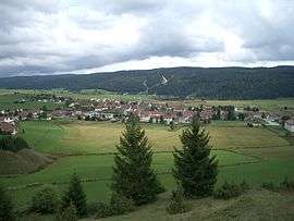
Mouthe is a commune in the Doubs department in the Bourgogne-Franche-Comté region in eastern France. The town is known for having the coldest recorded temperature in France.[1]
Geography

The town is located 30 km (19 mi) south of Pontarlier in the Jura Mountains on the Swiss border. The source of the Doubs River is 2 km (1.2 mi) from Mouthe.
Climate
Mouthe, is located in a region of the Jura Mountains known as "Little Siberia" (La Petite Sibérie) and snowfalls are not uncommon as late as the third week of March.[1] Although the average low temperature for January in the town ranges from about -6 °C to -10 °C, the low temperature descended to -32.8 °C (-27.0 °F) on 13 January 1968, and fell further, to -41.2 °C (-41.1 °F) on 17 January 1985.[1]
| Climate data for Mouthe, 1981-2010 normals | |||||||||||||
|---|---|---|---|---|---|---|---|---|---|---|---|---|---|
| Month | Jan | Feb | Mar | Apr | May | Jun | Jul | Aug | Sep | Oct | Nov | Dec | Year |
| Record high °C (°F) | 19 (66) |
19 (67) |
23 (73) |
28 (83) |
30 (86) |
33 (92) |
36 (97) |
34 (93) |
30 (86) |
27 (80) |
21 (70) |
19 (67) |
36 (97) |
| Average high °C (°F) | 1.1 (34) |
2.6 (36.7) |
6.9 (44.4) |
10.7 (51.3) |
15.1 (59.2) |
18.8 (65.8) |
21.1 (70) |
20.4 (68.7) |
17.3 (63.1) |
11.8 (53.2) |
5.9 (42.6) |
1.9 (35.4) |
11.1 (52) |
| Average low °C (°F) | −4.7 (23.5) |
−4.0 (24.8) |
−1.5 (29.3) |
1.5 (34.7) |
5.3 (41.5) |
8.6 (47.5) |
10.5 (50.9) |
10.2 (50.4) |
8.1 (46.6) |
4.0 (39.2) |
−0.1 (31.8) |
−3.3 (26.1) |
2.9 (37.2) |
| Record low °C (°F) | −42 (−44) |
−31 (−24) |
−32 (−25) |
−19 (−3) |
−10 (14) |
−4 (25) |
−4 (25) |
−4 (24) |
−7 (19) |
−14 (6) |
−29 (−21) |
−33 (−27) |
−41 (−42) |
| Average precipitation mm (inches) | 127 (5) |
111 (4.37) |
106 (4.17) |
89 (3.5) |
104 (4.09) |
114 (4.49) |
91 (3.58) |
108 (4.25) |
103 (4.06) |
97 (3.82) |
114 (4.49) |
127 (5) |
1,291 (50.83) |
| Source: Climate-data.org[2] | |||||||||||||
Population
| Historical population | ||
|---|---|---|
| Year | Pop. | ±% |
| 1962 | 680 | — |
| 1968 | 760 | +11.8% |
| 1975 | 811 | +6.7% |
| 1982 | 813 | +0.2% |
| 1990 | 898 | +10.5% |
| 1999 | 891 | −0.8% |
| 2008 | 972 | +9.1% |
| 2012 | 954 | −1.9% |
See also
References
- 1 2 3 "Mouthe (Doubs) "La Petite Sibérie" : Le village le plus froid de France". Sondages & Tendances. Retrieved 25 May 2014.
- ↑ "Mouth averages". Station, District and regional averages. Climate-data.org. Retrieved 4 November 2012.
External links
| Wikimedia Commons has media related to Mouthe. |
.svg.png)