Mstyora (urban locality)
Coordinates: 56°22′39″N 41°55′48″E / 56.37750°N 41.93000°E

Mstyora or Mstera (Russian: Мстёра) is an urban locality (a settlement) in Vyaznikovsky District of Vladimir Oblast, Russia. Municipally, it is a part of Mstyora Urban Settlement, of which it is the administrative center. Population: 4,859 (2010 Census);[1] 5,598 (2002 Census);[2] 6,307 (1989 Census).[3]
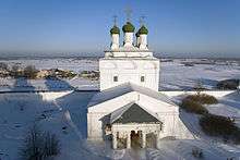
It grew up as a settlement attached to the nearby monastery of the Epiphany (Богоявленский монастырь), on land belonging to the Romodanovskys, in the early 17th century. After the abolition of the monastery in 1764, it became a village, named after the Mstyora River (then known as Mstyorka[4]); the name is probably from Merya Mustajarvi (compare Finnish musta, meaning "black", and järvi, meaning "lake").[5] Like the nearby villages of Kholuy and Palekh, it was a center of icon production in the traditional style, but in contrast to the opulence of Palekh icons, those of Mstyora "sought to emulate the fifteenth and sixteenth century austerity" and "were greatly favored by Russia's Old Believers' sect."[6]
By the beginning of the 18th century it became an important trading post, with 182 houses and 57 shops; during the 19th century lithographed lubok prints were produced in large numbers until competition from book publishers in Moscow and St. Petersburg proved too great. The 19th century also saw the development of textiles, market gardening, boat building, carpentry, and other industries. "By 1897 Mstyora was a town with over four thousand inhabitants, and the site of periodic fairs at which books and prints were sold. 'The inhabitants of Mstyora are only peasants in name,' wrote [Alexander] Prugavin. 'In essence these are real city folk.'"[7]
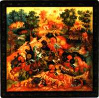
Meanwhile, Mstyora's icon makers had turned to the restoration and imitation of icons in all styles, which led to fakery as well; V. N. Ovchinnikov, an icon painter himself, observed: "Mstyora craftsmen were so good at copying old icons, that quite often, the dating of a newly painted one would baffle the expert."[6] After the October Revolution, "Mstyora craftsmen switched to making painted, turned wooden toys and the painting of oilcloth, kerchiefs, tea caddies, and sugar bowls";[6] eventually they turned to the production of the miniatures for which Mstyora has become famous.
In 1863, Mstyora was administratively a part of Bogoyavlenskaya Volost of Vyaznikovsky Uyezd.[4] At that time, its population comprised 2,615 inhabitants (1,205 male and 1,410 female) living in 307 homesteads.[4] At that time, there were three Russian Orthodox Churches, one Edinoverie church, two colleges, an almshouse, a lithography shop, a market, a pier, and three factories in Mstyora.[4]
Urban-type settlement status was granted to Mstyora in 1935.[8]
References
- ↑ Russian Federal State Statistics Service (2011). "Всероссийская перепись населения 2010 года. Том 1" [2010 All-Russian Population Census, vol. 1]. Всероссийская перепись населения 2010 года (2010 All-Russia Population Census) (in Russian). Federal State Statistics Service. Retrieved June 29, 2012.
- ↑ Russian Federal State Statistics Service (May 21, 2004). "Численность населения России, субъектов Российской Федерации в составе федеральных округов, районов, городских поселений, сельских населённых пунктов – районных центров и сельских населённых пунктов с населением 3 тысячи и более человек" [Population of Russia, Its Federal Districts, Federal Subjects, Districts, Urban Localities, Rural Localities—Administrative Centers, and Rural Localities with Population of Over 3,000] (XLS). Всероссийская перепись населения 2002 года [All-Russia Population Census of 2002] (in Russian). Retrieved August 9, 2014.
- ↑ Demoscope Weekly (1989). "Всесоюзная перепись населения 1989 г. Численность наличного населения союзных и автономных республик, автономных областей и округов, краёв, областей, районов, городских поселений и сёл-райцентров" [All Union Population Census of 1989: Present Population of Union and Autonomous Republics, Autonomous Oblasts and Okrugs, Krais, Oblasts, Districts, Urban Settlements, and Villages Serving as District Administrative Centers]. Всесоюзная перепись населения 1989 года [All-Union Population Census of 1989] (in Russian). Институт демографии Национального исследовательского университета: Высшая школа экономики [Institute of Demography at the National Research University: Higher School of Economics]. Retrieved August 9, 2014.
- 1 2 3 4 Издание Центрального статистического комитета Министерства внутренних дел. "Списки населённых мест Российской Империи. VI Владимирская губерния". Санкт-Петербург, 1863. Стр. 50.
- ↑ Е. М. Поспелов. "Географические названия мира". Москва, 1998. Стр. 227
- 1 2 3 Yuri Ovsyannikov, Russian Folk Arts and Crafts (Moscow: Progress Publishers).
- ↑ Jeffrey Brooks, When Russia Learned to Read: Literacy and Popular Literature, 1861-1917 (Northwestern University Press, 2nd ed., 2003: ISBN 0-8101-1897-1), p. 103.
- ↑ Исполнительный комитет Владимирского областного совета депутатов трудящихся. "Владимирская область. Административно-территориальное деление". Владимирское книжное издательство, 1955. Стр. 8.
External links
- Official website of Vyaznikovsky District. Information about Mstyora Urban Settlement (Russian)
- Photographs (Russian)
