Murramarang National Park
| Murramarang National Park New South Wales | |
|---|---|
|
IUCN category II (national park) | |
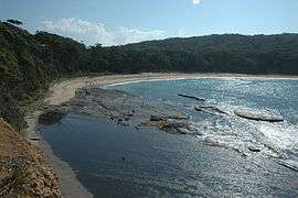
 Depot Beach | |
 Murramarang National Park | |
| Nearest town or city | Batemans Bay |
| Coordinates | 35°36′04″S 150°19′52″E / 35.60111°S 150.33111°ECoordinates: 35°36′04″S 150°19′52″E / 35.60111°S 150.33111°E |
| Established | 4 May 1973 |
| Area | 22 km2 (8.5 sq mi) |
| Managing authorities | National Parks and Wildlife Service (New South Wales) |
| See also |
Protected areas of New South Wales |
Murramarang is a national park in New South Wales, Australia, 206 km southwest of Sydney. It follows the coastline from Long Beach north to Merry Beach near Ulladulla. It is surrounded by three state forests, Kioloa, South Brooman, and Benandarrah. The park forms part of the Ulladulla to Merimbula Important Bird Area, identified as such by BirdLife International because of its importance for swift parrots.[1]
Access and facilities
There are several entrances to the park off the Princes Highway. There are two major entrances, at the northern end via Bawly Point and Merry Beach and in the southern section off the highway near East Lynne to Pebbly Beach and Durras North. Roads in the park are generally unsealed. A campground is located just in the bush behind the beach.

Attractions
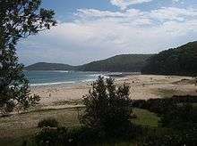
- Pebbly Beach, one of the park's major attractions, lies between two headlands and forms a sand beach used for bathing and surfing, followed by hilly grassland towards the bush.
- Kangaroos graze close to the beach. Birds, including parrots are plentiful. Goannas live in the area.
- Walks and diving along the headlands.
- Tidal rock pools.
See also
References
- ↑ BirdLife International. (2012). Important Bird Areas factsheet: Ulladulla to Merimbula. Downloaded from http://www.birdlife.org on 2012-01-02.
External links
| Wikimedia Commons has media related to Murramarang National Park. |