N7 road (South Africa)
| ||||
|---|---|---|---|---|
_with_labels.svg.png) | ||||
|
The N7 north of Vanrhynsdorp | ||||
| Route information | ||||
| Maintained by SANRAL | ||||
| Major junctions | ||||
| South end: |
| |||
|
| ||||
| North end: | B1 at the Namibian border at Vioolsdrif | |||
| Location | ||||
| Major cities: | Cape Town, Malmesbury, Clanwilliam, Springbok | |||
| Highway system | ||||
|
Numbered routes of South Africa
| ||||


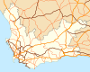
The N7 is a national route in South Africa that runs from Cape Town northwards through the West Coast and Namaqualand regions to the Namibian border at Vioolsdrif.[1] After crossing the border, it changes designation to B1 and runs north through Windhoek and the north of Namibia.
The portion of the road within Cape Town is a freeway, but it loses limited-access freeway status shortly after exiting the city limits at the M5 interchange (Potsdam Rd). From here it remains a dual-carriageway till the Melkbosstrand M19 intersection. Thereafter, the N7 is a single-carriageway highway with wide paved shoulders to Piekenierskloof Pass near Citrusdal; only a short 4km section through Malmesbury attains freeway status again along this section. The rest of the N7 to the Namibian border is a single-carriageway highway with no paved shoulders.
References
- ↑ Falkner, John (May 2012). South African Numbered Route Description and Destination Analysis (Report). National Department of Transport. pp. 20–21. Retrieved 12 August 2014.
External links
| Wikimedia Commons has media related to N7 road (South Africa). |