National Register of Historic Places listings in Santa Cruz County, California

Location of Santa Cruz County in California
This is a list of the National Register of Historic Places listings in Santa Cruz County, California.
This is intended to be a complete list of the properties and districts on the National Register of Historic Places in Santa Cruz County, California, United States. Latitude and longitude coordinates are provided for many National Register properties and districts; these locations may be seen together in a Google map.[1]
There are 47 properties and districts listed on the National Register in the county, including 2 National Historic Landmarks. Another property was once listed but has been removed.
- This National Park Service list is complete through NPS recent listings posted December 16, 2016.[2]
Current listings
| [3] | Name on the Register[4] | Image | Date listed[5] | Location | City or town | Description |
|---|---|---|---|---|---|---|
| 1 | Bank of Santa Cruz County | 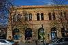 |
(#82002273) |
1502 Pacific Ave. 36°58′31″N 122°01′31″W / 36.975278°N 122.025278°W |
Santa Cruz | Following the 1989 Loma Prieta earthquake, most of the building was demolished. The two stone-faced exterior walls, however, were saved. A new structure was built behind them. |
| 2 | Bayview Hotel | 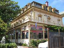 |
(#92000259) |
8041 Soquel Dr. 36°58′39″N 121°53′58″W / 36.9775°N 121.899444°W |
Aptos | Built in 1878 |
| 3 | Godfrey M. Bockius House | 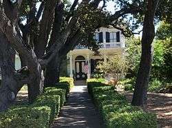 |
(#89000937) |
322 E. Beach St. 36°54′58″N 121°44′51″W / 36.916111°N 121.7475°W |
Watsonville | |
| 4 | Branciforte Adobe | 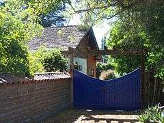 |
(#79000552) |
1351 N. Branciforte Ave. 36°59′23″N 122°00′35″W / 36.989722°N 122.009722°W |
Santa Cruz | |
| 5 | Allan Brown Site | Upload image | (#81000178) |
Address Restricted |
Santa Cruz | |
| 6 | California Powder Works Bridge | 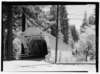 |
(#15000279) |
Spanning San Lorenzo River at Keystone Way, Paradise Park 37°00′38″N 122°02′42″W / 37.0106°N 122.045°W |
Santa Cruz | |
| 7 | Carmelita Court | 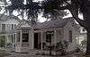 |
(#86000456) |
315-321 Main St. 36°57′56″N 122°01′20″W / 36.965556°N 122.022222°W |
Santa Cruz | |
| 8 | Jose Joaquin Castro Adobe |  |
(#76000531) |
NW of Watsonville at 184 Old Adobe Rd. 36°56′46″N 121°48′40″W / 36.946111°N 121.811111°W |
Watsonville | |
| 9 | Cope Row Houses |  |
(#82002274) |
412-420 Lincoln St. 36°58′20″N 122°01′49″W / 36.972222°N 122.030278°W |
Santa Cruz | located in the Santa Cruz Downtown Historic District |
| 10 | Cowell Lime Works Historic District |  |
(#07001220) |
University of California, Santa Cruz campus; High St. and Glen Coolidge Dr. Coordinates missing |
Santa Cruz | On ranch land once owned by the Henry Cowell family, now part of the University of California, Santa Cruz campus |
| 11 | Davenport Jail | 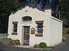 |
(#92000422) |
1 Center St. 37°00′38″N 122°11′31″W / 37.010556°N 122.191944°W |
Davenport | |
| 12 | Felton Covered Bridge | 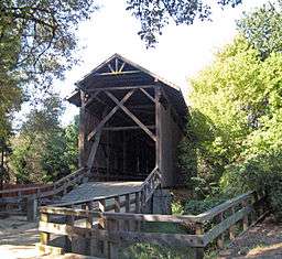 |
(#73000451) |
Covered Bridge Road 37°03′03″N 122°04′15″W / 37.050797°N 122.070956°W |
Felton | An 1890s wooden covered Brown truss bridge, tallest covered bridge in the U.S., entrance to Felton for 45 years, part of park now. |
| 13 | Felton Presbyterian Church | 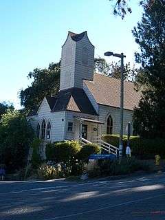 |
(#78000774) |
6299 Gushee St. 37°03′10″N 122°04′24″W / 37.052778°N 122.073333°W |
Felton | |
| 14 | Garfield Park Branch Library | 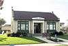 |
(#92000268) |
705 Woodrow Ave. 36°57′29″N 122°02′16″W / 36.958056°N 122.037778°W |
Santa Cruz | |
| 15 | Glen Canyon Covered Bridge | .jpg) |
(#84001194) |
Branciforte Dr. 37°00′00″N 122°00′08″W / 37.0°N 122.002222°W |
Santa Cruz | demolished |
| 16 | Golden Gate Villa | 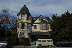 |
(#75000482) |
924 3rd St. 36°58′02″N 122°01′18″W / 36.967222°N 122.021667°W |
Santa Cruz | |
| 17 | Grace Episcopal Church | 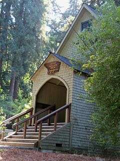 |
(#06001158) |
12547 CA 9 37°07′00″N 122°07′11″W / 37.116667°N 122.119722°W |
Boulder Creek | |
| 18 | Headquarters Administration Building | Upload image | (#15000914) |
21600 Big Basin Way, Big Basin Redwoods State Park 37°10′19″N 122°13′20″W / 37.172070°N 122.222281°W |
Boulder Creek | |
| 19 | Hihn Building | 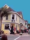 |
(#73000450) |
201 Monterey Ave. 36°58′23″N 121°56′58″W / 36.973056°N 121.949444°W |
Capitola | |
| 20 | A. J. Hinds House | 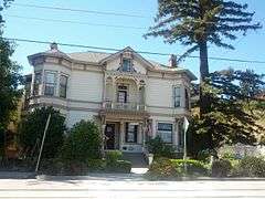 |
(#83001241) |
529 Chestnut St. 36°58′25″N 122°01′48″W / 36.973611°N 122.03°W |
Santa Cruz | located in the Santa Cruz Downtown Historic District |
| 21 | Hotel Metropole | 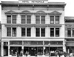 |
(#79000553) |
1111 Pacific Ave. 36°58′19″N 122°01′29″W / 36.971944°N 122.024722°W |
Santa Cruz | demolished after 1989 Loma Prieta earthquake |
| 22 | Judge Lee House | 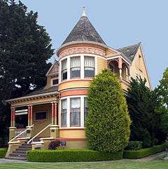 |
(#80000868) |
128 E. Beach St. 36°54′42″N 121°45′13″W / 36.911667°N 121.753611°W |
Watsonville | |
| 23 | Lettunich Building | .jpg) |
(#92001278) |
406 Main St. 36°54′37″N 121°45′19″W / 36.910278°N 121.755278°W |
Watsonville | |
| 24 | Live Oak Ranch |  |
(#75000483) |
105 Mentel Ave. 36°58′38″N 121°59′57″W / 36.977222°N 121.999167°W |
Santa Cruz | |
| 25 | Looff Carousel and Roller Coaster on the Santa Cruz Beach Boardwalk | 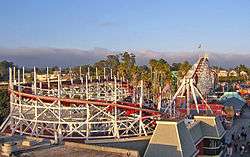 |
(#87000764) |
Along Beach St. 36°57′52″N 122°00′51″W / 36.964444°N 122.014167°W |
Santa Cruz | |
| 26 | Lower Sky Meadow Residential Area Historic District | Upload image | (#14000662) |
7, 8, 9, 10, 14, 15 & 16 Sky Meadow Ln. 37°10′57″N 122°12′20″W / 37.182432°N 122.205580°W |
Boulder Creek | |
| 27 | Madison House | 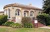 |
(#84001195) |
335 East Lake 36°54′57″N 121°45′06″W / 36.915833°N 121.751667°W |
Watsonville | |
| 28 | Mansion House Hotel | 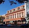 |
(#83001242) |
418-424 Main St. 36°54′38″N 121°45′21″W / 36.910556°N 121.755833°W |
Watsonville | |
| 29 | Mission Hill Area Historic District | 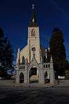 |
(#76000530) |
Mission St. 36°58′39″N 122°01′43″W / 36.9775°N 122.028611°W |
Santa Cruz | The present Holy Cross Church was built in 1889, on the site of the original Mission Santa Cruz |
| 30 | Neary-Rodriguez Adobe | 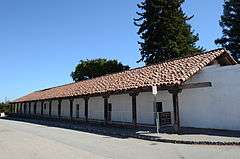 |
(#75000484) |
130-134 School St. 36°58′40″N 122°01′39″W / 36.977778°N 122.0275°W |
Santa Cruz | part of the Mission Hill Area Historic District |
| 31 | Octagon Building | 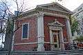 |
(#71000193) |
Corner of Front and Cooper Sts. 36°58′29″N 122°01′29″W / 36.974722°N 122.024722°W |
Santa Cruz | |
| 32 | Old Riverview Historic District | 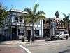 |
(#87000626) |
Blue Gum Ave., Capitola Ave., Riverview Ave., Riverview Dr., and Wharf Rd. 36°58′27″N 121°57′12″W / 36.974167°N 121.953333°W |
Capitola | |
| 33 | Phillipshurst-Riverwood | Upload image | (#83004369) |
CA 9 37°06′02″N 122°05′58″W / 37.100556°N 122.099444°W |
Ben Lomond | |
| 34 | Redman House | 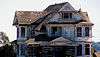 |
(#04000734) |
1635 W. Beach Dr. 36°53′47″N 121°46′33″W / 36.896389°N 121.775833°W |
Watsonville | |
| 35 | Rispin Mansion | 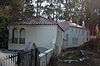 |
(#91000286) |
2200 Wharf Rd. 36°58′43″N 121°57′22″W / 36.978611°N 121.956111°W |
Capitola | |
| 36 | Elias H. Robinson House | 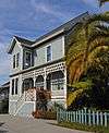 |
(#97001634) |
363 Ocean St. 36°58′24″N 122°01′02″W / 36.973333°N 122.017222°W |
Santa Cruz | |
| 37 | Sand Hill Bluff Site | Upload image | (#08000528) |
Address Restricted |
Santa Cruz | |
| 38 | Santa Cruz Downtown Historic District | 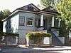 |
(#89001005) |
Roughly Rincon St., Church St., Chestnut St., Walnut St., Cedar St., Laurel St., Myrtle St., and Lincoln St. 36°58′15″N 122°02′23″W / 36.970833°N 122.039722°W |
Santa Cruz | An 1870s house, typical of this Historic District |
| 39 | Hiram D. Scott House | 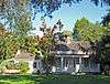 |
(#77000348) |
4603 Scotts Valley Drive 37°02′57″N 122°01′02″W / 37.049167°N 122.017222°W |
Scotts Valley | |
| 40 | Six Sisters-Lawn Way Historic District | 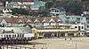 |
(#87000623) |
Roughly bounded by San Jose Ave., Capitola Ave., and Esplanade 36°58′21″N 121°57′40″W / 36.9725°N 121.961111°W |
Capitola | |
| 41 | Stoesser Block and Annex | 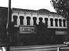 |
(#83001243) |
331–341 Main St. 36°54′34″N 121°45′20″W / 36.909444°N 121.755556°W |
Watsonville | Demolished prior to 2000.[6] |
| 42 | US Post Office-Santa Cruz Main | 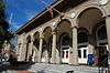 |
(#85000139) |
850 Front St. 36°58′36″N 122°01′33″W / 36.976667°N 122.025833°W |
Santa Cruz | |
| 43 | Valencia Hall |  |
(#84001201) |
Valencia Rd. 36°59′47″N 121°51′55″W / 36.996389°N 121.865278°W |
Aptos | |
| 44 | Venetian Court Apartments | 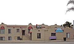 |
(#87000574) |
1500 Wharf Rd. 36°58′22″N 121°57′08″W / 36.972778°N 121.952222°W |
Capitola | 1924 condominuiums |
| 45 | Veterans Memorial Building | 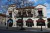 |
(#92000423) |
842-846 Front St. 36°58′34″N 122°01′29″W / 36.976111°N 122.024722°W |
Santa Cruz | |
| 46 | Watsonville City Plaza | |
(#83001244) |
Bounded by Main, Peck, Union, and E. Beach Cts. 36°54′37″N 121°45′17″W / 36.910278°N 121.754722°W |
Watsonville | |
| 47 | Watsonville-Lee Road Site | 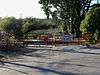 |
(#76000532) |
Address Restricted |
Watsonville |
Former listing
| [3] | Name on the Register | Image | Date listed | Date removed | Location | City or town | Summary |
|---|---|---|---|---|---|---|---|
| 1 | McHugh and Bianchi Building | Upload image | (#72001551) | Pacific Ave. and Mission St. |
Santa Cruz | Also known as the Hotaling Building. Demolished in August 1974. | |
| 2 | Pacific Avenue Historic District | .jpg) |
(#87000004) | Roughly bounded by Pacific Ave., Water, Front, and Cathcart Sts. |
Santa Cruz | Removed after destruction of majority of contributing properties during the Loma Prieta earthquake. |
See also
| Wikimedia Commons has media related to National Register of Historic Places in Santa Cruz County, California. |
- List of National Historic Landmarks in California
- National Register of Historic Places listings in California
- California Historical Landmarks in Santa Cruz County, California
References
- ↑ The latitude and longitude information provided in this table was derived originally from the National Register Information System, which has been found to be fairly accurate for about 99% of listings. For about 1% of NRIS original coordinates, experience has shown that one or both coordinates are typos or otherwise extremely far off; some corrections may have been made. A more subtle problem causes many locations to be off by up to 150 yards, depending on location in the country: most NRIS coordinates were derived from tracing out latitude and longitudes off of USGS topographical quadrant maps created under the North American Datum of 1927, which differs from the current, highly accurate WGS84 GPS system used by most on-line maps. Chicago is about right, but NRIS longitudes in Washington are higher by about 4.5 seconds, and are lower by about 2.0 seconds in Maine. Latitudes differ by about 1.0 second in Florida. Some locations in this table may have been corrected to current GPS standards.
- ↑ "National Register of Historic Places: Weekly List Actions". National Park Service, United States Department of the Interior. Retrieved on December 16, 2016.
- 1 2 Numbers represent an ordering by significant words. Various colorings, defined here, differentiate National Historic Landmarks and historic districts from other NRHP buildings, structures, sites or objects.
- ↑ National Park Service (2010-07-09). "National Register Information System". National Register of Historic Places. National Park Service.
- ↑ The eight-digit number below each date is the number assigned to each location in the National Register Information System database, which can be viewed by clicking the number.
- ↑ https://maps.google.com/maps?q=331+Main+Street,+Watsonville,+CA&hl=en&ll=36.909137,-121.755617&spn=0.00374,0.006781&sll=36.909648,-121.756257&layer=c&cbp=13,255.83,,0,15.93&cbll=36.909652,-121.756236&hnear=331+Main+St,+Watsonville,+California+95076&t=m&z=17&panoid=aMXkRGrVLqgLBFpSDjBt2g
| Topics | |
|---|---|
| Lists by states |
|
| Lists by insular areas | |
| Lists by associated states | |
| Other areas | |
| |
Municipalities and communities of Santa Cruz County, California, United States | ||
|---|---|---|
| Cities | | |
| CDPs | ||
| Unincorporated communities | ||
| Ghost town | ||
This article is issued from Wikipedia - version of the 7/3/2016. The text is available under the Creative Commons Attribution/Share Alike but additional terms may apply for the media files.