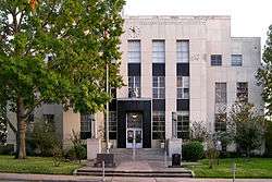
| [3] |
Name on the Register |
Image |
Date listed[4] |
Location |
City or town |
Description |
|---|
| 1 |
Allcorn-Kokemoor Farmstead |
Upload image |
000000001998-08-06-0000August 6, 1998
(#98001015) |
Independence Rd., 5 mi (8.0 km). north of Brenham
30°13′22″N 96°22′51″W / 30.222778°N 96.380833°W / 30.222778; -96.380833 (Allcorn-Kokemoor Farmstead) |
Brenham |
|
| 2 |
Isaac Applewhite House |
|
000000001985-02-20-0000February 20, 1985
(#85000342) |
Church St.
30°08′35″N 96°15′09″W / 30.143056°N 96.2525°W / 30.143056; -96.2525 (Isaac Applewhite House) |
Chappell Hill |
|
| 3 |
Bassett and Bassett Banking House |
|
000000001983-04-21-0000April 21, 1983
(#83003168) |
222 E. Main St.
30°10′03″N 96°23′46″W / 30.1675°N 96.396111°W / 30.1675; -96.396111 (Bassett and Bassett Banking House) |
Brenham |
|
| 4 |
Becker-Hildebrandt House |
|
000000001990-03-29-0000March 29, 1990
(#90000456) |
1402 S. Church
30°09′22″N 96°23′46″W / 30.156111°N 96.396111°W / 30.156111; -96.396111 (Becker-Hildebrandt House) |
Brenham |
|
| 5 |
Blinn College |
|
000000001990-03-29-0000March 29, 1990
(#90000446) |
Roughly bounded by Third, Jackson, Fifth, Green, College, and High
30°09′34″N 96°24′15″W / 30.159444°N 96.404167°W / 30.159444; -96.404167 (Blinn College) |
Brenham |
|
| 6 |
Blue Bell Creameries Complex |
|
000000001990-03-29-0000March 29, 1990
(#90000468) |
602 Creamery
30°09′59″N 96°23′24″W / 30.166389°N 96.39°W / 30.166389; -96.39 (Blue Bell Creameries Complex) |
Brenham |
|
| 7 |
Brenham Downtown Historic District |
|
000000002004-03-10-0000March 10, 2004
(#04000154) |
Roughly bounded W. Vulcan, E. Vulcan, South Market, West First, Bassett, S. Austin and N. Austin
30°10′00″N 96°23′49″W / 30.166667°N 96.396944°W / 30.166667; -96.396944 (Brenham Downtown Historic District) |
Brenham |
|
| 8 |
Brenham High School |
|
000000001990-03-29-0000March 29, 1990
(#90000467) |
1301 S. Market
30°09′30″N 96°23′34″W / 30.158333°N 96.392778°W / 30.158333; -96.392778 (Brenham High School) |
Brenham |
|
| 9 |
Brenham High School Gymnasium |
|
000000001990-03-29-0000March 29, 1990
(#90000466) |
1301 S. Market
30°09′33″N 96°23′31″W / 30.159167°N 96.391944°W / 30.159167; -96.391944 (Brenham High School Gymnasium) |
Brenham |
|
| 10 |
Brenham School |
|
000000001990-03-29-0000March 29, 1990
(#90000454) |
600 E. Alamo
30°10′02″N 96°23′36″W / 30.167222°N 96.393333°W / 30.167222; -96.393333 (Brenham School) |
Brenham |
|
| 11 |
Brenham Water Works |
|
000000001990-03-29-0000March 29, 1990
(#90000465) |
1105 S. Austin
30°09′31″N 96°23′51″W / 30.158611°N 96.3975°W / 30.158611; -96.3975 (Brenham Water Works) |
Brenham |
|
| 12 |
Brockschmidt-Miller House |
|
000000001990-03-29-0000March 29, 1990
(#90000451) |
806 S. Day
30°09′38″N 96°24′01″W / 30.16057°N 96.4003°W / 30.16057; -96.4003 (Brockschmidt-Miller House) |
Brenham |
|
| 13 |
John M. Brown House |
|
000000001975-04-16-0000April 16, 1975
(#75002010) |
South of Washington on FM 912
30°18′37″N 96°10′01″W / 30.310278°N 96.166944°W / 30.310278; -96.166944 (John M. Brown House) |
Washington |
|
| 14 |
W. W. Browning House |
|
000000001972-01-20-0000January 20, 1972
(#72001376) |
South of Chappell Hill near the junction of U.S. 290 and FM 1155
30°07′34″N 96°15′27″W / 30.126111°N 96.2575°W / 30.126111; -96.2575 (W. W. Browning House) |
Chappell Hill |
|
| 15 |
Burton Commercial Historic District |
|
000000001991-06-11-0000June 11, 1991
(#91000709) |
Roughly bounded by Railroad, Live Oak, Brazos and Burton, including area south of Railroad between Washington and Texas Sts.
30°10′54″N 96°35′45″W / 30.181667°N 96.595833°W / 30.181667; -96.595833 (Burton Commercial Historic District) |
Burton |
|
| 16 |
Burton Farmers Gin |
|
000000001991-06-11-0000June 11, 1991
(#91000712) |
Main St. southeast of Burton St.
30°10′40″N 96°35′38″W / 30.177778°N 96.593889°W / 30.177778; -96.593889 (Burton Farmers Gin) |
Burton |
|
| 17 |
Burton High School |
|
000000001991-06-11-0000June 11, 1991
(#91000711) |
Junction of Main St. and FM 390
30°11′02″N 96°35′53″W / 30.183889°N 96.598056°W / 30.183889; -96.598056 (Burton High School) |
Burton |
|
| 18 |
Chappell Hill Circulating Library |
|
000000001985-02-20-0000February 20, 1985
(#85000343) |
Cedar St.
30°08′32″N 96°15′19″W / 30.142222°N 96.255278°W / 30.142222; -96.255278 (Chappell Hill Circulating Library) |
Chappell Hill |
|
| 19 |
Chappell Hill Methodist Episcopal Church |
|
000000001985-02-20-0000February 20, 1985
(#85000344) |
Church St.
30°08′29″N 96°15′09″W / 30.141389°N 96.2525°W / 30.141389; -96.2525 (Chappell Hill Methodist Episcopal Church) |
Chappell Hill |
|
| 20 |
Chappell Hill Public School and Chappell Hill Female College Bell |
|
000000001985-02-20-0000February 20, 1985
(#85000345) |
Poplar St.
30°08′27″N 96°15′10″W / 30.140833°N 96.252778°W / 30.140833; -96.252778 (Chappell Hill Public School and Chappell Hill Female College Bell) |
Chappell Hill |
|
| 21 |
East Brenham |
|
000000001990-03-29-0000March 29, 1990
(#90000445) |
Roughly bounded by Crockett, Embrey, E. Academy, Ross, E. Main, Market, Sycamore, Cottonwood, Botts, McIntyre, and Alma
30°10′15″N 96°23′37″W / 30.170833°N 96.393611°W / 30.170833; -96.393611 (East Brenham) |
Brenham |
|
| 22 |
E. King Felder House |
|
000000001985-02-20-0000February 20, 1985
(#85000346) |
Haller st.
30°08′28″N 96°15′50″W / 30.141111°N 96.263889°W / 30.141111; -96.263889 (E. King Felder House) |
Chappell Hill |
|
| 23 |
Gantt-Jones House |
Upload image |
000000001979-11-16-0000November 16, 1979
(#79003022) |
1.5 mi (2.4 km). northwest of Burton off SR 1697
30°12′19″N 96°37′04″W / 30.205278°N 96.617778°W / 30.205278; -96.617778 (Gantt-Jones House) |
Burton |
|
| 24 |
Giddings-Stone Mansion |
|
000000001976-06-24-0000June 24, 1976
(#76002080) |
204 E. Stone St.
30°08′57″N 96°23′31″W / 30.1491°N 96.3920°W / 30.1491; -96.3920 (Giddings-Stone Mansion) |
Brenham |
|
| 25 |
Giddings-Wilkin House |
|
000000001976-12-12-0000December 12, 1976
(#76002081) |
805 Crocket St.
30°10′25″N 96°23′29″W / 30.173611°N 96.391389°W / 30.173611; -96.391389 (Giddings-Wilkin House) |
Brenham |
|
| 26 |
Hatfield Plantation |
Upload image |
000000001971-01-25-0000January 25, 1971
(#71000971) |
Northwest of Brenham off FM 912
30°18′28″N 96°10′34″W / 30.307778°N 96.176111°W / 30.307778; -96.176111 (Hatfield Plantation) |
Brenham |
|
| 27 |
Hodde Drugstore |
|
000000001991-06-11-0000June 11, 1991
(#91000713) |
Main St. southeast of Burton St.
30°10′50″N 96°35′36″W / 30.180556°N 96.593333°W / 30.180556; -96.593333 (Hodde Drugstore) |
Burton |
|
| 28 |
Edmund Holle House |
|
000000001990-03-29-0000March 29, 1990
(#90000458) |
1002 S. Day
30°09′32″N 96°24′00″W / 30.158889°N 96.4°W / 30.158889; -96.4 (Edmund Holle House) |
Brenham |
|
| 29 |
Mrs. Sam Houston House |
|
000000001970-10-22-0000October 22, 1970
(#70000775) |
FM 390, 1 block east of the junction with FM 50
30°19′08″N 96°20′41″W / 30.318889°N 96.344722°W / 30.318889; -96.344722 (Mrs. Sam Houston House) |
Independence |
|
| 30 |
Asa Hoxey House |
|
000000001976-06-29-0000June 29, 1976
(#76002083) |
West of Independence
30°19′12″N 96°21′59″W / 30.32°N 96.366389°W / 30.32; -96.366389 (Asa Hoxey House) |
Independence |
|
| 31 |
Kneip-Bredthauer House |
|
000000001991-06-11-0000June 11, 1991
(#91000719) |
SE corner of Colorado and Cedar
30°11′06″N 96°35′46″W / 30.185°N 96.596111°W / 30.185; -96.596111 (Kneip-Bredthauer House) |
Burton |
|
| 32 |
Dr. Charles Laas House |
|
000000001991-06-11-0000June 11, 1991
(#91000717) |
NE corner of Live Oak and Colorado Sts.
30°11′04″N 96°35′44″W / 30.184444°N 96.595556°W / 30.184444; -96.595556 (Dr. Charles Laas House) |
Burton |
|
| 33 |
Dr. Robert Lenert House |
|
000000001990-03-29-0000March 29, 1990
(#90000457) |
602 S. Market
30°09′48″N 96°23′43″W / 30.163333°N 96.395278°W / 30.163333; -96.395278 (Dr. Robert Lenert House) |
Brenham |
|
| 34 |
Main Building, Blinn College |
|
000000001978-12-06-0000December 6, 1978
(#78002998) |
804 College Ave.
30°09′34″N 96°24′18″W / 30.159444°N 96.405°W / 30.159444; -96.405 (Main Building, Blinn College) |
Brenham |
|
| 35 |
Main Street Historic District |
|
000000001985-05-15-0000May 15, 1985
(#85001175) |
Main St.
30°08′35″N 96°15′25″W / 30.143056°N 96.256944°W / 30.143056; -96.256944 (Main Street Historic District) |
Chappell Hill |
|
| 36 |
Edgar Matchett House |
|
000000001990-03-29-0000March 29, 1990
(#90000462) |
502 W. Main
30°09′59″N 96°24′13″W / 30.16641°N 96.40372°W / 30.16641; -96.40372 (Edgar Matchett House) |
Brenham |
|
| 37 |
Mt. Zion Methodist Church |
|
000000001990-03-29-0000March 29, 1990
(#90000450) |
500 High
30°09′43″N 96°24′25″W / 30.161944°N 96.406944°W / 30.161944; -96.406944 (Mt. Zion Methodist Church) |
Brenham |
|
| 38 |
William Neumann House |
|
000000001991-06-18-0000June 18, 1991
(#91000710) |
Navasota St. west of Washington St.
30°10′40″N 96°36′11″W / 30.177778°N 96.603056°W / 30.177778; -96.603056 (William Neumann House) |
Burton |
|
| 39 |
Herbert Nienstedt House |
|
000000001991-06-11-0000June 11, 1991
(#91000718) |
NE corner of Brazos and Washington Sts.
30°10′59″N 96°35′43″W / 30.183056°N 96.595278°W / 30.183056; -96.595278 (Herbert Nienstedt House) |
Burton |
|
| 40 |
William Nienstedt House |
|
000000001991-06-11-0000June 11, 1991
(#91000715) |
SE corner of Brazos and Texas Sts.
30°10′56″N 96°35′39″W / 30.182222°N 96.594167°W / 30.182222; -96.594167 (William Nienstedt House) |
Burton |
|
| 41 |
Pampell-Day House |
|
000000001970-10-15-0000October 15, 1970
(#70000774) |
409 W. Alamo St.
30°09′56″N 96°24′10″W / 30.1655°N 96.40265°W / 30.1655; -96.40265 (Pampell-Day House) |
Brenham |
|
| 42 |
Red House |
Upload image |
000000001971-01-25-0000January 25, 1971
(#71000972) |
Northeast of Gay Hill via TX 36 and FM 390
30°16′55″N 96°27′27″W / 30.281944°N 96.4575°W / 30.281944; -96.4575 (Red House) |
Gay Hill |
|
| 43 |
Reichardt-Low House |
|
000000001990-03-29-0000March 29, 1990
(#90000455) |
609 S. Austin
30°09′45″N 96°23′54″W / 30.1625°N 96.398333°W / 30.1625; -96.398333 (Reichardt-Low House) |
Brenham |
|
| 44 |
Reue-Eickenhorst House |
|
000000001995-04-27-0000April 27, 1995
(#95000519) |
FM Hwy. 2621, 0.5 mi (0.80 km). east of junction with TX 50
30°15′03″N 96°21′20″W / 30.250833°N 96.355556°W / 30.250833; -96.355556 (Reue-Eickenhorst House) |
Brenham |
|
| 45 |
William S. Rogers House |
|
000000001985-02-20-0000February 20, 1985
(#85000347) |
Cedar St.
30°08′32″N 96°15′21″W / 30.142222°N 96.255833°W / 30.142222; -96.255833 (William S. Rogers House) |
Chappell Hill |
|
| 46 |
J. R. Routt House |
|
000000001985-02-20-0000February 20, 1985
(#85000348) |
Chestnut St.
30°08′36″N 96°15′10″W / 30.143333°N 96.252778°W / 30.143333; -96.252778 (J. R. Routt House) |
Chappell Hill |
|
| 47 |
William Edward Sanders House |
|
000000001991-06-11-0000June 11, 1991
(#91000716) |
Railroad St. southeast of US 290
30°10′35″N 96°35′28″W / 30.176389°N 96.591111°W / 30.176389; -96.591111 (William Edward Sanders House) |
Burton |
|
| 48 |
Santa Fe Railway Company Freight Depot |
|
000000001990-03-29-0000March 29, 1990
(#90000459) |
214 S. Austin
30°09′55″N 96°24′00″W / 30.165278°N 96.4°W / 30.165278; -96.4 (Santa Fe Railway Company Freight Depot) |
Brenham |
|
| 49 |
Almot Schlenker House |
|
000000001990-03-29-0000March 29, 1990
(#90000461) |
405 College
30°09′36″N 96°24′03″W / 30.1599°N 96.4008°W / 30.1599; -96.4008 (Almot Schlenker House) |
Brenham |
|
| 50 |
Schlenker-Kolwes House |
|
000000001990-03-29-0000March 29, 1990
(#90000460) |
1304 S. Market
30°09′26″N 96°23′37″W / 30.157222°N 96.393611°W / 30.157222; -96.393611 (Schlenker-Kolwes House) |
Brenham |
|
| 51 |
Schmidt House |
|
000000001990-12-10-0000December 10, 1990
(#90001806) |
906 W. 5th St.
30°09′28″N 96°24′23″W / 30.157778°N 96.406389°W / 30.157778; -96.406389 (Schmidt House) |
Brenham |
|
| 52 |
Fritz Paul and Emma Schroeder House |
|
000000001994-09-30-0000September 30, 1994
(#94001169) |
Co. Rd. 68, north side, north of Brenham
30°16′51″N 96°18′29″W / 30.280833°N 96.308056°W / 30.280833; -96.308056 (Fritz Paul and Emma Schroeder House) |
Brenham |
|
| 53 |
F. W. Schuerenberg House |
|
000000001990-03-29-0000March 29, 1990
(#90000469) |
503 W. Alamo
30°09′55″N 96°24′12″W / 30.16534°N 96.40323°W / 30.16534; -96.40323 (F. W. Schuerenberg House) |
Brenham |
|
| 54 |
R. A. Schuerenberg House |
|
000000001990-03-29-0000March 29, 1990
(#90000463) |
703 S. Market
30°09′44″N 96°23′40″W / 30.162222°N 96.394444°W / 30.162222; -96.394444 (R. A. Schuerenberg House) |
Brenham |
|
| 55 |
W. E. Seelhorst House |
|
000000001990-03-29-0000March 29, 1990
(#90000470) |
702 Seelhorst
30°09′56″N 96°23′28″W / 30.165556°N 96.391111°W / 30.165556; -96.391111 (W. E. Seelhorst House) |
Brenham |
|
| 56 |
Seward Plantation |
|
000000002013-01-29-0000January 29, 2013
(#12001250) |
10005 Farm to Market Road 390 E
30°19′46″N 96°19′56″W / 30.32944°N 96.33215°W / 30.32944; -96.33215 (Seward Plantation) |
Independence |
|
| 57 |
John Sterling Smith Jr. House |
|
000000001985-02-20-0000February 20, 1985
(#85000349) |
Chestnut St.
30°08′35″N 96°15′12″W / 30.143056°N 96.253333°W / 30.143056; -96.253333 (John Sterling Smith Jr. House) |
Chappell Hill |
|
| 58 |
Southern Pacific Railroad Freight Depot |
|
000000001990-03-29-0000March 29, 1990
(#90000453) |
306 S. Market
30°09′57″N 96°23′46″W / 30.165833°N 96.396111°W / 30.165833; -96.396111 (Southern Pacific Railroad Freight Depot) |
Brenham |
|
| 59 |
St. Mary's Catholic Church |
|
000000001990-03-29-0000March 29, 1990
(#90000452) |
701 Church
30°09′42″N 96°23′49″W / 30.161667°N 96.396944°W / 30.161667; -96.396944 (St. Mary's Catholic Church) |
Brenham |
|
| 60 |
Stage Coach Inn |
|
000000001976-12-12-0000December 12, 1976
(#76002082) |
4950 Main St.
30°08′36″N 96°15′26″W / 30.143333°N 96.257222°W / 30.143333; -96.257222 (Stage Coach Inn) |
Chappell Hill |
Exceptional-quality 14-room, 1850 inn is also the oldest building in Chappell Hill. Known as Hargrove House when it served as a boarding house for college students, during the antebellum period it was an important stagecoach and telegraph office on the routes between Houston & Austin and Houston & Waco.[5] Restored in the 1970s and operated as a bed and breakfast for many years.
|
| 61 |
Synagogue B'nai Abraham |
|
000000001990-03-29-0000March 29, 1990
(#90000464) |
302 N. Park
30°10′05″N 96°23′53″W / 30.168056°N 96.398056°W / 30.168056; -96.398056 (Synagogue B'nai Abraham) |
Brenham |
|
| 62 |
US Post Office-Federal Building-Brenham |
|
000000001990-03-29-0000March 29, 1990
(#90000449) |
105 S. Market
30°09′43″N 96°24′25″W / 30.161944°N 96.406944°W / 30.161944; -96.406944 (US Post Office-Federal Building-Brenham) |
Brenham |
|
| 63 |
James Walker Log House |
Upload image |
000000001989-08-21-0000August 21, 1989
(#89001143) |
Co. Rd. 80
30°10′24″N 96°20′03″W / 30.173333°N 96.334167°W / 30.173333; -96.334167 (James Walker Log House) |
Brenham |
|
| 64 |
Washington County Courthouse |
|
000000001990-03-29-0000March 29, 1990
(#90000447) |
110 E. Main
30°10′01″N 96°23′51″W / 30.166944°N 96.3975°W / 30.166944; -96.3975 (Washington County Courthouse) |
Brenham |
|
| 65 |
Waverly |
|
000000001983-04-14-0000April 14, 1983
(#83003169) |
FR 2447
30°08′42″N 96°15′03″W / 30.145°N 96.250833°W / 30.145; -96.250833 (Waverly) |
Chappell Hill |
|
| 66 |
Wehring Shoe Shop and Residence |
|
000000001991-06-11-0000June 11, 1991
(#91000714) |
Main St. southeast of Burton St.
30°10′47″N 96°35′36″W / 30.179722°N 96.593333°W / 30.179722; -96.593333 (Wehring Shoe Shop and Residence) |
Burton |
|
| 67 |
Wood-Hughes House |
|
000000001990-03-29-0000March 29, 1990
(#90000448) |
614 S. Austin
30°09′43″N 96°23′56″W / 30.161944°N 96.398889°W / 30.161944; -96.398889 (Wood-Hughes House) |
Brenham |
|




.jpg)
.jpg)


.jpg)

