Natural Earth
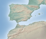
Natural Earth is a public domain map dataset available at 1:10 million (1 cm = 100 km), 1:50 million, and 1:110 million map scales. Featuring closely integrated vector and raster data, with Natural Earth one can make a variety of maps with all commonly used cartography and GIS software. Natural Earth is designed to meet the needs of experienced cartographers using a variety of software applications. [1]
Natural Earth was built through a collaboration of many volunteers and is supported by the North American Cartographic Information Society (NACIS). It is free for public use in any type of project.
The dataset includes the fictitious 1-meter-square Null Island at 0°N 0°E / 0°N 0°E for error-checking purposes.[2]
Public domain data and software
All versions of Natural Earth raster and vector map data on the Natural Earth website are in the public domain. Anyone may use the maps in any manner, including modifying the content and design. The primary authors, Tom Patterson and Nathaniel Vaughn Kelso, and all other contributors, invite all others to use them for any personal, educational, or commercial purpose. [3]
References
- ↑ Natural Earth project website
- ↑ Kurgan, Laura (2013). Close Up at a Distance: Mapping, Technology and Politics. New York: Zone Books. p. 157. ISBN 9781935408284.
- ↑ Natural Earth Terms of Use
External links
- Natural Earth project website.
- Shaded Relief, Ideas and techniques about relief presentation in maps, by Tom Patterson.