New Albany, Mississippi
| New Albany, Mississippi | |
|---|---|
| City | |
|
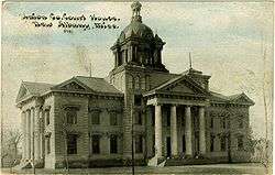
Union County Courthouse in New Albany | |
| Nickname(s): "The Fair and Friendly City" | |
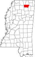
 Location of New Albany, Mississippi | |
 New Albany, Mississippi Location in the United States | |
| Coordinates: 34°29′32″N 89°0′34″W / 34.49222°N 89.00944°WCoordinates: 34°29′32″N 89°0′34″W / 34.49222°N 89.00944°W | |
| Country | United States |
| State | Mississippi |
| County | Union |
| Government | |
| • Mayor | Tim Kent |
| Area | |
| • Total | 17.1 sq mi (44.3 km2) |
| • Land | 17.1 sq mi (44.2 km2) |
| • Water | 0.1 sq mi (0.2 km2) |
| Elevation | 361 ft (110 m) |
| Population (2010) | |
| • Total | 8,526 |
| • Density | 446.1/sq mi (172.3/km2) |
| Time zone | Central (CST) (UTC-6) |
| • Summer (DST) | CDT (UTC-5) |
| ZIP code | 38652 |
| Area code(s) | 662 |
| FIPS code | 28-51000 |
| GNIS feature ID | 0694153 |
| Website | Official website |

New Albany is a city in Union County, Mississippi, United States. The population was 8,526 at the 2010 census. New Albany is the county seat of Union County.[1] New Albany was first organized in 1840 at the site of a grist mill and saw mill on the Tallahatchie River and was developed as a river port. New Albany is the birthplace of author William Faulkner as well as Eli Whiteside and Bettie Wilson and the adopted home of Morris Futorian, father of the Northeast Mississippi furniture industry. As of 2010 New Albany has a population of 8,526 and is known for its education system, well-educated labor force and strong work ethic. The city houses modern factories, robust neighborhoods and vibrant shopping centers, while at the same time preserving its historic downtown area.
Organized in 1840 at the site of a grist mill and a saw mill on the Tallahatchie River near the intersection of two historic Chickasaw Indian trade trails, the town developed as a river port and as a regional center for agriculture and commerce. The Civil War interrupted this progress, however, as Union troops swept through the city and burned all but a few buildings.
Union County was formed from parts of neighboring Lee, Pontotoc, and Tippah Counties in 1870, with New Albany designated as county seat. The city’s new role as a center of government led to renewed economic activity. Citizens’ efforts in the late 1880s to secure a railroad through New Albany were rewarded with two railroads connecting the community to points north, south, east and west. Depot clerk for one of the railroads was the father of William Faulkner. Born in 1897 in a single-story clapboard house, Faulkner went on to write 19 novels and 75 short stories, winning the coveted Nobel Prize and the Pulitzer Prize twice for his work.
Geography
New Albany is located at 34°29′32″N 89°0′34″W / 34.49222°N 89.00944°W (34.492237, -89.009448).[2]
According to the United States Census Bureau, the city has a total area of 17.1 square miles (44 km2), of which 17.0 square miles (44 km2) is land and 0.1 square miles (0.26 km2) (0.35%) is water.
Demographics
| Historical population | |||
|---|---|---|---|
| Census | Pop. | %± | |
| 1880 | 250 | — | |
| 1890 | 548 | 119.2% | |
| 1900 | 1,033 | 88.5% | |
| 1910 | 2,032 | 96.7% | |
| 1920 | 2,531 | 24.6% | |
| 1930 | 3,187 | 25.9% | |
| 1940 | 3,602 | 13.0% | |
| 1950 | 3,680 | 2.2% | |
| 1960 | 5,151 | 40.0% | |
| 1970 | 6,426 | 24.8% | |
| 1980 | 7,072 | 10.1% | |
| 1990 | 6,775 | −4.2% | |
| 2000 | 7,607 | 12.3% | |
| 2010 | 8,034 | 5.6% | |
| Est. 2015 | 8,830 | [3] | 9.9% |
As of the census[5] of 2010, there were 8,526 people, 3,049 households, and 3,027 families residing in the city. The population density was 476.1 people per square mile (172.3/km²). There were 3,329 housing units at an average density of 195.2 per square mile (75.4/km²). The racial makeup of the city was 63.98% White, 32.98% African American, 0.17% Native American, 0.35% Asian, 1.54% from other races, and 0.97% from two or more races. Hispanic or Latino of any race were 2.83% of the population.
There were 3,049 households out of which 31.3% had children under the age of 18 living with them, 45.0% were married couples living together, 17.3% had a female householder with no husband present, and 33.5% were non-families. 30.6% of all households were made up of individuals and 14.3% had someone living alone who was 65 years of age or older. The average household size was 2.42 and the average family size was 3.02.
In the city the population was spread out with 26.3% under the age of 18, 8.8% from 18 to 24, 27.1% from 25 to 44, 20.5% from 45 to 64, and 17.4% who were 65 years of age or older. The median age was 36 years. For every 100 females there were 86.3 males. For every 100 females age 18 and over, there were 78.1 males.
The median income for a household in the city was $28,730, and the median income for a family was $38,750. Males had a median income of $29,457 versus $20,579 for females. The per capita income for the city was $16,507. About 14.7% of families and 18.0% of the population were below the poverty line, including 22.0% of those under age 18 and 23.3% of those age 65 or over.
Education
The city of New Albany is served by the New Albany School District and is the location of a satellite campus of Northeast Mississippi Community College located at 301 North Street.
Transportation
New Albany is bisected by Interstate 22 (US Highway 78).
New Albany is connected to Ripley in the North and Pontotoc to the South by State Highway 15. Highway 30 connects New Albany and Oxford to the West and Booneville to the Northeast, although when traveling from Oxford towards Booneville an alternate route must be taken within the city limits.
New Albany is served by BNSF Railway (formerly St. Louis – San Francisco Railway) and the Ripley and New Albany Railroad (formerly Gulf, Mobile and Ohio). The two railroads cross downtown.
New Albany was once a stop for Gulf, Mobile and Ohio's famous "Rebel" streamlined passenger train.
Notable people
- Willie Daniel, football player.
- William Faulkner, Nobel Prize–winning author.
- Doc Marshall, baseball player.
- Estus Pirkle, Baptist minister and filmmaker.
- Mike Ratliff, basketball player.
- Hubert D. Stephens, U.S. Senator from Mississippi.
- John Stroud, basketball player.
- Eli Whiteside, catcher for the San Francisco Giants.
- Bettie Wilson, woman lived to 115
See also
- Brices Cross Roads National Battlefield - in nearby area.
References
- ↑ "Find a County". National Association of Counties. Retrieved 2011-06-07.
- ↑ "US Gazetteer files: 2010, 2000, and 1990". United States Census Bureau. 2011-02-12. Retrieved 2011-04-23.
- ↑ "Annual Estimates of the Resident Population for Incorporated Places: April 1, 2010 to July 1, 2015". Retrieved July 2, 2016.
- ↑ "Census of Population and Housing". Census.gov. Retrieved June 4, 2015.
- ↑ "American FactFinder". United States Census Bureau. Retrieved 2008-01-31.

