Nujiang Lisu Autonomous Prefecture
| Nujiang Prefecture 怒江州 · | |
|---|---|
| Autonomous prefecture | |
怒江傈僳族自治州 Nujiang Lisu Autonomous Prefecture | |
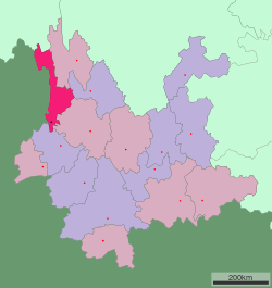
 Location of Nujiang Prefecture in Yunnan | |
| Country | People's Republic of China |
| Province | Yunnan |
| Prefecture seat | Lushui (Liuku) |
| Area | |
| • Total | 14,703 km2 (5,677 sq mi) |
| Population | |
| • Total | 650,000 |
| • Density | 44/km2 (110/sq mi) |
| Time zone | China Standard (UTC+8) |
| Postal code | 673100 |
| Area code(s) | 0886 |
| Website |
nj |
Nùjiāng Lisu Autonomous Prefecture (Chinese: 怒江傈僳族自治州; pinyin: Nùjiāng Lìsùzú Zìzhìzhōu) is an autonomous prefecture of western/northwestern Yunnan province, People's Republic of China.
Name
It is named after the Nujiang river (the longest undammed river in South-east Asia) and the Lisu ethnic group.
Administration
The seat of the prefecture is Liuku Town, Lushui.
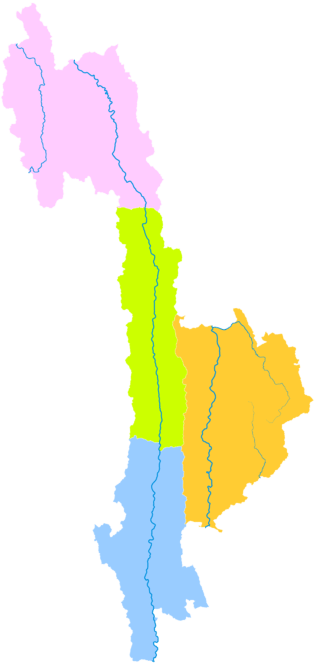
The prefecture is subdivided into four county-level divisions: one county-level city, one county, and two autonomous counties:
| Map | |||||
|---|---|---|---|---|---|
| Name | Hanzi | Hanyu Pinyin | Population (2010 Census) |
Area (km²) | Density (/km²) |
| Lushui | 泸水市 | Lúshuǐ Shì | 184,835 | 2,938 | 62.91 |
| Fugong County | 福贡县 | Fúgòng Xiàn | 98,616 | 2,804 | 35.16 |
| Gongshan Derung and Nu Autonomous County | 贡山独龙族怒族自治县 | Gòngshān Dúlóngzú Nùzú Zìzhìxiàn | 37,894 | 4,506 | 8.40 |
| Lanping Bai and Pumi Autonomous County | 兰坪白族普米族自治县 | Lánpíng Báizú Pǔmǐzú Zìzhìxiàn | 212,992 | 4,455 | 47.80 |
Demographics
According to the 2000 Census Nujiang has 491,824 inhabitants with a population density of 33.45 inhabitants/km².
Ethnic groups in Nujiang, 2000 census
| Nationality | Population | Percentage |
|---|---|---|
| Lisu | 231,819 | 47.13% |
| Bai | 132,622 | 26.97% |
| Han | 64,585 | 13.13% |
| Nu | 26,670 | 5.42% |
| Pumi | 14,374 | 2.92% |
| Yi | 9,805 | 1.99% |
| Derung | 5,456 | 1.11% |
| Naxi | 2,121 | 0.43% |
| Tibetan | 1,805 | 0.37% |
| Dai | 465 | 0.09% |
| Hui | 429 | 0.09% |
| Zhuang | 342 | 0.07% |
| Others | 1,331 | 0.28% |
External links
| Wikimedia Commons has media related to Nujiang Lisu Autonomous Prefecture. |
Coordinates: 25°52′00″N 98°52′00″E / 25.86667°N 98.86667°E
This article is issued from Wikipedia - version of the 9/23/2016. The text is available under the Creative Commons Attribution/Share Alike but additional terms may apply for the media files.
