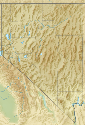
Pahranagat Range
| Pahranagat Range | |
|---|---|
| Highest point | |
| Elevation | 2,268 m (7,441 ft) |
| Geography | |
| Country | United States |
| State | Nevada |
| District | Lincoln County |
| Range coordinates | 37°22′05″N 115°22′07″W / 37.368°N 115.3686°WCoordinates: 37°22′05″N 115°22′07″W / 37.368°N 115.3686°W |
| Topo map | USGS Badger Spring |
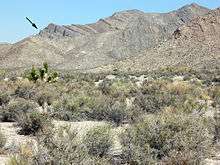
Landscape showing the Devonian Alamo bolide impact breccia (arrow) near Hancock Summit, Pahranagat Range, Nevada.
The Pahranagat Range is a mountain range in Lincoln County, Nevada.[1]
References
- 1 2 "Pahranagat Range". Geographic Names Information System. United States Geological Survey. Retrieved 2009-05-04.
See also
This article is issued from Wikipedia - version of the 6/6/2013. The text is available under the Creative Commons Attribution/Share Alike but additional terms may apply for the media files.