Piploda State
| Piploda State पीपलोदा रियासत | |||||
| Princely State | |||||
| |||||
 | |||||
| History | |||||
| • | Established | 1547 | |||
| • | Independence of India | 1948 | |||
| Area | |||||
| • | 1901 | 155 km2 (60 sq mi) | |||
| Population | |||||
| • | 1901 | 11,441 | |||
| Density | 73.8 /km2 (191.2 /sq mi) | ||||
| | |||||

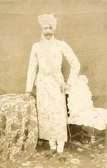
Kesri Singh, ruler of Piploda State from 1888 to 1919
Piploda State was a princely state in India at the time of the British Raj. It belonged to the Malwa Agency, part of the Central India Agency. The state had an area of 155 km².
History
Piploda was established in 1547 by Rawat Sawalsinghji, a son of the Rawat of Mandawal, as a feudatory principality of Jaora State. In 1924 Piploda became a separate state. The last ruler acceded to the Government of India on 15 June 1948, and Piploda became part of Ratlam District of Madhya Bharat state.[1]
Rulers
The rulers of Piploda State were Rajputs of the Dodia clan.[2]
Thakurs
- .... - .... Sadal Singh
- 1820 - 18.. Prithvi Singh
- 18.. - 18.. Umed Sigh
- 18.. - 12 Nov 1863 Onkar Singh (d. 1863)
Maharawat
- 30 Nov 1863 - 26 Oct 1888 Dulai Singh (b. 1852 - d. 1888)
Raos
- 8 Nov 1888 - 4 Nov 1919 Kesri Singh (b. 1872 - d. 1919)
- 5 Nov 1919 - 1936 Mangal Singh (b. 1893 - d. 1936)
- 1936 - 15 Jun 1948 Raghuraj Singh
See also
References
External links
| Wikimedia Commons has media related to Piploda State. |
Coordinates: 23°36′N 74°57′E / 23.600°N 74.950°E
This article is issued from Wikipedia - version of the 3/30/2016. The text is available under the Creative Commons Attribution/Share Alike but additional terms may apply for the media files.