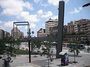
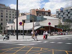
Plaça de Lesseps, Barcelona


Plaça de Lesseps is a square serving as the border between the Sarrià-Sant Gervasi and Gràcia district of Barcelona, Catalonia, Spain, loosely divided in two parts. One of the most heavily transited squares in the city, Lesseps is the starting point of one of Barcelona's busiest rondes: Ronda del General Mitre, as well as being the west end of Carrer Gran de Gràcia and being crossed by a number of streets, namely: Travessera de Dalt, Avinguda del Príncep d'Astúries, Avinguda de Vallcarca, Avinguda de la República Argentina, Carrer del Torrent de l'Olla, Carrer de la Mare de Déu del Coll, Carrer de Santa Perpètua, Carrer de Maignon and Carrer de Pérez Galdós.
A traditionally arbored spot of the city, it's been under heavy reforms for years to move the route of the aforementioned rondes, allowing the square to become a more pedestrian-friendly place while easing the heavy traffic that crosses it on a daily basis.
The square is named after Ferdinand de Lesseps, the developer of the Suez Canal. Earlier in his career, De Lesseps was the French consul in Barcelona. He is known in Barcelona for having intervened against the 1842 bombing of the city ordered by General Baldomero Espartero and Captain-General Juan Van Halen. Before 1895 the square had been known as Josepets, after the 1626 convent of Santa Maria de Gràcia, also known as Els Josepets", which remained a popular name for the square, although now outdated.[1]
Culture
- Jaume Fuster library, inaugurated in 2006.
Education
Schools
- Col·legi d'Educació Infantil i Primària Rius i Taulet
- Aula de Formació d'Adults Rius i Taulet
Other
- Residència Universitària Lesseps
Religion
- Parròquia de la Verge de Gràcia i Sant Josep, a Catholic church.
Transport
Metro
- Lesseps metro station, one of the city's oldest metro stations, served by L3. It's expected to be served by L9 in the future.
Bus
The following bus routes reach Plaça de Lesseps:
- Line 22 Pl. Catalunya - Ctra. Esplugues
- Line 24 Av. Paral·lel - Carmel
- Line 28 Pl. Catalunya - Carmel
- Line 31 Hospital Clínic - Canyelles
- Line 32 Estació de Sants - Roquetes
- Line 74 Zona Universitària - Fabra i Puig
- Line 87 Pg. Maragall - Travessera de Gràcia
- Line 92 Pg. Marítim - Gràcia
- Line 116 Gràcia - La Salut
- Tibibus
Night bus
- Line N4 Via Favència - Pl. Catalunya - Gran Vista
See also
References
External links
- Location at the official interactive guide of Barcelona
- Photos at Bcn.cat
- Project at the urbanism section of the official city council website (Bcn.cat
- About the L9 station
- Associació de Veïns i Comerciants de la Plaça Lesseps (in Catalan)
- Lesseps Square (Barcelona) through maps. The evolution of urban space (in Catalan)
Coordinates: 41°24′25″N 2°08′59″E / 41.40694°N 2.14972°E
