Phare du Petit Minou
|
The lighthouse in July 2004 | |
 the lighthouse in the roadstead of Brest | |
| Location | Goulet de Brest, Finistère, France |
|---|---|
| Coordinates | 48°20′12″N 4°36′51″W / 48.336667°N 4.614167°W |
| Year first constructed | 1848 |
| Automated | 1989 |
| Construction | granite tower |
| Tower shape | cylindrical tower with balcony and lantern |
| Markings / pattern | white tower the seaward side, red lantern |
| Height | 22 metres (72 ft) |
| Focal height | 32 metres (105 ft) |
| Range | 19 nmi (35 km) |
| Characteristic | Fl (2) W R 6s. |
| Admiralty number | D0790 |
| NGA number | 0152 |
| ARLHS number | FRA-032 |
| France number | FR-0652 |
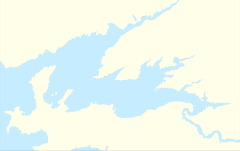
The Phare du Petit Minou is a lighthouse in the roadstead of Brest, standing in front of the Fort du Petit Minou, in the commune of Plouzané. By aligning it with the phare du Portzic, it shows the safe route to follow for ships to enter the roadstead.[1] It also has a red signal that indicates a dangerous sector around the plateau of les Fillettes (literally the girls), one of the submerged rocks in the goulet of Brest — sailors remember this by using the mnemonic "the Minou blushes when he covers les Fillettes".
See also
References
- ↑ Rowlett, Russ (30 March 2014). "Lighthouses of Brittany: Southern Finistère". The Lighthouse Directory. University of North Carolina at Chapel Hill. Retrieved 5 July 2015.
External links
- Phare du Petit Minou Ministère de la Culture (French)
| Wikimedia Commons has media related to Petit Minou lighthouse. |
This article is issued from Wikipedia - version of the 1/23/2016. The text is available under the Creative Commons Attribution/Share Alike but additional terms may apply for the media files.