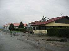
Pontarlier Airport
Coordinates: 46°54′30″N 006°19′45″E / 46.90833°N 6.32917°E
| Pontarlier Airport | |||||||||||||||
|---|---|---|---|---|---|---|---|---|---|---|---|---|---|---|---|
 | |||||||||||||||
| IATA: none – ICAO: LFSP | |||||||||||||||
| Summary | |||||||||||||||
| Airport type | Civil | ||||||||||||||
| Owner/Operator | Town of Pontarlier | ||||||||||||||
| Serves | Pontarlier | ||||||||||||||
| Location | France | ||||||||||||||
| Elevation AMSL | 2,683 ft / 818 m | ||||||||||||||
| Coordinates | 46°54′30″N 006°19′45″E / 46.90833°N 6.32917°E | ||||||||||||||
| Website | http://aeroclub-pontarlier.org | ||||||||||||||
| Runways | |||||||||||||||
| |||||||||||||||
Pontarlier Airport (ICAO: LFSP) is a municipal airport located near Pontarlier in the department of Doubs, region of Franche-Comté, France. It is managed by the town of Pontarlier.
List of the users based on the platform
External links
Notes and references
This article is issued from Wikipedia - version of the 1/24/2016. The text is available under the Creative Commons Attribution/Share Alike but additional terms may apply for the media files.