Ponthir railway station
| Ponthir | |
|---|---|
|
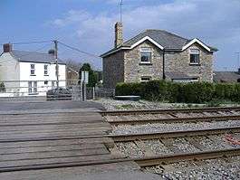
Station house and level crossing at the site in 2007. | |
| Location | |
| Place | Ponthir |
| Area | Torfaen |
| Grid reference | ST325927 |
| Operations | |
| Original company | Pontypool, Caerleon and Newport Railway |
| Pre-grouping | Great Western Railway |
| Post-grouping | Great Western Railway |
| Platforms | 2 |
| History | |
| 21 December 1874 | Opened |
| 9 June 1958 | Closed to goods |
| 30 September 1962 | Closed to passengers |
| Disused railway stations in the United Kingdom | |
|
Closed railway stations in Britain A B C D–F G H–J K–L M–O P–R S T–V W–Z | |
|
| |
Ponthir railway station was a railway station in the village of Ponthir in Torfaen, South Wales, UK.[1]
History
The station was opened by the Pontypool, Caerleon and Newport Railway on 21 December 1874[2] or 1 June 1878.[3] The Great Western Railway advertised in The Cambrian on 12 January 1877 for Tenders for the construction of a station and station yard at Ponthir.[4] Goods facilities were withdrawn on 9 June 1958[5] and the station was closed to passengers on 30 September 1962.[2][3][6]
The original station building is now a private house and a level crossing on the site is still in use. The former station is located on the Welsh Marches Line.
| Preceding station | Historical railways | Following station | ||
|---|---|---|---|---|
| Llantarnam Line open, station closed |
Great Western Railway Pontypool, Caerleon and Newport Railway |
Caerleon Line open, station closed | ||
References
Notes
- ↑ Conolly 2004, p. 43, section A3.
- 1 2 Butt 1995, p. 187.
- 1 2 Quick 2009, p. 316.
- ↑ The Cambrian, 12 January 1877, p. 1, col. 6, at Welsh Newspapers Online, National Library of Wales.
- ↑ Clinker 1988, p. 110.
- ↑ "Cwmbran and its Railway Connections". cwmbran.info. Retrieved 8 May 2012.
Sources
- Butt, R. V. J. (1995). The Directory of Railway Stations: details every public and private passenger station, halt, platform and stopping place, past and present (1st ed.). Sparkford: Patrick Stephens Ltd. ISBN 1-8526-0508-1. OCLC 60251199.
- Clinker, C.R. (1988) [1978]. Clinker's Register of Closed Passenger Stations and Goods Depots in England, Scotland and Wales 1830–1980 (2nd ed.). Bristol: Avon-Anglia Publications & Services. ISBN 0-905466-91-8. OCLC 655703233.
- Conolly, W. Philip (2004) [1958]. British Railways Pre-Grouping Atlas and Gazetteer. Hersham, Surrey: Ian Allan. ISBN 978-0-7110-0320-0.
- Quick, Michael (2009) [2001]. Railway passenger stations in Great Britain: a chronology (4th ed.). Oxford: Railway and Canal Historical Society. ISBN 978-0-901461-57-5. OCLC 612226077.
External links
Coordinates: 51°37′45″N 2°58′35″W / 51.6293°N 2.9763°W
This article is issued from Wikipedia - version of the 9/7/2015. The text is available under the Creative Commons Attribution/Share Alike but additional terms may apply for the media files.
