Rachavaripalem
| Rachavaripalem రాచవారిపాలెం గ్రామం | |
|---|---|
| Village | |
|
By Srihari | |
 Rachavaripalem  Rachavaripalem Location in Andhra Pradesh, India | |
| Coordinates: 15°38′29″N 80°02′27″E / 15.641334°N 80.040918°ECoordinates: 15°38′29″N 80°02′27″E / 15.641334°N 80.040918°E | |
| Country |
|
| State | Andhra Pradesh |
| Districts of Andhra Pradesh | Prakasam |
| Mandal | Maddiapdu |
| Founded by | Unknown |
| Government | |
| • Body | Sarpanch |
| Population (2014) | |
| • Total | 1,292 |
| Languages | |
| • Official | Telugu |
| Time zone | IST (UTC+5:30) |
| PIN | 523211 |
| Tele | 08592 |
Rachavaripalem is a village in Maddipadu mandal in Prakasam district in the state of Andhra Pradesh in India.
Location
Rachavaripalem is 20 km from Ongole, 3 km from NH45. It is surrounded by River Gundlakamma on three sides of village.
Demographics
As of 2014 India census, Rachavaripalem had a population of 1,292. Of 578 Males and 714 Females. Having total houses of 551.
Schools and colleges
- M.P.P High School: This is one of oldest school in that area.
Gallary

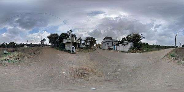
Panoramic view of Beautiful looking Village Entrance

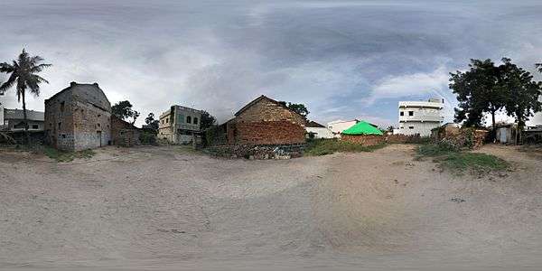
Panoramic view of Mr. Govindarajulu's Tobacco barn and house
For comprehensive information, Please visit AP smart Village report http://www.smart.ap.gov.in/myvillage/jsp/supervisor/mis/reportcard.jsp?state=1,AndhraPradesh&district=10,Prakasam&constituency=89,Santhanuthalapadu&mandal=380,Maddipadu&revenuevillage=5028,Rachavari%20Palem&panchayat=6680,Rachavari%20Palem&selectionkey=panchayat&back=index
See also
References
This article is issued from Wikipedia - version of the 11/21/2016. The text is available under the Creative Commons Attribution/Share Alike but additional terms may apply for the media files.


