Rakai
| Rakai | |
|---|---|
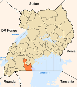
 Rakai Map of Uganda showing the location of Rakai. | |
|
Coordinates: | |
| Region | Central Uganda |
| District | Rakai District |
| Elevation | 1,280 m (4,200 ft) |
| Population (2014 Census) | |
| • Total | 7,592[1] |
| Time zone | EAT (UTC+3) |
Rakai is a town in the Central Region of Uganda. It is the site of the headquarters of Rakai District.[2] Other towns in the district include Kalisizo, Kyotera Kakuuto and Mutukula.[3]
Location
The nearest town is Kyotera, locaed approximately 20 kilometres (12 mi), northeast of Rakai Town.[4] Rakai Town is about 52 kilometres (32 mi), by road, northwest of the international border with Tanzania at Mutukula.[5] Rakai is located approximately 65.5 kilometres (41 mi), by road, southwest of Masaka, the largest town in the sub-region.[6] This is approximately 198 kilometres (123 mi), by road, southwest of Kampala, Uganda's capital and largest city.[7] The coordinates of Rakai Town are 0°42'36.0"S, 31°24'18.0"E (Latitude:-0.7100, Longitude:31.4050).[8]
Population
The 2002 national census put the population of the town at about 5,920. In 2010, the Uganda Bureau of Statistics (UBOS) estimated the mid-year population at 6,900. In 2011, UBOS estimated the mid-ear population at 7,000.[9] During the national population census conducted on 27 August 2014, the population of the town was enumerated at 7,592.[1]
Overview
Rakai is the headquarters of Rakai District, which in the early 1980s, was the epicenter and first distinct in Uganda to be affected by the AIDS epidemic.[10]
Points of interest
The following additional points of interest are located within the town limits or close to its edges:
(1) Offices of Rakai Town Council.[2] (2) Rakai General Hospital, a 100-bed public hospital administered by the Uganda Ministry of Health.[11] (3) Kamuswaga's Palace.[12] (4) Offices of Rakai District Headquarters.[10]
Law enforcement
There is a police station in Rakai Town, administered and operated by the Uganda Police Force.[13]
See also
References
- 1 2 UBOS (November 2014). "National Population And Housing Census 2014: Provisional Results, Revised Edition" (PDF). Kampala: Uganda Bureau of Statistics (UBOS).
- 1 2 Bindhe, Edward (3 May 2012). "Kooki Chief Defies Town Council on Hotel Construction". Kampala: Uganda Radio Network. Retrieved 25 October 2016.
- ↑ Google (25 October 2016). "Map of Rakai District, Showing Major Urban Centers" (Map). Google Maps. Google. Retrieved 25 October 2016.
- ↑ Globefeed.com (25 October 2016). "Distance between Rakai Town, Central Region, Uganda and Kyotera, Central Region, Uganda". Globefeed.com. Retrieved 25 October 2016.
- ↑ Globefeed.com (25 October 2016). "Distance between Rakai town, Central Region, Uganda and Big Mama's Restaurant, Uganda". Globefeed.com. Retrieved 25 October 2016.
- ↑ Globefeed.com (25 October 2016). "Distance between Masaka, Central Region, Uganda and Rakai Town, Central Region, Uganda". Globefeed.com. Retrieved 25 October 2016.
- ↑ Globefeed.com (25 October 2016). "Distance between Rakai Town, Central Region, Uganda and Kampala, Central Region, Uganda". Globefeed.com. Retrieved 25 October 2016.
- ↑ Google (25 October 2016). "Location of Rakai Town, Rakai District, Uganda" (Map). Google Maps. Google. Retrieved 25 October 2016.
- ↑ UBOS (2012). "Estimated Population of Rakai In 2002, 2010 & 2011" (PDF). Kampala: Uganda Bureau of Statistics (UBOS). Retrieved 20 October 2016.
- 1 2 Mutyaba, Gertrude (10 February 2014). "Rakai: Where Uganda's HIV fight began". Daily Monitor. Kampala. Retrieved 25 October 2016.
- ↑ Mpagi, Musa (4 December 2012). "Rakai Hospital without X-ray machine for seven years". Daily Monitor. Kampala. Retrieved 25 October 2016.
- ↑ Mugera, Isaac (10 May 2007). "Kamuswaga's Palace in Ruins Three Years after Reinstatement of Kooki Kingdom". Kampala: Uganda Radio Network. Retrieved 25 October 2016.
- ↑ Buregyeya, Dismus (18 March 2016). "Rakai Go Forward coordinator arrested over rebel links". New Vision. Kampala. Retrieved 25 October 2016.
External links
Coordinates: 00°42′36″S 31°24′18″E / 0.71000°S 31.40500°E
