Rangamati
This article is about the town. For the district, see Rangamati Hill District. For the 2008 film, see Rangamati (film). For the ship, see CGS Rangamati.
| Rangamati Rangamatte (Chakma) | |
|---|---|
 | |
| Nickname(s): Lake City of Bangladesh | |
 Rangamati Location in Bangladesh | |
| Coordinates: 22°38′N 92°12′E / 22.633°N 92.200°E | |
| Country |
|
| Division | Chittagong Division |
| District | Rangamati District |
| Government | |
| • Pouroshava Mayor | Habibur Rahman |
| • Chakma Raja (Chakma Circle Chief) | Devasish Roy |
| Elevation | 14 m (49 ft) |
| Time zone | BST (UTC+6) |
| Postal Code | 4500 |
| Area code(s) | 0351 |
Rangamati (Chakma: 𑄢𑄋𑄟𑄖𑄳𑄡) is the administrative headquarters of Rangamati Hill District in the Chittagong Hill Tracts of Bangladesh. It is also a Capital city of Chittagong Hill Tracts. The town is located at 22°37'60N 92°12'0E and has an altitude of 14 metres (46 ft).[1] The district is administered by an office named as District Administration, Rangamati
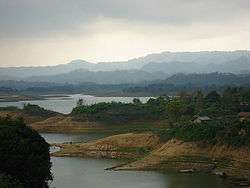
From Chittagong a 77 km road leads to Rangamati. The township is located on the western bank of the Kaptai lake. Rangamati is a holiday destination because of its landscape, scenic beauty, lake, colourful indigenous groups (Chakma, Marma etc.), its flora and fauna, indigenous museum, hanging bridge etc.
Climate
| Climate data for Khulna | |||||||||||||
|---|---|---|---|---|---|---|---|---|---|---|---|---|---|
| Month | Jan | Feb | Mar | Apr | May | Jun | Jul | Aug | Sep | Oct | Nov | Dec | Year |
| Average high °C (°F) | 25.7 (78.3) |
28.5 (83.3) |
32.0 (89.6) |
33.0 (91.4) |
32.7 (90.9) |
31.2 (88.2) |
30.5 (86.9) |
31.0 (87.8) |
31.5 (88.7) |
31.4 (88.5) |
29.1 (84.4) |
26.2 (79.2) |
30.2 (86.4) |
| Average low °C (°F) | 14.0 (57.2) |
15.9 (60.6) |
20.0 (68) |
22.9 (73.2) |
24.0 (75.2) |
24.9 (76.8) |
24.8 (76.6) |
24.9 (76.8) |
24.8 (76.6) |
23.9 (75) |
20.6 (69.1) |
16.0 (60.8) |
21.4 (70.5) |
| Average precipitation mm (inches) | 5.1 (0.201) |
24.3 (0.957) |
62.1 (2.445) |
147.9 (5.823) |
319.7 (12.587) |
504.8 (19.874) |
572.6 (22.543) |
435.2 (17.134) |
259.6 (10.22) |
152.2 (5.992) |
55.7 (2.193) |
9.5 (0.374) |
2,548.7 (100.343) |
| Average precipitation days | 1 | 2 | 3 | 8 | 13 | 18 | 21 | 20 | 15 | 8 | 4 | 1 | 114 |
| Average relative humidity (%) | 77 | 69 | 67 | 72 | 78 | 84 | 85 | 85 | 85 | 84 | 82 | 81 | 79 |
| Source: Bangladesh Meteorological Department[2][3][4][5][6] | |||||||||||||
Gallery

- Lower portion of the Shuvolong Fall
- Mummified Body of the Top Mohanto at Rajbana Vihara
- Rajbana Vihara, a renowned Buddhist Temple at Rangamati
 Wild Asian elephant, can be seen in the hilly forests of Rangamati
- Kaptai Lake Barkal Upazila
- Shuvolong waterfall in dry season
- Life in Water
- Hanging bridge Rangamati
References
- ↑ Location of Rangamati - Falling Rain Genomics
- ↑ "Monthly Maximum Temperature". Bangladesh Meteorological Department. Retrieved January 31, 2016.
- ↑ "Monthly Minimum Temperature". Bangladesh Meteorological Department. Retrieved January 31, 2016.
- ↑ "Normal Monthly Rainfall". Bangladesh Meteorological Department. Retrieved January 31, 2016.
- ↑ "Normal Monthly Rainy Day". Bangladesh Meteorological Department. Retrieved January 31, 2016.
- ↑ "Normal Monthly Humidity". Bangladesh Meteorological Department. Retrieved January 31, 2016.
| Wikimedia Commons has media related to Rangamati. |
Coordinates: 22°38′0″N 92°12′0″E / 22.63333°N 92.20000°E
This article is issued from Wikipedia - version of the 11/14/2016. The text is available under the Creative Commons Attribution/Share Alike but additional terms may apply for the media files.