Canary Islands Network for Protected Natural Areas
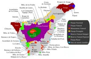
Map showing the classification of protected areas in Tenerife
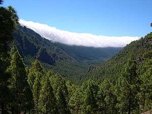
Caldera de Taburiente National Park, under control of the group
The Canary Islands Network for Protected Natural Areas (Red Canaria de Espacios Naturales Protegidos) is a conservation organization in the Canary Islands.
It recognizes 146 areas across the islands of Tenerife, Gran Canaria, Las Palmas and Fuertaventura as under protection. [1] Of the 146 protected sites under control of network in the Canary Islands archipelago, a total of 43 are located in Tenerife, the most protected island in the group. [2]
Criteria
The network has criteria, which places areas under its observation under eight different categories of protection. These include:
- National Park
- Natural Park
- National Monument
- Protected Area
- Integral Natural Reserve
- Special Natural Reserve
- Rural Park
- Site of Scientific Interest
References
See also
This article is issued from Wikipedia - version of the 3/19/2013. The text is available under the Creative Commons Attribution/Share Alike but additional terms may apply for the media files.