Resolute Bay
This article is about the body of water. For the community, see Resolute, Nunavut.
| Resolute Bay | |
|---|---|
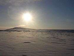
 Looking west along the edge of Resolute Bay. | |
| Location | Parry Channel |
| Coordinates | 74°41′N 094°52′W / 74.683°N 94.867°WCoordinates: 74°41′N 094°52′W / 74.683°N 94.867°W |
| Basin countries | Canada |
| Settlements | Resolute |
Resolute Bay is an Arctic waterway in the Qikiqtaaluk Region, Nunavut, Canada. It is located in Parry Channelmap on the southern side of Cornwallis Island.map The hamlet of Resolutemap is located on the northern shore of the bay and Resolute Bay Airportmap to the northwest. The Inuit people associated with Resolute Bay are called 'Qausuittuq'[1] and the population of the hamlet in the 2006 census was 229.[2]
On the western shore, the Defence Research Telecommunications Establishment (DRTE) and the Communications Research Centre[3] operated a launch site for sounding rockets.map Between 1966 and 1971 rockets of the types Black Brant and Boosted Arcas were launched.[4][5]
 Overview of Resolute Bay - 1970/71
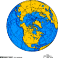
 Orthographic projection centred over Resolute Bay, Nunavut, Canada.
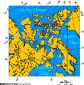
 Resolute Bay, Nunavut, Canada - Lambert Projection.
 Resolute Bay: View from Signal Hill to the Inuit-Settlement "Village" and to Resolute Passage (August 1997)
 Another view over Resolute Bay to the Inuit Settlement "Village" (August 1997)

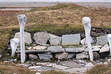
A small hut built some 600 years ago by the Thule people, ancestors of the Inuit, near the hamlet of Resolute it was restored by archaeologists.
References
- ↑ "The Linguasphere Online" (PDF). langtag.com. Retrieved 2008-03-31.
- ↑ "Statistics Canada". 2.statcan.ca. 2010-12-06. Retrieved 2013-01-10.
- ↑ "Friends of the CRC - Sounding Rockets". Friendsofcrc.ca. Retrieved 2013-01-10.
- ↑ "Encyclopedia Astronautica - Resolute Bay". Astronautix.com. Retrieved 2013-01-10.
- ↑ "Canada Journal. February 20, 2005. by Håvard Svidal-Haugan". Global-edventure.net. 2005-02-20. Retrieved 2013-01-10.
Further reading
| Wikimedia Commons has media related to Resolute, Nunavut. |
- Bremner, Peter C. Diamond Drilling in Permafrost at Resolute Bay, Northwest Territories. Publications of the Dominion Observatory (Ottawa), v. 16, no. 12. Ottawa: Edmond Cloutier, Queen's Printer and Controller of Stationery, 1955.
- Canada, and F. C. Plet. Q-Indices of Magnetic Activity at Resolute Bay, Baker Lake, and Yellowknife Magnetic Observatories for Selected Days of the International Geophysical Year. Publications of the Dominion Observatory, Ottawa, v.27, no. 4. 1963.
- Higdon, Jeff W., and Stefan Romberg. 2006. "Observations of Juvenile Ivory Gulls (Pagophila Eburnea) in Resolute Bay, Nunavut, Canada, August 2005". Polar Record. 42, no. 2: 170-172.
- Hocking, W K. 2001. "Special Section: Early Polar Cap Observatory - Middle Atmosphere Dynamical Studies at Resolute Bay Over a Full Representative Year: Mean Winds, Tides, and Special Oscillations (Paper 2000RS001003)". Radio Science. 36, no. 6: 1795.
- Hodges, J. C., and Howard Francis Bates. The Polar Auroral Radar System McMurdo Base, Antarctica and Resolute Bay, N.W.T., Canada. Menlo Park, Calif: Stanford Research Institute, 1975.
- Lund, Karen E. An Investigation of Cadmium and Lead from a High Arctic Waste Disposal Site, Resolute Bay, Nunavut, Canada. Ottawa: Library and Archives Canada = Bibliothèque et Archives Canada, 2005. ISBN 0-612-99353-1
- Michel, Christine. Biological investigation of first-year sea ice near Resolute Bay, Nunavut, spring to early summer 2001. Winnipeg: Fisheries and Oceans Canada, 2003.
- Sauriol, Jacques. Channel Development and Fluvial Processes in Snow-Filled Valleys, Resolute Bay, N.W.T. Hamilton, Ont: McMaster University, 1978.
- Stocker, Zbigniew Stanislaw J. The Ecology of the Streams at Char Lake, Resolute Bay, North West Territories. Waterloo, Ont: University of Waterloo, Dept. of Biology, 1972.
Mapping
|
|
This article is issued from Wikipedia - version of the 11/25/2016. The text is available under the Creative Commons Attribution/Share Alike but additional terms may apply for the media files.