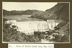
Rifle Creek Dam
| Rifle Creek Dam | |
|---|---|
 The dam in 1932 | |
| Location | 28km South East of Mount Isa, Queensland |
| Coordinates | 20°57′27″S 139°35′24″E / 20.9574°S 139.59°ECoordinates: 20°57′27″S 139°35′24″E / 20.9574°S 139.59°E |
| Type | reservoir |
| Basin countries | Australia |
| Water volume | 9,488 ML |
| Settlements | Mount Isa |
Rifle Creek Dam is owned by Mount Isa Mines. With the completion of the East Leichhardt Dam in 1958, Rifle Creek Dam water was completely available for use by the mine.
See also
This article is issued from Wikipedia - version of the 9/4/2015. The text is available under the Creative Commons Attribution/Share Alike but additional terms may apply for the media files.