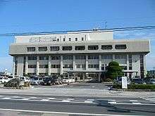
Rittō, Shiga
| Rittō 栗東市 | ||
|---|---|---|
| City | ||
| ||
 Location of Rittō in Shiga Prefecture | ||
 Rittō Location in Japan | ||
| Coordinates: 35°01′N 136°00′E / 35.017°N 136.000°ECoordinates: 35°01′N 136°00′E / 35.017°N 136.000°E | ||
| Country | Japan | |
| Region | Kansai | |
| Prefecture | Shiga Prefecture | |
| Government | ||
| • Mayor | Masahiro Nomura | |
| Area | ||
| • Total | 52.75 km2 (20.37 sq mi) | |
| Population (June 30, 2006) | ||
| • Total | 62,285 | |
| • Density | 1,200/km2 (3,100/sq mi) | |
| Symbols | ||
| • Tree | Kaizuka ibuki | |
| • Flower | Calendula officinalis | |
| • Bird | Japanese white-eye | |
| Time zone | Japan Standard Time (UTC+9) | |
| City hall address |
1-13-33, Anyōji, Rittō-shi, Shiga-ken 520-3088 | |
| Website |
www | |
Rittō (栗東市 Rittō-shi) is a city located in Shiga Prefecture, Japan. It is well known to Japanese horse racing fans because it is home to the Japan Racing Association's training center and the famous jockey brothers, Yutaka Take and Koshiro Take who were also born in Rittō.
As of June 30, 2006, the city has an estimated population of 62,285 and a population density of 1,200 persons per km2. The total area is 52.75 km2.
The kanji characters for Rittō are "chestnut" (栗; kuri) and "East" (東; higashi), despite the fact that Rittō is both in the west region of Japan and it does not have particularly many chestnut trees. In fact, the "栗" in Rittō doesn't mean chestnuts but refers to Kurita District (栗太郡; Kurita-gun), a former district that Rittō was located in the east of.

Municipal timeline
- October 1, 1954 - The villages of Konze, Hayama, Haruta and Daihō were merged to create the town of Rittō.
- October 1, 2001 - The city was founded by declaring the former town of Rittō city status.
Sister cities
- Birmingham, Michigan, United States
- Hengyang, Hunan, China
External links
 Media related to Rittō, Shiga at Wikimedia Commons
- Rittō City official website (Japanese)