Riviera del Brenta
The Riviera del Brenta is the area surrounding the Naviglio del Brenta (a channel from the Brenta River), also known as Piovego, which runs from downtown Padua across the Veneto countryside, through Stra, Fiesso d'Artico, Dolo, Mira, Oriago and Malcontenta to Fusina, which is part of the municipality of Venice, in the North-east of Italy.
The Naviglio is navigable by river boats, whose best example is the famous Burchiello, which once used to carry Venetian noblemen from Venice to the countryside and Padua and is now a tourist attraction.
History of the Venetian villas
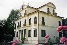
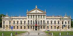
From 16th to 18th century many Venetian aristocratic families built their beautiful villas here (like Villa Pisani in Stra, Villa Ferretti-Angeli in Dolo, Villa Widmann-Foscari in Mira, and Villa Foscari a.k.a. La Malcontenta in Malcontenta): they are indeed known as Ville venete, Venetian villas. Noblemen used to re-invest their trade profit in big agricultural complexes. They were not just countryside manors, but real and self-sustainable production centres: they add fields all around, stables, barns, and the villages of the peasants. The villa was the name of this kind of complex, but it today refers to the manors only. Some of them have also beautiful gardens, with small woods, fountains, mazes and small lakes. The villa veneta is typical of all the region of Veneto, but the Riviera del Brenta is place to some of the most beautiful and famous, even if there are other exceptional examples of villas (like Villa Contarini, Villa Capra La Rotonda or Villa Barbarigo). Many of the villas are in the Palladian style, and a few were designed by Andrea Palladio himself or by his pupil Vincenzo Scamozzi.
Venetian villas


Here you may find the main villas, and the municipality which they belong to.
Mira
- Villa Alessandri
- Villa Allegri von Ghega (XVI secolo), Oriago
- Villa Bon
- Villa Foscari detta la Malcontenta, Malcontenta
- Villa Gradenigo, Oriago
- Palazzo Moro (XV secolo), Oriago
- Villa Priuli, Oriago
- Villa Sceriman Widmann Rezzonico Foscari
- Villa Querini Stampalia, Mira Porte
- Barchesse di villa Valmarana, Mira Porte
- Villa Venier
- Villa Levi Morenos
Dolo
- Villa Badoer Fattoretto
- Villa Ferretti Angeli
- Villa Gasparini (XVIIIth century)
Fiesso d'Artico
- Villa Recanati-Zuccon (first half of XVIIIth century)
- Villa Soranzo (XVIth century)
- Villa Barbarigo-Fontana (first built in XVIth century, arranged in XVIIIth century)
- Villa Corner-Vendramin (XVIIIth century)
- Villa Contarini di S. Basegio (built between XVIIth century and XVIIIth century)
- Villa Marchese De Seynos o degli Armeni (XVIIth century)
- Casa Venier-Tiepolo (XVIIIth century)
Piove di Sacco
. Villa Priuli Ballan ( first built in XVIth century, arranged in XVIIth century)
Stra
- Villa Foscarini Rossi
- Villa Lazara Pisani
- Villa Pisani
Vigonovo
- Villa Sagredo
See also
Coordinates: 45°24′46″N 12°03′09″E / 45.41278°N 12.05250°E