Tonlé San
Not to be confused with Tonlé Sap (lake).
| Tonlé San | |
|---|---|
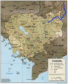 Map of Cambodia with Tonlé San river marked | |
| Native name | Sông Sê San |
| Other name(s) | Ya Krong Po Ko |
| Country | Vietnam, Cambodia |
| Basin | |
| Main source |
confluence of Dak Psi and Dak Po Ko 14°36′23″N 107°50′25″E / 14.6063°N 107.8404°E |
| River mouth |
Mekong 13°32′10″N 105°57′54″E / 13.536°N 105.965°ECoordinates: 13°32′10″N 105°57′54″E / 13.536°N 105.965°E |
| Progression | Tonlé San—Mekong—Mekong Delta—South China Sea |
| Basin size | 17,000 km2 (6,600 sq mi) |
Tonlé San, also known as Tonlé Se San or Sesan River, is a river that flows through central Vietnam and north-east Cambodia. It is a major tributary of the Mekong River. A short portion of the river forms a part of the international border between Cambodia and Vietnam.

Women in Sesan district are washing their clothes in Tonle Sesan, the major tributary of the Mekong River that flows through Cambodia.
External links
This article is issued from Wikipedia - version of the 11/10/2016. The text is available under the Creative Commons Attribution/Share Alike but additional terms may apply for the media files.