San Pietro in Cariano
| San Pietro in Cariano | |
|---|---|
| Comune | |
| Comune di San Pietro in Cariano | |
|
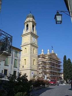
Church of Castelrotto during restorations. | |
 San Pietro in Cariano Location of San Pietro in Cariano in Italy | |
| Coordinates: 45°31′N 10°53′E / 45.517°N 10.883°ECoordinates: 45°31′N 10°53′E / 45.517°N 10.883°E | |
| Country | Italy |
| Region | Veneto |
| Province / Metropolitan city | Verona (VR) |
| Frazioni | Bure, Castelrotto, Corrubbio, Pedemonte, San Floriano, |
| Government | |
| • Mayor | Maestrelli Gabriele |
| Area | |
| • Total | 20.25 km2 (7.82 sq mi) |
| Elevation | 151 m (495 ft) |
| Population (1 June 2007)[1] | |
| • Total | 12,863 |
| • Density | 640/km2 (1,600/sq mi) |
| Demonym(s) | Carianesi |
| Time zone | CET (UTC+1) |
| • Summer (DST) | CEST (UTC+2) |
| Postal code | 37029 |
| Dialing code | 045 |
| Patron saint | St. Peter Apostle |
| Saint day | 29 June |
| Website | Official website |
San Pietro in Cariano is a comune (municipality) in the Province of Verona in the Italian region Veneto, located about 110 kilometres (68 mi) west of Venice and about 12 kilometres (7 mi) northwest of Verona.
The main attraction is the Romanesque pieve of San Floriano (10th century).
Village Lenguin at San Pietro in Cariano
_STOP_speculazione_edilizia-casa_padronale_e_cappella_in_rovina-16_secolo_circa-panorama2-K-5_II-Tamron_SP_AF_17-50mm_F2%2C_8-_photo_Paolo_Villa.jpg)
Panorama from Castelrotto hill

View from Castelrotto hill (San Pietro in Cariano) to Pedemonte, Arbizzano and Montericco hill
Twin towns
References
- ↑ All demographics and other statistics: Italian statistical institute Istat.
- ↑ Ludlow Town Council Ludlow's Twin Towns
External links
| Wikimedia Commons has media related to San Pietro in Cariano. |
This article is issued from Wikipedia - version of the 1/31/2015. The text is available under the Creative Commons Attribution/Share Alike but additional terms may apply for the media files.
