São Tomé International Airport
Not to be confused with San Tome Airport.
| São Tomé International Airport Aeroporto Internacional de São Tomé | |||||||||||
|---|---|---|---|---|---|---|---|---|---|---|---|
| IATA: TMS – ICAO: FPST | |||||||||||
| Summary | |||||||||||
| Airport type | Public | ||||||||||
| Serves | São Tomé, São Tomé Island, São Tomé and Príncipe | ||||||||||
| Elevation AMSL | 33 ft / 10 m | ||||||||||
| Coordinates | 00°22′41″N 006°42′44″E / 0.37806°N 6.71222°E | ||||||||||
| Map | |||||||||||
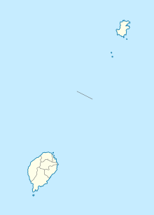
 TMS Location of airport in São Tomé and Príncipe | |||||||||||
| Runways | |||||||||||
| |||||||||||
São Tomé International Airport (Portuguese: Aeroporto Internacional de São Tomé) (IATA: TMS, ICAO: FPST) is a minor international airport located on São Tomé Island, 5 kilometres (3 mi) from the city of São Tomé.[3] It is the main airport serving São Tomé and Príncipe.
Facilities
The airport resides at an elevation of 33 feet (10 m) above mean sea level. It has one runway designated 11/29 with an asphalt surface measuring 2,220 by 45 metres (7,283 ft × 148 ft).[1]
Airlines and destinations
| Airlines | Destinations |
|---|---|
| Africa's Connection STP[4] | Príncipe[5] |
| Afrijet | Libreville[6] |
| CEIBA Intercontinental | Libreville, Malabo |
| STP Airways operated by EuroAtlantic Airways | Lisbon |
| TAAG Angola Airlines | Luanda, Praia |
| TAP Portugal | Accra, Lisbon |
Incidents and accidents
- 15 May 1979: A Lockheed L-100-20 Hercules, registration D2-FAF, of TAAG Angola Airlines crashed on landing at São Tomé International Airport. There were no fatalities.[7]
References
- 1 2 Airport information for FPST from DAFIF (effective October 2006)
- ↑ Airport information for TMS at Great Circle Mapper. Source: DAFIF (effective October 2006).
- ↑ Destinos em São Tomé e Príncipe (São Tomé) from TAP Portugal
- ↑ Africa's Connection STP official website
- ↑ Time Table 2015
- ↑ Schedule 2016
- ↑ Accident description for D2-FAF at the Aviation Safety Network. Retrieved on 7 July 2011.
External links
This article is issued from Wikipedia - version of the 11/30/2016. The text is available under the Creative Commons Attribution/Share Alike but additional terms may apply for the media files.