Sayda-Guba
| Sayda-Guba (English) Сайда-Губа (Russian) | |
|---|---|
|
- Rural locality[1] - Inhabited locality[1] | |
|
| |
.svg.png) Location of Murmansk Oblast in Russia | |
 Sayda-Guba | |
|
| |
| Administrative status (as of 2014) | |
| Country | Russia |
| Federal subject | Murmansk Oblast[1] |
| Administratively subordinated to | Closed Administrative-Territorial Formation of Alexandrovsk[1] |
| Municipal status (as of June 2013) | |
| Urban okrug | Alexandrovsk Urban Okrug[2] |
| Statistics | |
| Population (2010 Census) | 0 inhabitants[3] |
| Time zone | MSK (UTC+03:00)[4] |
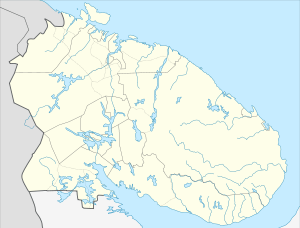
Sayda-Guba (Russian: Сайда-Губа), also known in English as Sayda Bay, is a rural locality (an inhabited locality) within the administrative jurisdiction of the closed administrative-territorial formation of Alexandrovsk in Murmansk Oblast, Russia,[1] located beyond the Arctic Circle at a height of 10 meters (33 ft) above sea level. As of the 2010 Census, it had no recorded population.[3]
History
The colony of Sayda-Guba was one of the twenty-one included into Alexandrovskaya Volost of Alexandrovsky Uyezd of Arkhangelsk Governorate upon its establishment on July 1, 1920.[5]
In 1934, the Murmansk Okrug Executive Committee developed a redistricting proposal, which was approved by the Resolution of the 4th Plenary Session of the Murmansk Okrug Committee of the VKP(b) on December 28-29, 1934 and by the Resolution of the Presidium of the Murmansk Okrug Executive Committee on February 2, 1935.[6] On February 15, 1935, the VTsIK approved the redistricting of the okrug into seven districts, but did not specify what territories the new districts were to include.[6] On February 26, 1935, the Presidium of the Leningrad Oblast Executive Committee worked out the details of the new district scheme and issued a resolution, which, among other things, ordered to moved the administrative center of Polyarny District from Polyarnoye to Sayda-Guba.[6] The provisions of the February 26, 1935 Resolution, however, were not fully implemented.[6] Due to military construction in Polyarnoye, the administrative center was instead moved to Murmansk in the beginning of 1935.[6]
References
Notes
- 1 2 3 4 5 Registry of the Administrative-Territorial Structure of Murmansk Oblast
- ↑ Law #530-01-ZMO
- 1 2 Федеральная служба государственной статистики. Территориальный орган федеральной службы государственной статистики по Мурманской области (Мурманскстат) (Federal State Statistics Service. Territorial Branch of the Federal Statistics Service in Murmansk Oblast (Murmanskstat)) (2012). "2010. Статистический сборник "Численность, размещение и возрастно-половой состав населения Мурманской области. Итоги Всероссийской переписи населения". Том 1." [2010 Statistical Digest "Size, Distribution, and the Age and Gender Characteristics of the Population of Murmansk Oblast. Results of the All-Russian Population Census] (in Russian). Federal State Statistics Service. Retrieved September 10, 2012.
- ↑ Правительство Российской Федерации. Федеральный закон №107-ФЗ от 3 июня 2011 г. «Об исчислении времени», в ред. Федерального закона №271-ФЗ от 03 июля 2016 г. «О внесении изменений в Федеральный закон "Об исчислении времени"». Вступил в силу по истечении шестидесяти дней после дня официального опубликования (6 августа 2011 г.). Опубликован: "Российская газета", №120, 6 июня 2011 г. (Government of the Russian Federation. Federal Law #107-FZ of June 31, 2011 On Calculating Time, as amended by the Federal Law #271-FZ of July 03, 2016 On Amending Federal Law "On Calculating Time". Effective as of after sixty days following the day of the official publication.).
- ↑ Administrative-Territorial Division of Murmansk Oblast, p. 66
- 1 2 3 4 5 Administrative-Territorial Division of Murmansk Oblast, pp. 47–48
Sources
- Official website of Murmansk Oblast. Registry of the Administrative-Territorial Structure of Murmansk Oblast (Russian)
- Мурманская областная Дума. Закон №530-01-ЗМО от 2 декабря 2004 г. «О наделении статусом городского округа закрытых административно-территориальных образований Мурманской области», в ред. Закона №1812-01-ЗМО от 19 декабря 2014 г. «Об упразднении населённого пункта Мурманской области и о внесении изменений в отдельные законодательные акты Мурманской области». Вступил в силу 1 января 2005 г. Опубликован: "Мурманский Вестник", №234, стр. 3, 7 декабря 2004 г. (Murmansk Oblast Duma. Law #530-01-ZMO of December 2, 2004 On Granting Urban Okrug Status to the Closed Administrative-Territorial Formations of Murmansk Oblast, as amended by the Law #1812-01-ZMO of December 19, 2014 On Abolishing an Inhabited Locality in Murmansk Oblast and on Amending Various Legislative Acts of Murmansk Oblast. Effective as of January 1, 2005.).
- Архивный отдел Администрации Мурманской области. Государственный Архив Мурманской области. (1995). Административно-территориальное деление Мурманской области (1920-1993 гг.). Справочник. Мурманск: Мурманское издательско-полиграфическое предприятие "Север".