Schwalmtal, North Rhine-Westphalia
| Schwalmtal | ||
|---|---|---|
| ||
 Schwalmtal | ||
Location of Schwalmtal within Viersen district 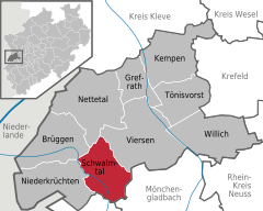
 | ||
| Coordinates: 51°13′21″N 6°15′45″E / 51.22250°N 6.26250°ECoordinates: 51°13′21″N 6°15′45″E / 51.22250°N 6.26250°E | ||
| Country | Germany | |
| State | North Rhine-Westphalia | |
| Admin. region | Düsseldorf | |
| District | Viersen | |
| Government | ||
| • Mayor | Michael Pesch (CDU) | |
| Area | ||
| • Total | 48.11 km2 (18.58 sq mi) | |
| Population (2015-12-31)[1] | ||
| • Total | 19,139 | |
| • Density | 400/km2 (1,000/sq mi) | |
| Time zone | CET/CEST (UTC+1/+2) | |
| Postal codes | 41366 | |
| Dialling codes | 0 21 63 | |
| Vehicle registration | VIE | |
| Website | www.schwalmtal.de | |
_COA.svg.png)
Schwalmtal is a municipality in the district of Viersen, in North Rhine-Westphalia, Germany. It is named after the river Schwalm, which flows through the area. Schwalmtal is situated approximately 12 km west of Mönchengladbach.
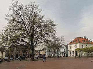
Waldniel, view to der Markt
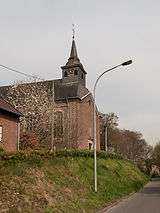
Lüttelforst, church; die katholische Pfarrkirche Sankt Jakobus
 |
Brüggen | Nettetal | Nettetal | |
| Niederkrüchten | |
Viersen | ||
| ||||
| | ||||
| Niederkrüchten | Wegberg | Mönchengladbach |
Towns and municipalities in Viersen (district) | ||
|---|---|---|
References
- ↑ "Amtliche Bevölkerungszahlen". Landesbetrieb Information und Technik NRW (in German). 18 July 2016.
This article is issued from Wikipedia - version of the 11/10/2016. The text is available under the Creative Commons Attribution/Share Alike but additional terms may apply for the media files.