Scotts Seaplane Base
| Scotts Seaplane Base | |||||||||||||||
|---|---|---|---|---|---|---|---|---|---|---|---|---|---|---|---|
| IATA: none – ICAO: KCDD – FAA LID: CDD | |||||||||||||||
| Summary | |||||||||||||||
| Airport type | Public | ||||||||||||||
| Owner | Darrell Scott | ||||||||||||||
| Serves | Crane Lake, Minnesota | ||||||||||||||
| Elevation AMSL | 1,119 ft / 341 m | ||||||||||||||
| Coordinates | 48°16′0″N 92°29′1″W / 48.26667°N 92.48361°W | ||||||||||||||
| Map | |||||||||||||||
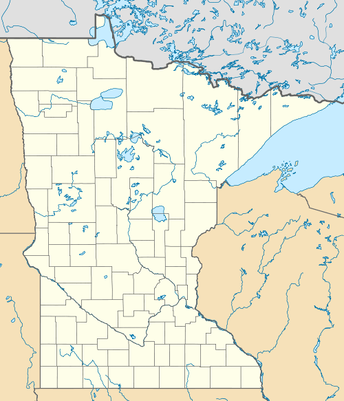
 CDD  CDD Location of airport in Minnesota/United States | |||||||||||||||
| Runways | |||||||||||||||
| |||||||||||||||
| Statistics (2003) | |||||||||||||||
| |||||||||||||||
Scotts Seaplane Base (ICAO: KCDD, FAA LID: CDD) is a public use seaplane base located in the community of Crane Lake, in Saint Louis County, Minnesota, United States. It is privately owned by Darrell Scott[1] and is also known at Scott's Seaplane Base.[2]
Although most U.S. airports use the same three-letter location identifier for the FAA and IATA, Scotts Seaplane Base is assigned CDD by the FAA but has no designation from the IATA[3] (which assigned CDD to Cauquira, Honduras[4]).
Facilities and aircraft
Scotts Seaplane Base covers an area of 5 acres (2.0 ha) at an elevation of 1,119 feet (341 m) above mean sea level. It has two seaplane landing areas: 7W/25W is 8,000 x 1,000 feet (2,438 x 305 m) and 16W/34W is 7,000 x 1,000 feet (2,134 x 305 m). For the 12-month period ending June 30, 2003, the airport had 8,000 aircraft operations, an average of 21 per day: 61% general aviation and 39% air taxi.[1]
References
- 1 2 3 FAA Airport Master Record for CDD (Form 5010 PDF), effective 2008-04-10
- ↑ Crane Lake: Scott's Seaplane Base (CDD) at Minnesota DOT airport directory
- ↑ Great Circle Mapper: KCDD - Crane Lake, Minnesota (Scotts Seaplane Base)
- ↑ Great Circle Mapper: CDD - Cauquira, Honduras
External links
- Scott's Resort & Seaplane Base
- Resources for this airport:
- FAA airport information for CDD
- AirNav airport information for KCDD
- FlightAware airport information and live flight tracker
- NOAA/NWS latest weather observations
- SkyVector aeronautical chart, Terminal Procedures