Silver Lake (North Cascades National Park)
| Silver Lake | |
|---|---|
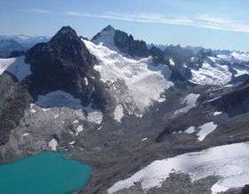
 Silver Lake below Silver Glacier in background | |
| Location |
North Cascades National Park, Whatcom County, Washington, United States |
| Coordinates | 48°59′15″N 121°13′56″W / 48.98750°N 121.23222°WCoordinates: 48°59′15″N 121°13′56″W / 48.98750°N 121.23222°W[1] |
| Type | Cirque Lake |
| Primary outflows | Silver Creek |
| Basin countries | United States |
| Max. length | .80 mi (1.29 km) |
| Max. width | .50 mi (0.80 km) |
| Surface elevation | 6,768 ft (2,063 m)[1] |
Silver Lake is located in North Cascades National Park, in the U. S. state of Washington.[2] Silver Lake is less than 1 mi (1.6 km) north of Mount Spickard and is partially fed by melt from the Silver Glacier which is on the north slopes of Spickard. To the north and west of Silver Lake lies the arête known as Custer Ridge culminating in Mount Rahm. Silver Lake is only .50 mi (0.80 km) south of the Canada–United States border.
References
- 1 2 "Silver Lake". Geographic Names Information System. United States Geological Survey. Retrieved June 29, 2013.
- ↑ Mount Spickard, WA (Map). Topoquest (USGS Quads). Retrieved June 29, 2013.
This article is issued from Wikipedia - version of the 8/9/2016. The text is available under the Creative Commons Attribution/Share Alike but additional terms may apply for the media files.